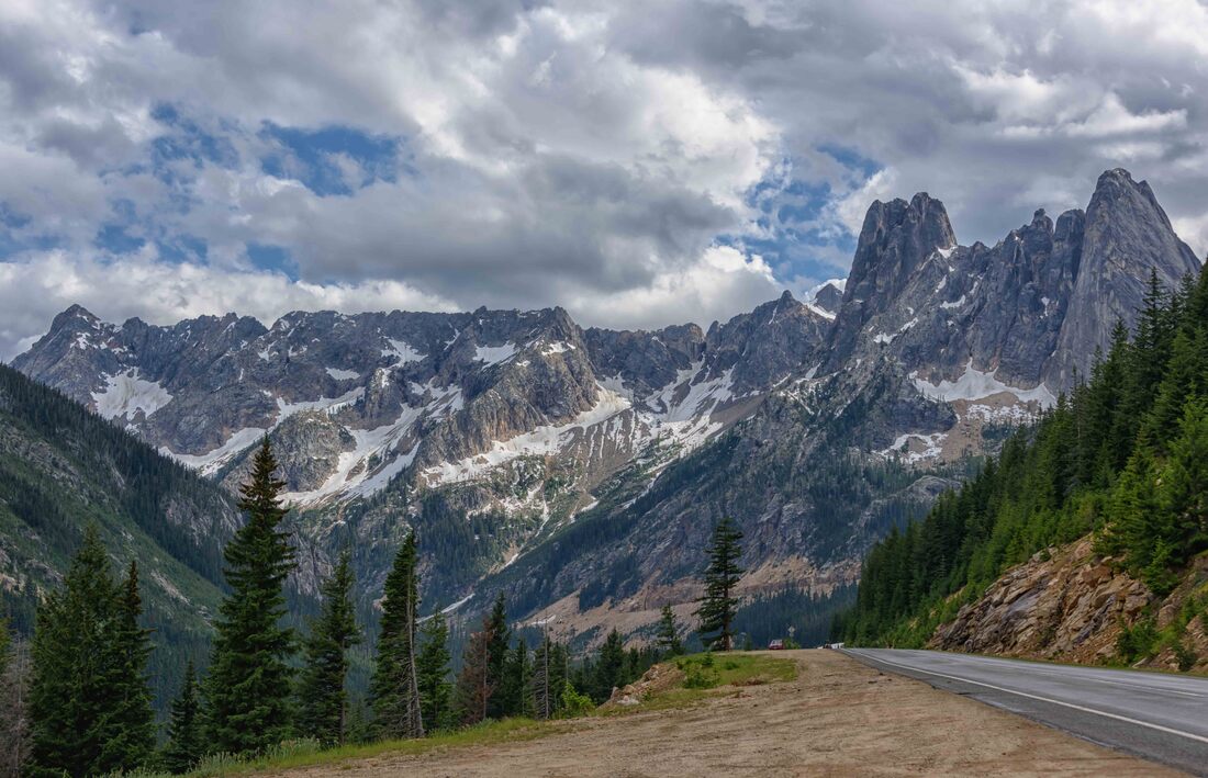
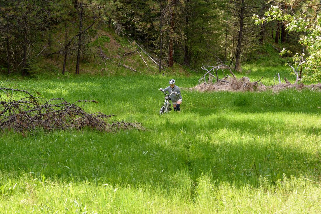
The North Cascades Scenic Byway may have its share of carsick worthy s curves, but this and other viewpoints make it a worthwhile route. Home in 2 days - it's been a good trip!
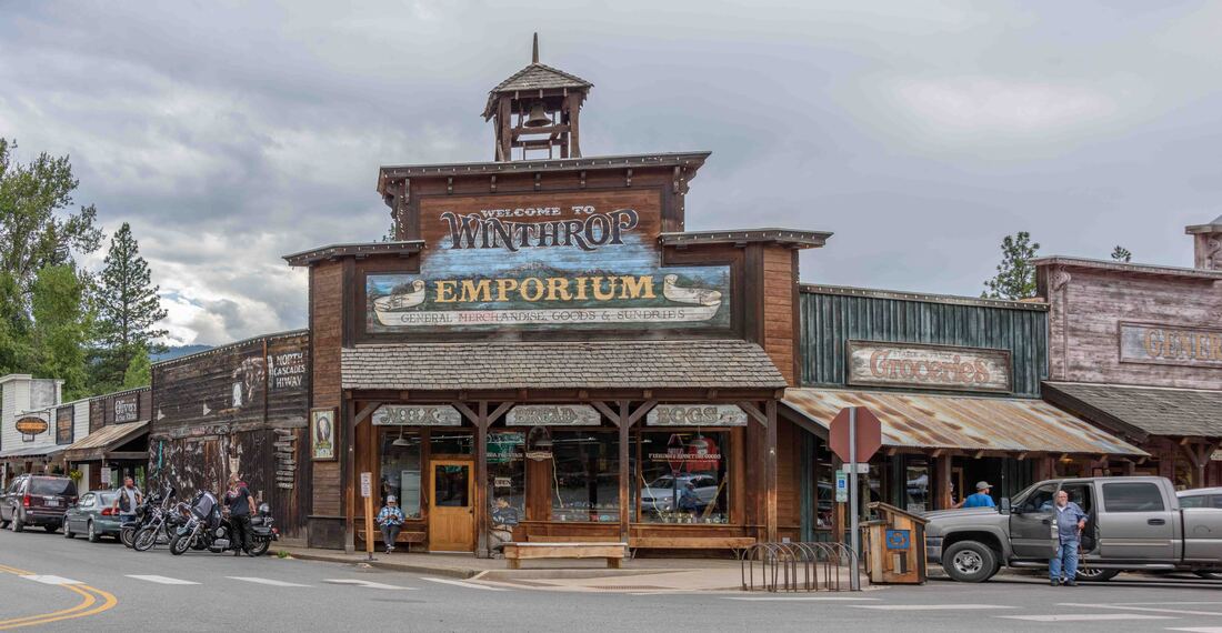
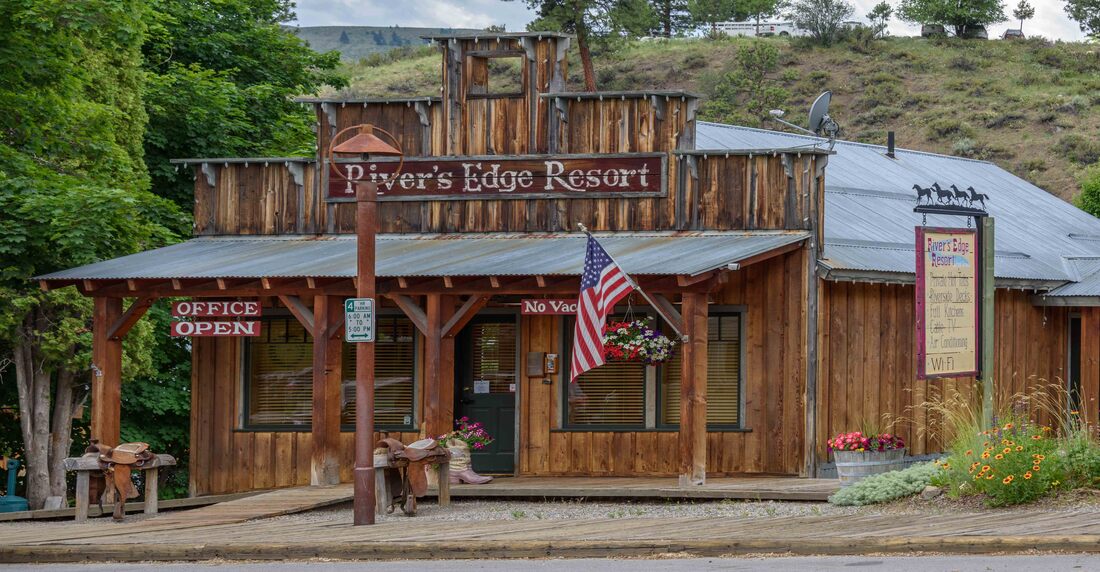
The North Cascades Scenic Byway was nearing completion in 1972 and Winthrop was situated at the eastern end of it. The town’s business people saw an opportunity to benefit from all those new travellers - original buildings from the late 1800s and early 1900s were given a facelift, shuffled about on the main street and repurposed to serve all manner of today’s tourist indulgences. The only thing that would make it a better experience would be to have the cars park elsewhere. (Winthrop, WA, June 15).
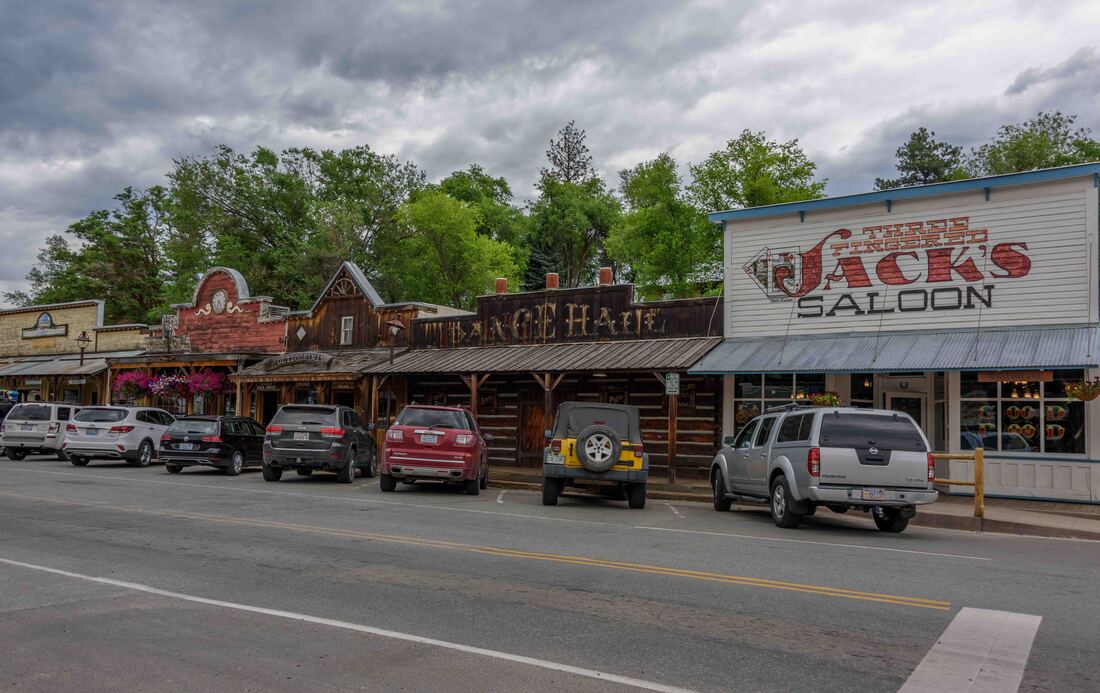
The oldest legal saloon in Washington - with alcohol the main offering, it’s no surprise that while other businesses have come and gone, Three Fingered Jack’s Saloon hasn’t stopped slinging beer for over a hundred years.
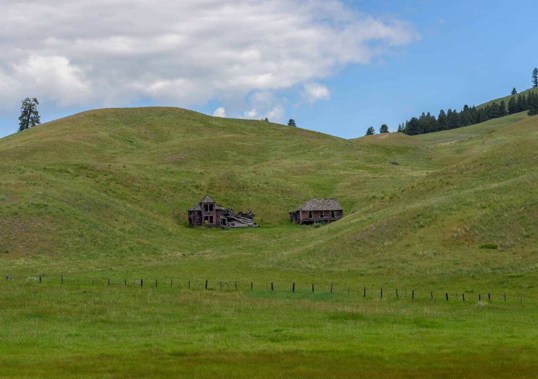
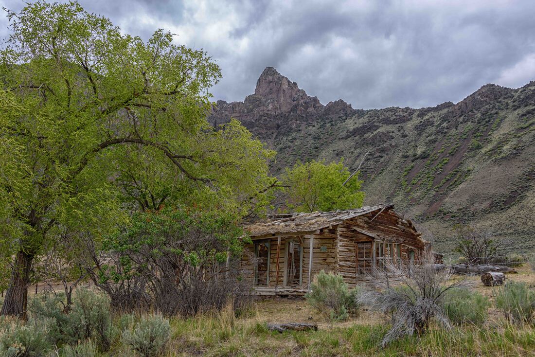
Throughout this past 4,000km there have been a surprising number of abandoned log cabins - a magnet for photography hobbyists. Snug in the mountains, this one took the picturesque prize and there was a posted story to go with it. In 1908, a German pioneer set about the laborious job of hauling materials from 10 miles away to build his dream home. Thirteen years later it still wasn’t complete, but the family moved on and the home has since slowly decayed. (Wauconda, WA, June 15)

Fairgrounds have become a favourite place to overnight. Often there are horses around or a horse show going on, the almost/totally deserted grounds are immaculate and always the sites are less expensive than the sardine-can style private RV parks. The 'funny' is how many times I ran from the camera back to my seat, with the 10 sec self timer set, to get this 'oh so relaxed' shot. (Republic, WA, June 14)

With the fairgrounds to ourselves, we watched the American Robins plucking worms from the freshly watered grounds as the warm evening sun set - simple pleasures.
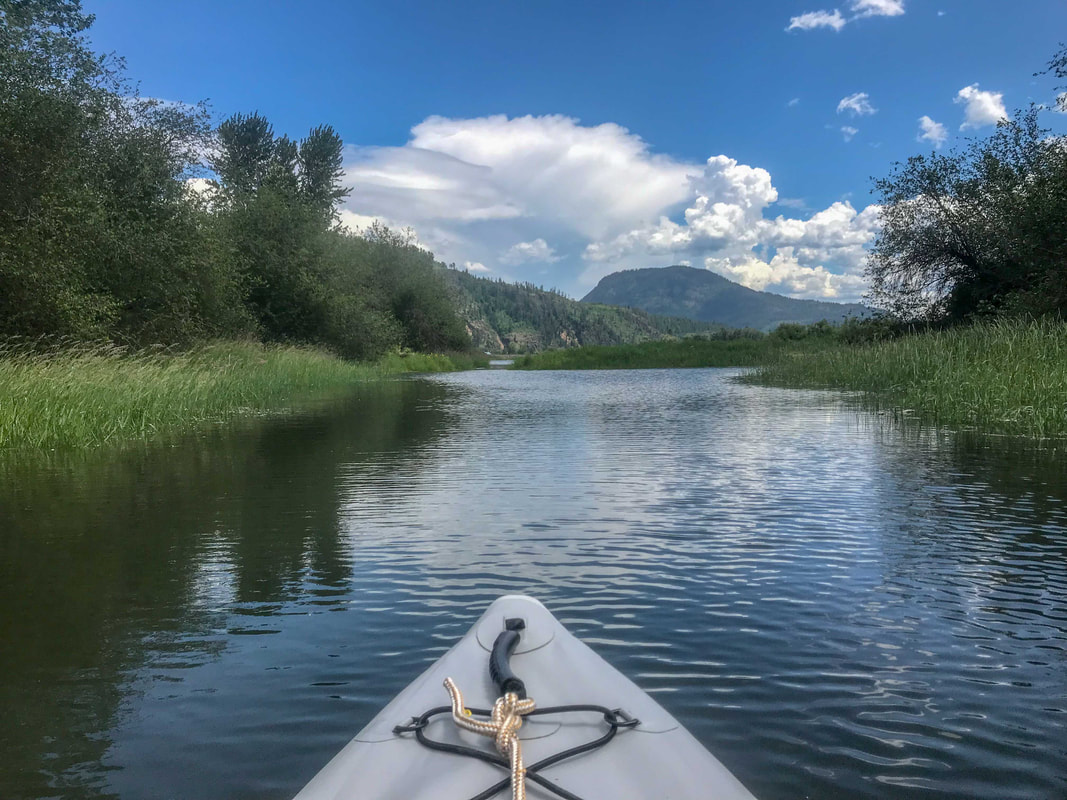
“Scenic Idaho” is stamped on every license plate and that really summed up this trip. For anyone with an interest in outdoor activities, it’s definitely a state worth visiting and for us, revisiting. Next time, it would be fun to take advantage of more of the kayaking opportunities. Above: Paddling in the windswept open waters was offset with calmer side channels - always fun to ‘explore’. (River delta near North Fork, ID, June 14)
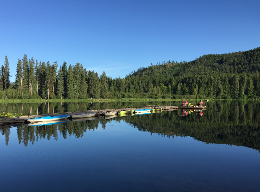
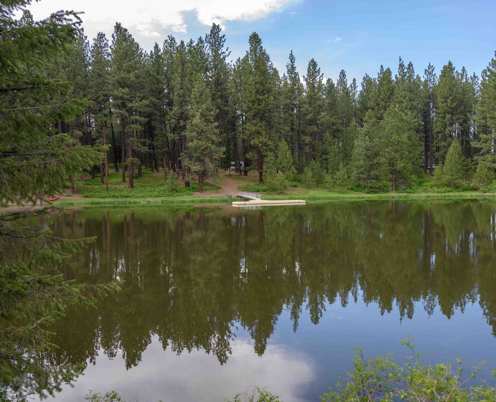
As it’s name suggests, the Round Lake State Park has such a lake. A wee paddle twice around the pond the following morning was a peaceful way to start the day. While a few bullfrogs vied for the most attention, it was watching and then hearing the loud snap of a heron’s beak catching a fly that most impressed us - we thought they only dined on fish. (Algoma, ID, June 11)
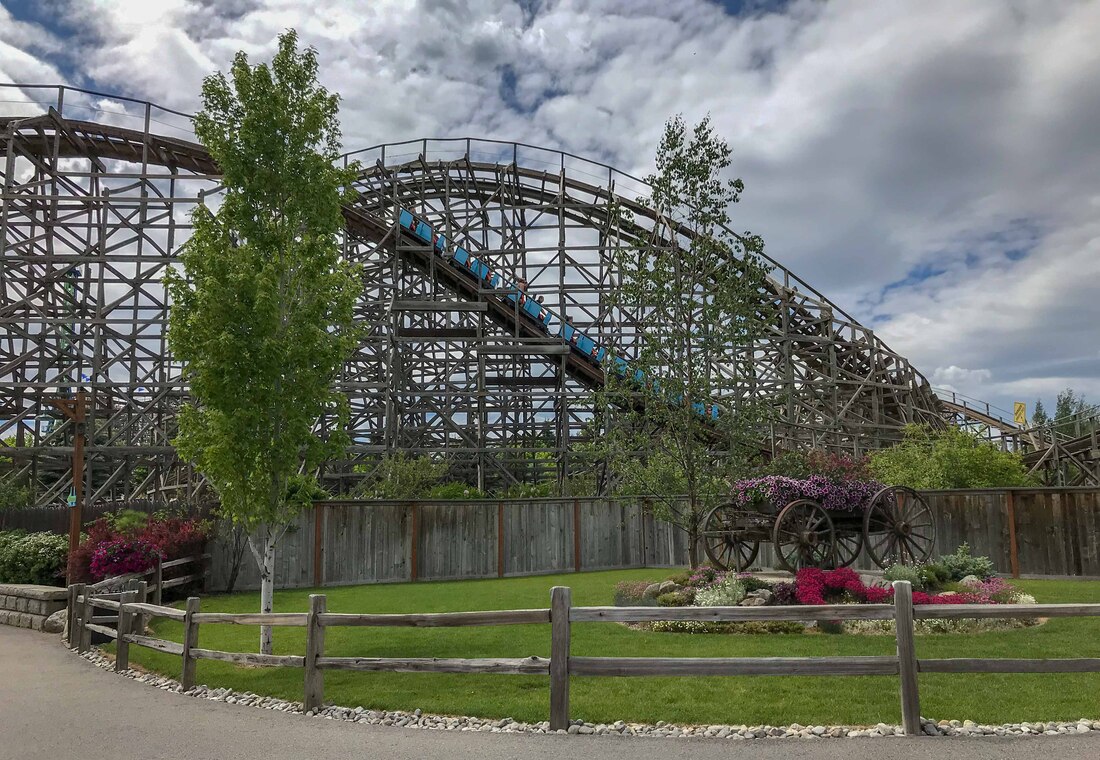
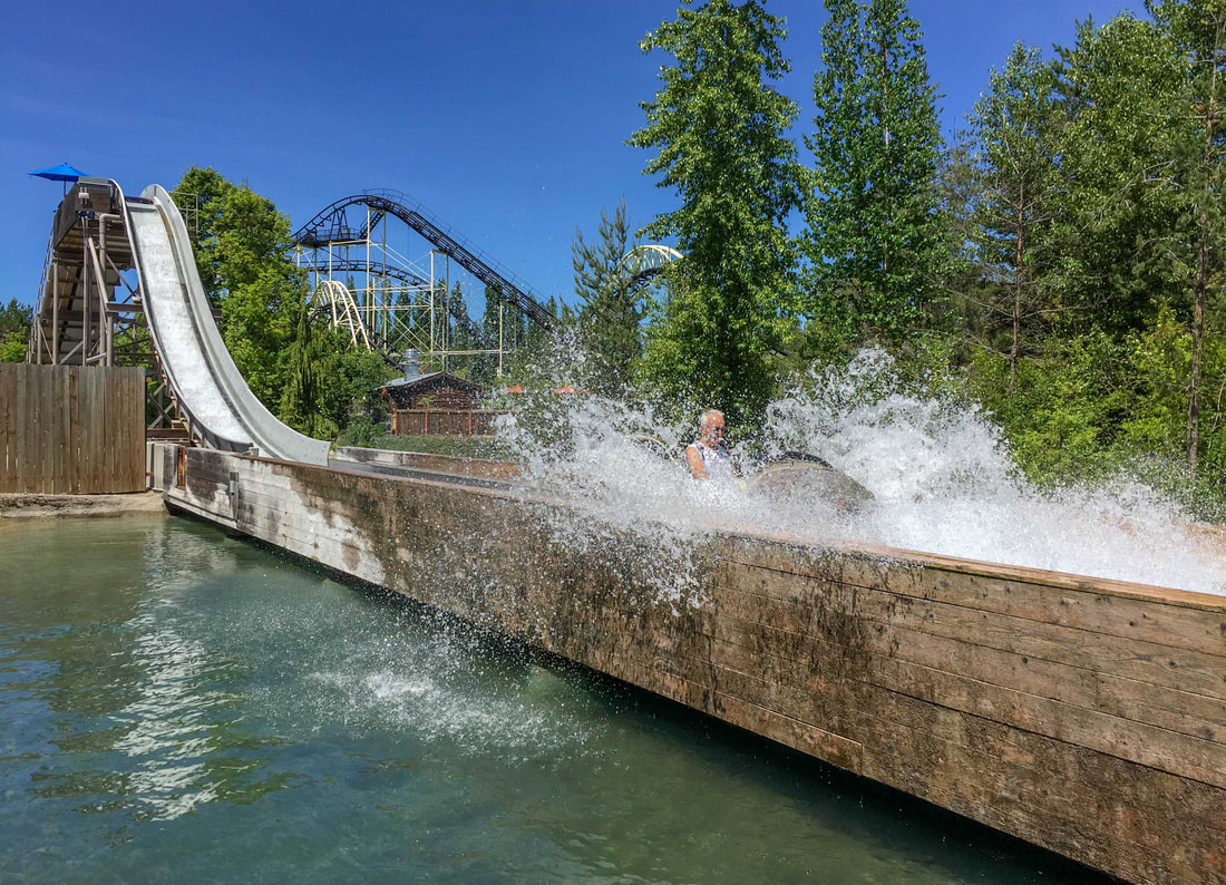
The Silverwood Theme Park was reminiscent of Dollywood, with rides that stretched one’s comfort zone, a couple of bone rattling wooden rollercoasters, quality entertainment, colourful landscaping adorned with old farm equipment and an equally expansive water park next door. (Athol, ID, June 10-11)
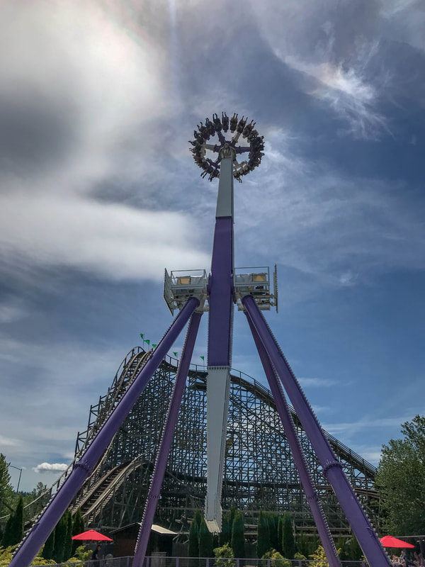
That was a very queasy ride, hanging upside down and slowly circling around for a 360 view - just when you thought it would stop it swung down and then up into the air for another round.
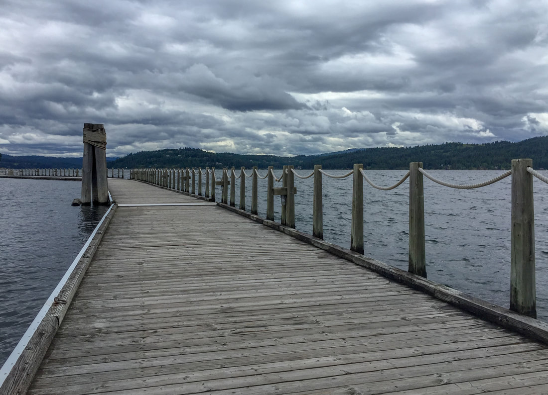
This picturesque town boasts the “longest floating boardwalk in the world” (3,300ft). It included a floating bridge and a short cruise further out took you to the floating golf course (which we passed on)! (Coeur d’Alene, June 6-9)
The 38km North Idaho Centennial Trail’s midway point is the city of Coeur d’Alene, where the trail runs through town alongside the lake (above) before continuing as far as the Washington border. From there it becomes the 60km Spokane River Centennial Trail which terminates in Spokane. The latter is more scenic so we rode a section of it the following day.
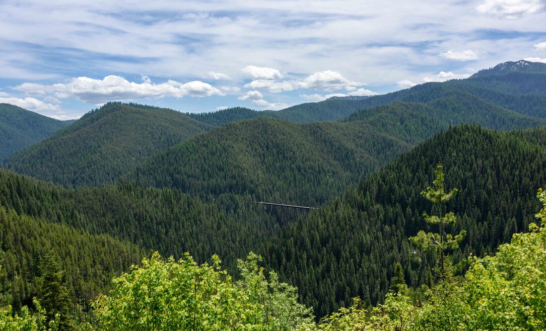
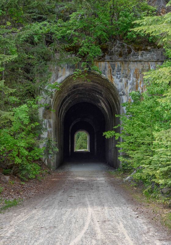
The Route of the Hiawatha bike path...7 steel trestles and 9 tunnels along a 24km downhill trail - it was an easy ride, especially with a shuttle service at the bottom. Above: a viewpoint at the top
of the trail offered a glimpse of one of the trestles nestled in the forest. (Route of the Hiawatha, ID, June 5)
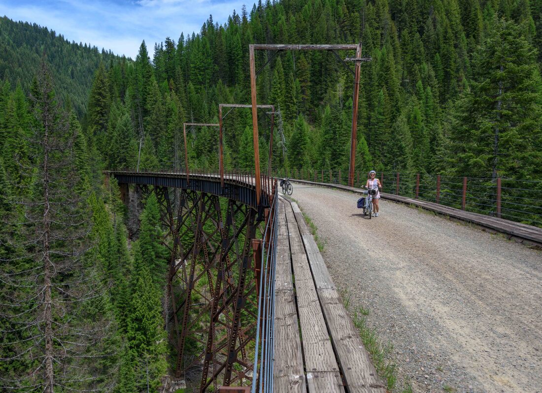
Between 1910-1960’s, the Milwaukee Railroad snaked along the Route of the Hiawatha. Travel was a novelty, passengers dressed in their Sunday best and dining was first class. The Pullman Porters company supplied the sleeping car attendants (formerly known as porters), drawn largely from former slaves. At its height in 1926, Pullman employed 10,000 porters - exclusively black - and is credited with helping form a black middle class, a precursor to the Civil Rights Movement.
The tunnels ranged in length from short to the longest at 2.5km! With the spring runoff channeling through the latter, it was a cold, wet and slippery ride. Good bike lights were essential in the pitch darkness.
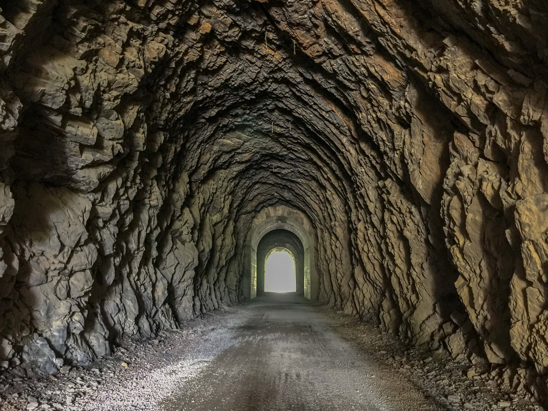
The great texture inside this tunnel looks less like it was finished with dynamite and more like it was shaped by manual labour.
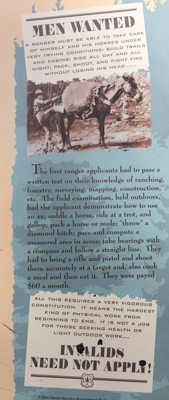
Signboards along the path recounted the history of the railroad and the early 1900s.
Above: an interesting list of ranger qualifications.
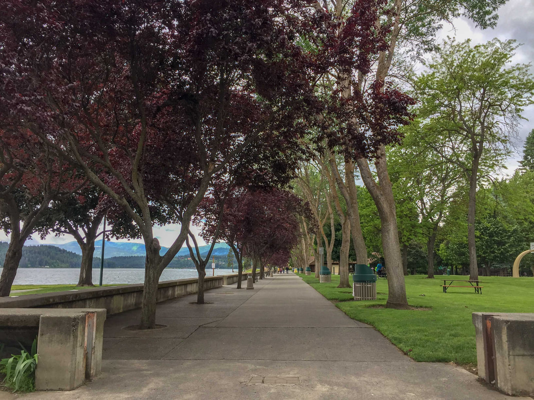
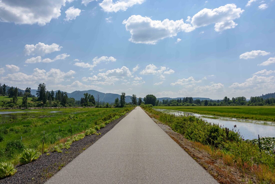
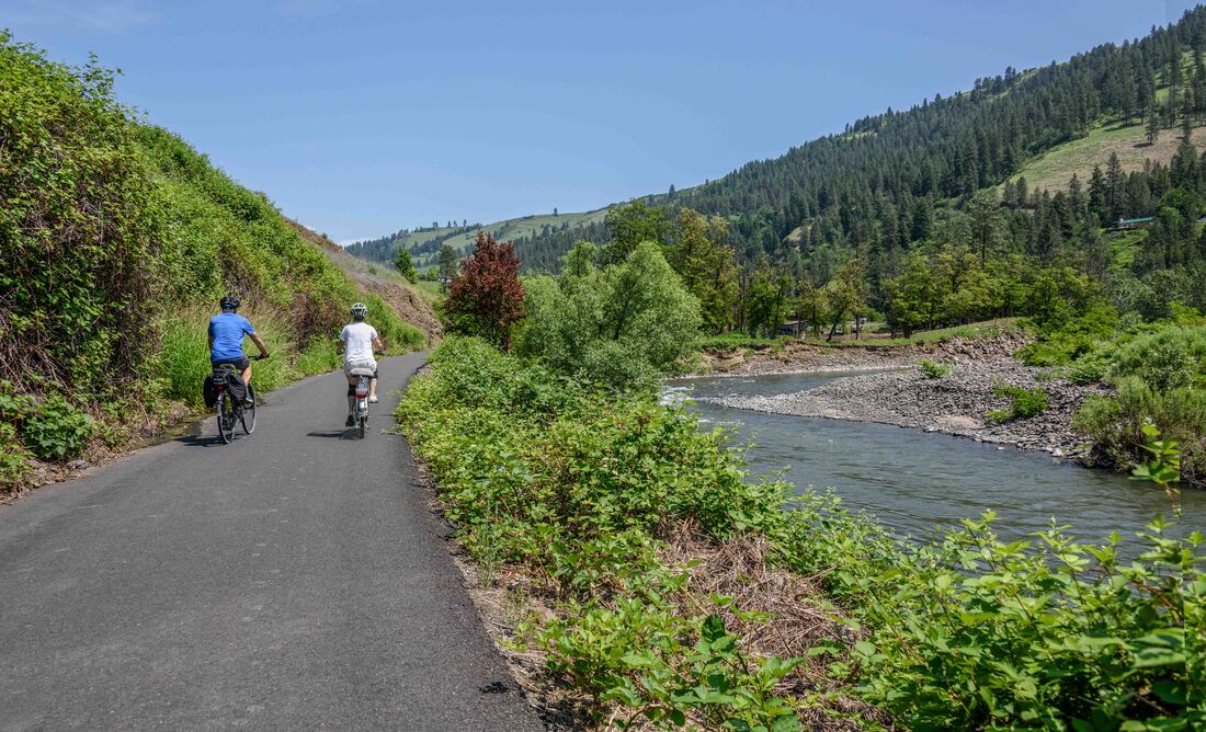
The Rails to Trails organization recognizes just a subset of its US trails as the best (Hall of Fame), including this, the Coeur d’Alene Trail; the longest path in the area’s collection, a 115km (one-way) paved trail that travels through communities between Plummer and Wallace. The next series of pictures capture scenes along the way. (June 1-4).
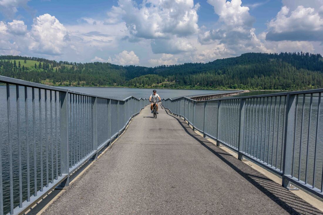
Above: The cyclist only bridge, with its wavy theme park design, spanned the Coeur d’Alene Lake. Given that this picture was taken at the mid-point of the bridge, no expense was spared to create this trail. (Ride: Harrison to Plummer & return, ID, June 1)
Ironically, today’s health benefits of riding the smooth asphalt of this trail can be traced back to the mining of lead, sliver and zinc that left a trail of toxic contaminates in the waterways and along the rail bed. One way to contain the contaminates was to pave the trail and border it with gravel. Repeated signage warned us not to eat on the ground, but to stick to paved resting areas. (Ride: Cataldo to Blackrock & return, ID, June 2)
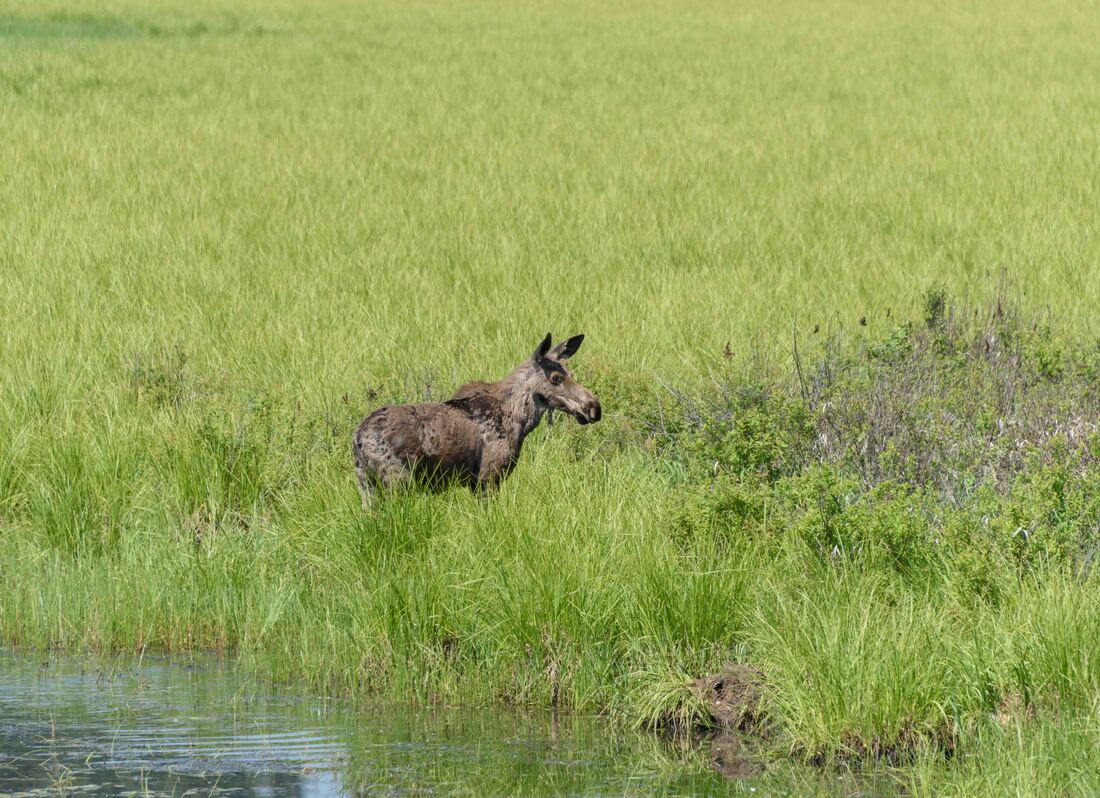
As part of the cleanup, a generous landowner allowed a section of his land to be flooded and after years of conservation the waterfowl and animals have finally returned. (Ride: Blackrock to Harrison & return, ID, June 3)
Rather than the usual forest scrub and bare patches, these Ponderosa Pines grew in a bed of soft, mint green grass - very pretty. The trees are particularly fire resistant as their bark simply peels off in the flames and the sun-starved lower branches easily burn off leaving no upper trail for the flame to climb. Wonder if this grove has gone through a recent burn given its perfect undergrowth.
(Cataldo to Kellogg & return, ID, June 4)
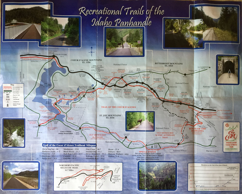
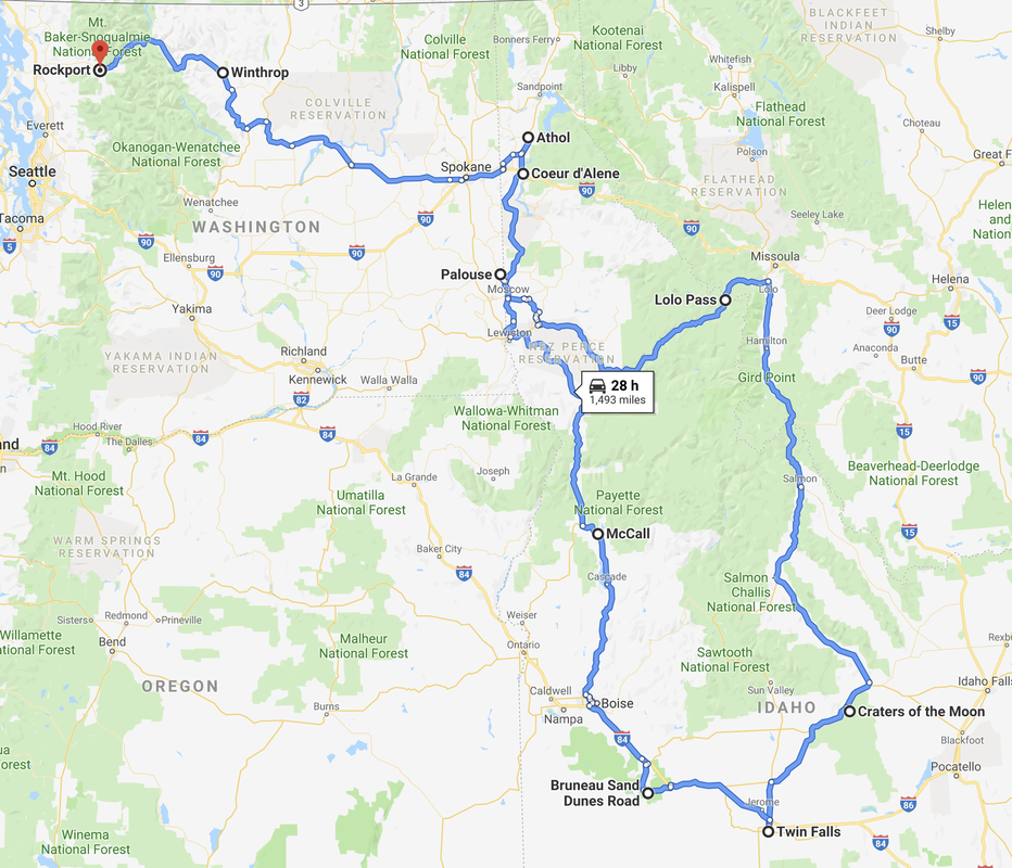
The Idaho Panhandle includes a collection of bike paths totaling 400km - 210km of those paved. With only enough time to explore a part of that system, we plan to visit again.
This path once served as the railroad route that connected the communities of Juliaetta and Kendrick. In the early 1900s, a Sunday outing for the townspeople would be to gather at their train depot to socialize with their neighbors while checking out who was arriving and departing-I’m sure there were few secrets in these small towns. (Juliaetta to Kendrick, May 31)
The fringes of The Palouse’s rolling hills extended into Idaho’s western border. (Culdesac, May 31)
During a bike ride around the state park lake, was a peak at our RV sitting in a sweet spot - home for the night. (Winchester, ID, May 29)
How typical...somehow, we took a wrong turn and lost our trail. (McCall, ID, May 28-29)
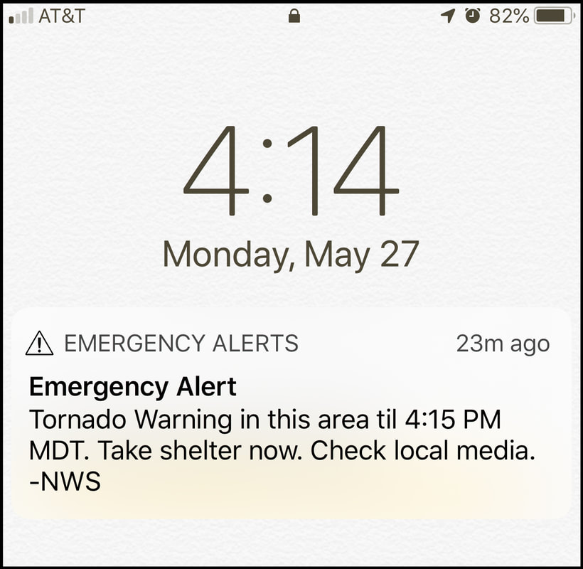
With the RV parked in an open field state park, miles from any town, a black cloud loomed and our phones blared an emergency tornado alert. We were told the wheelchair accessible washroom was the safest place to be...great, 20 campers and 6 dogs vying for the coveted spot. Not knowing what to expect, we battened down the hatches, packed some food and essentials and then watched the storm approach along with the other campers (who of course, couldn't resist telling their worst experiences). Alas, the storm veered north, and we were left with only an electrical storm and a good downpour. (Bruneau Dunes State Park, ID, May 27)
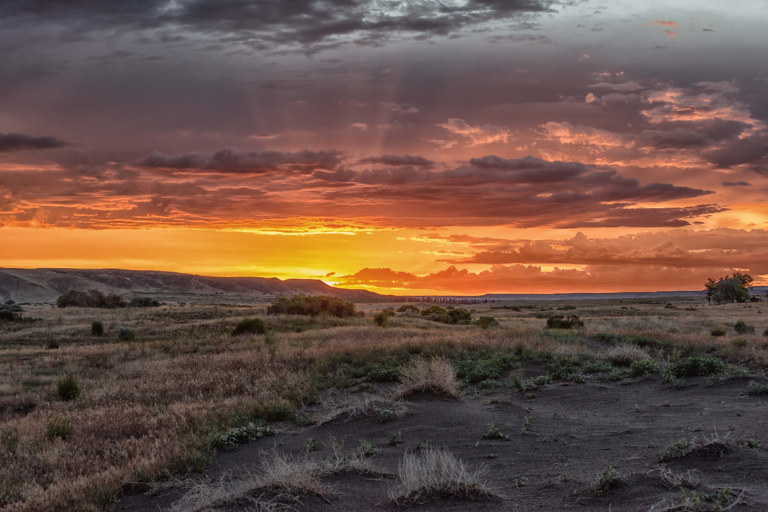
After all the drama, Mother Nature rewarded us with a brilliant sunset.
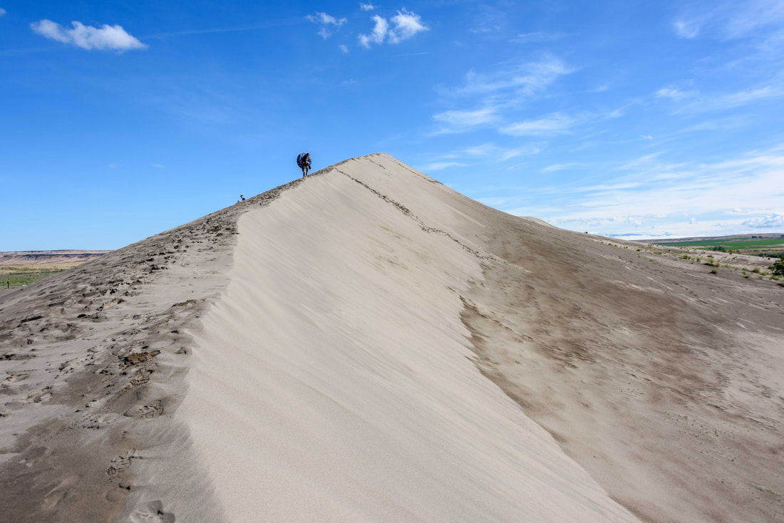
The state park has the 'highest single-structured sand dune in the US'. At 470' high, it draws a number of sand boarders.
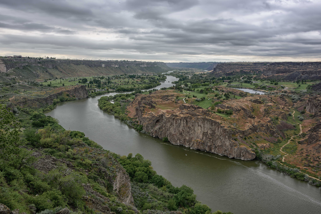
The scenic city of Twin Falls, set along the aptly named Snake River in the Snake River Canyon, was a mecca for outdoor activities. (Twin Falls, ID, May 25-26)
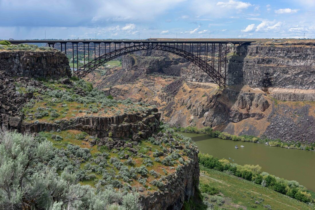
Spanning the Snake River, this bridge is popular with BASE jumpers, allowing year-round jumping without a permit. The arch supporting the bridge has stairs for the climbers to use to reach the mid-point. A mile upriver is a site made famous by a different sort of daredevil (below).
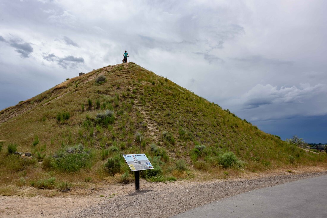
It was 1974 and Evel Knievel was going to ‘fly’ a mile across the Snake River canyon on his rocket motorcycle. We remember the moment - glued to our TV’s, with palms sweating. Today, as Rick perched atop Evel’s launch ramp, the 1-mile canyon span with its steep jagged cliffs seemed daunting. After all the hype, Evel’s parachute accidentally opened upon takeoff and the moment fizzled like a balloon with a leak. As a postscript; 42 years later the rocket designer’s son built a successor, named Evel Spirit, and another stuntman completed the feat.
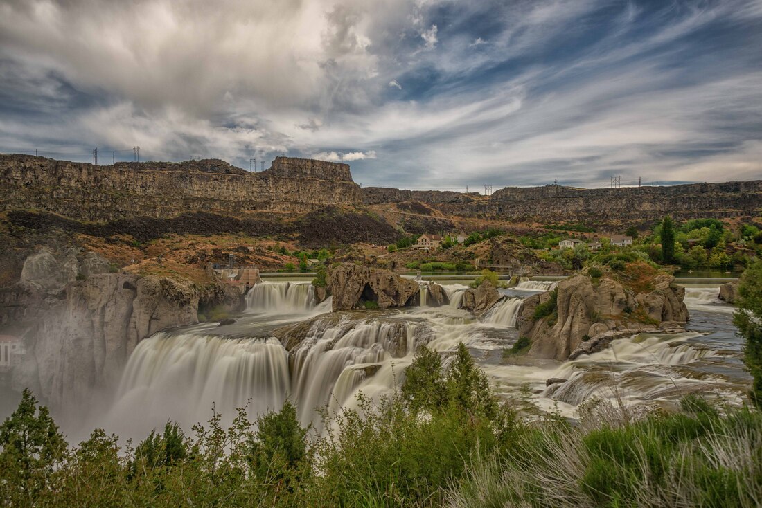
Not far from Evel’s ramp are the impressive Shoshone Falls - 45' higher than their cousin, Niagara Falls. A bike path runs along the rim of the canyon from town out to the falls – spectacular scenery.
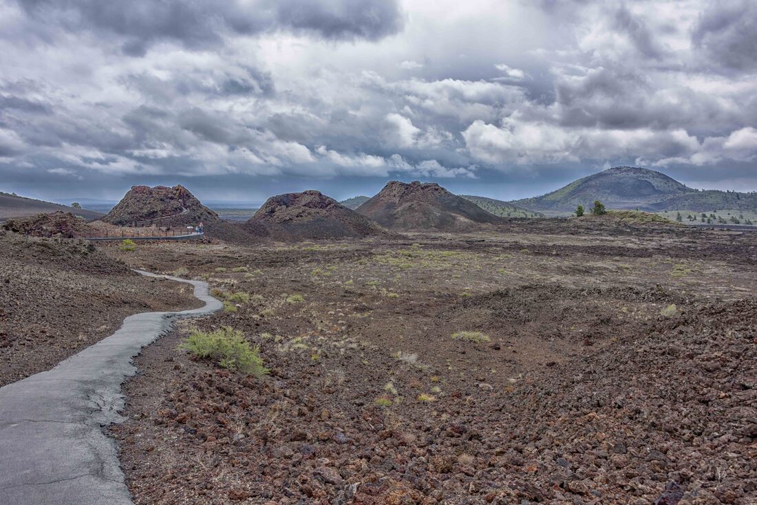
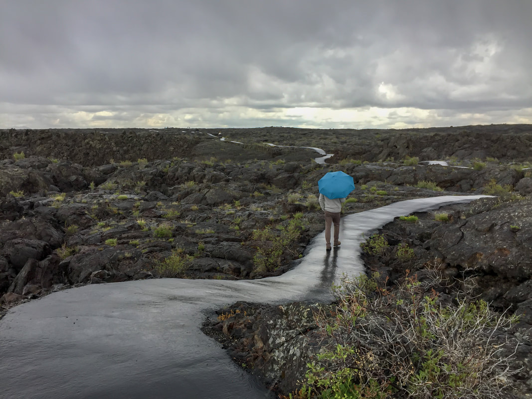
A Great Rift, 53mi long, runs through Idaho. Between 15,000 to just 2,000 years ago, lava made its way through fissures to create the Craters of the Moon Lava Field. The 618 sq mi preserve contains many examples of unique volcanic features: cinder cones, spatter cones, lava tubes, volcanic bombs and tree molds. Above: Spatter Cones - a trio of miniature volcanoes so named for the hot lava spatter that created them - similar to the appearance of clay thrown at a wall. (Craters of the Moon Nat’l Monument & Preserve, ID, May 24)
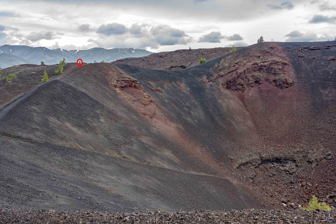
A steep walk up from the spatter cones lies the remains of the Big Crater. Rick (red circle) walking the rim of the mouth of this volcano, gives you a sense of scale.
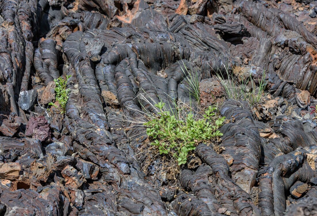
Over the millennia, seeds and soil have blown here to settle on the rope-like lava tubes.
The Limber Pine (perfect name) grows with the wind rather than trying to fight it. We saw one appear to defy gravity, only inches from the ground and parallel for 6’.
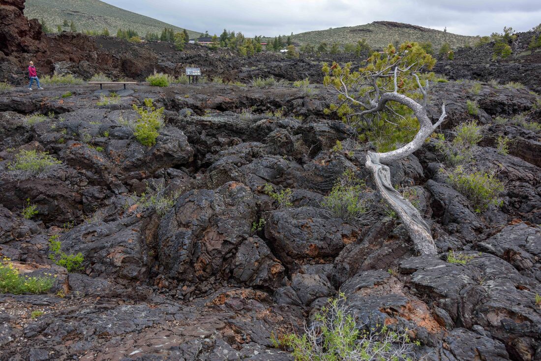
The lava fields extended as far as the eye could see. These photos don't do justice to the awesomeness of the preserve.
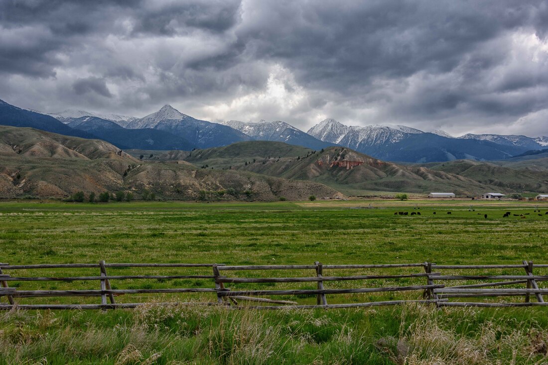
Travelling in a valley at an altitude nearing 2,000m, the Bitteroot Range flanked the North. The days and nights were cold. Naively expecting the state to be full of potato fields, it turns out they grow in the south - fueled in part by rich volcanic soil. (Lolo Pass, ID, May 23)
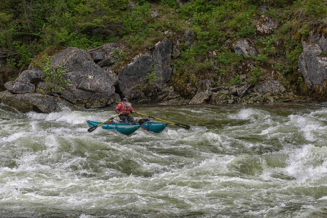
Lewis and Clark canoed this, the Clearwater River, in 1806 as part of their exploration up the Missouri River, across the Rocky Mountains and down the Columbia River to the Pacific Ocean. Amazingly, their party of 31 only experienced one loss and that was due to appendicitis. As we drove beside about 100 miles of rapids, now a draw for white water rafters, the perilousness of the expedition was reinforced. (Nez Perce-Clearwater National Forest, ID, May 21-22)
Along the Clearwater River sat several abandoned log cabins, many of their stories long forgotten. The area is still known for this type of home which is particularly suited for the harsh winters.
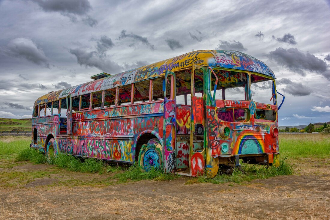
A roadside diversion. (Washtucna, The Palouse, WA)
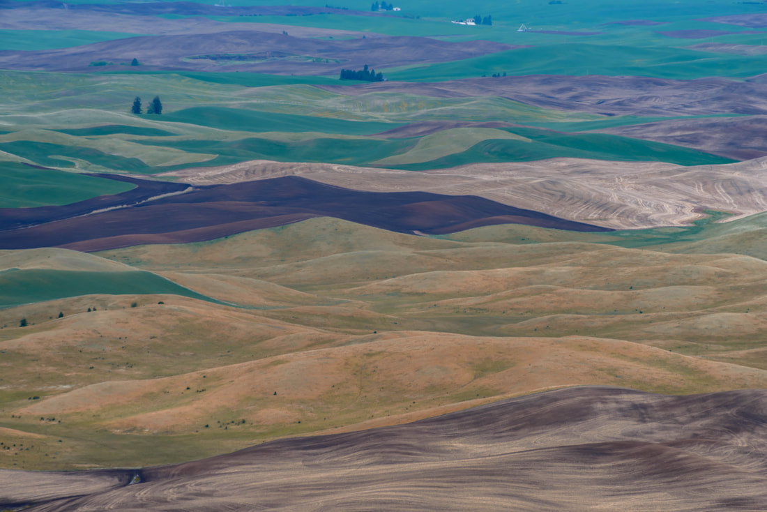
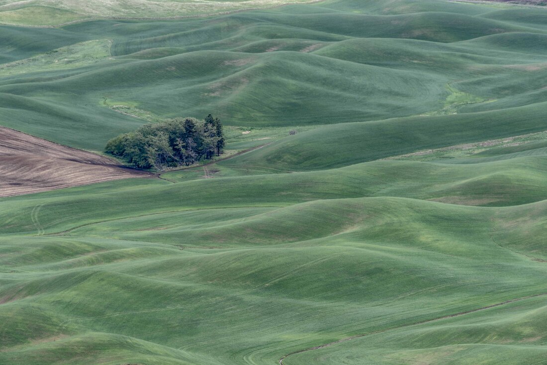
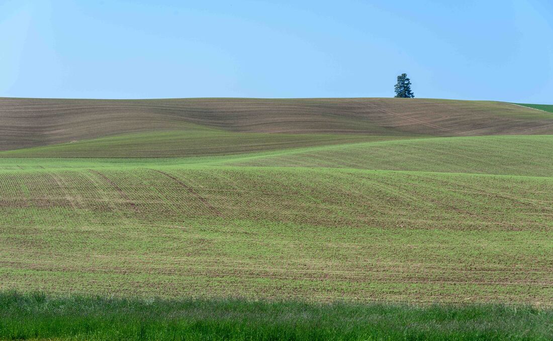
The undulating dune shaped fields of The Palouse span a collection of farming towns in Washington and Idaho. Over the last several ice ages, glaciers creeping southward from Canada ground up rock to create a fine dust called glacial flour. The ‘flour’ ended up in a glacial lake and when the lake dried up, all that silt was left for the winds to blow it into today’s landscape. (The Palouse, WA, May 17-20)
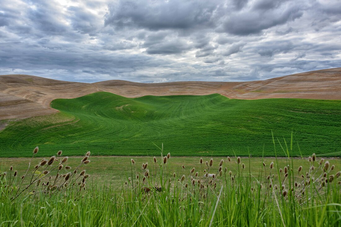
Wheat or lentils make up much of the green fields. The farmers play inadvertent artists as their combines create different patterns and shapes from hill to hill.
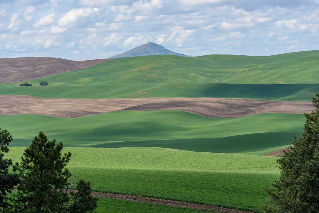
Some sections are left uncultivated at the top where the slope grade is too high for the machinery to climb. Even then, scaling the hills requires a self-leveling combine, invented here a century ago to tackle the Palouse’s challenging terrain.
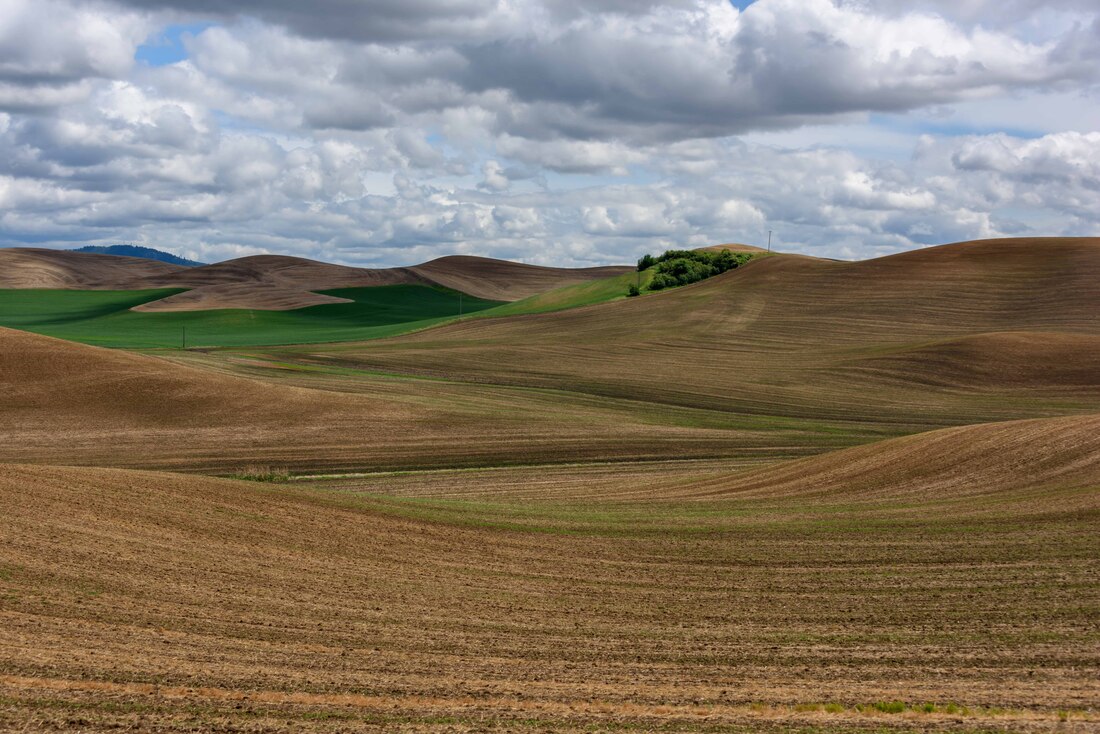
We had hoped to see most of the fields in green, but after spending hours driving around the hills we started to prefer the detail in the browns. Above, the remnants of the winter wheat harvest have left striking lines.