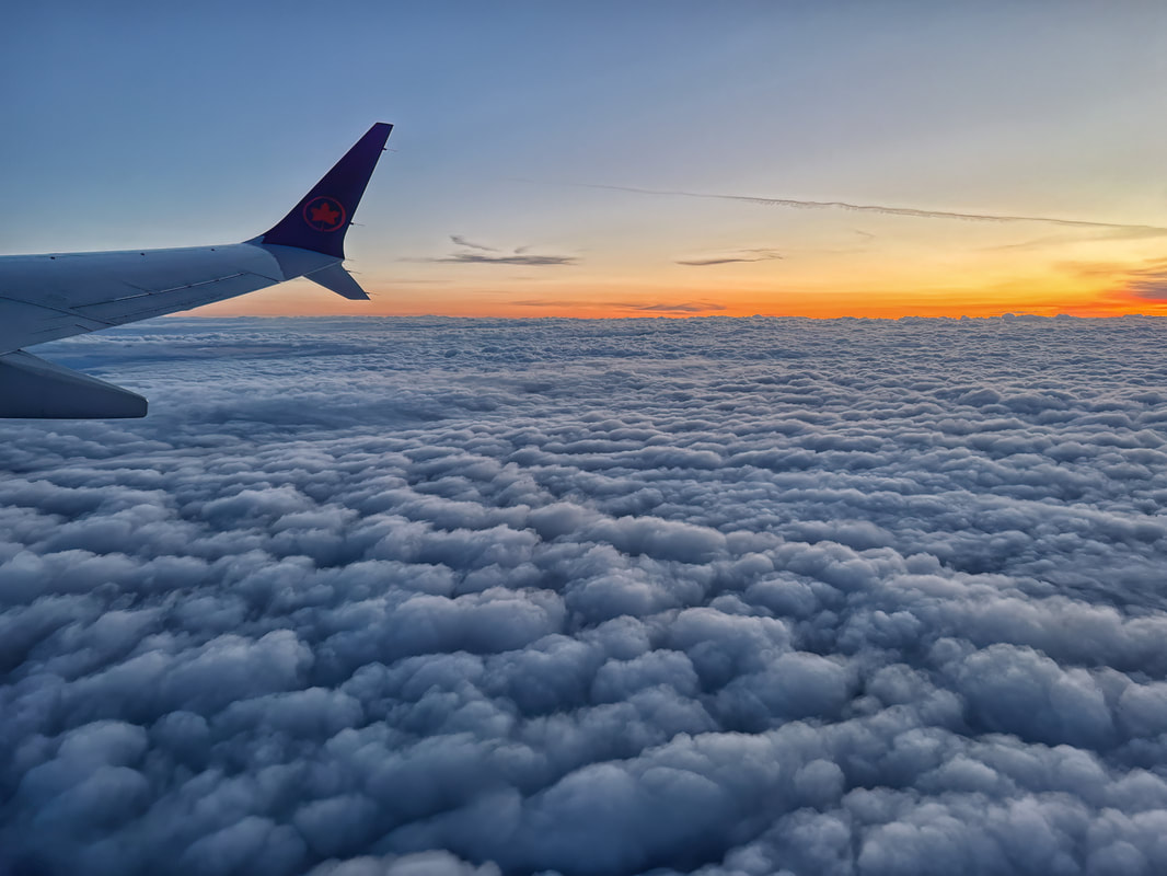
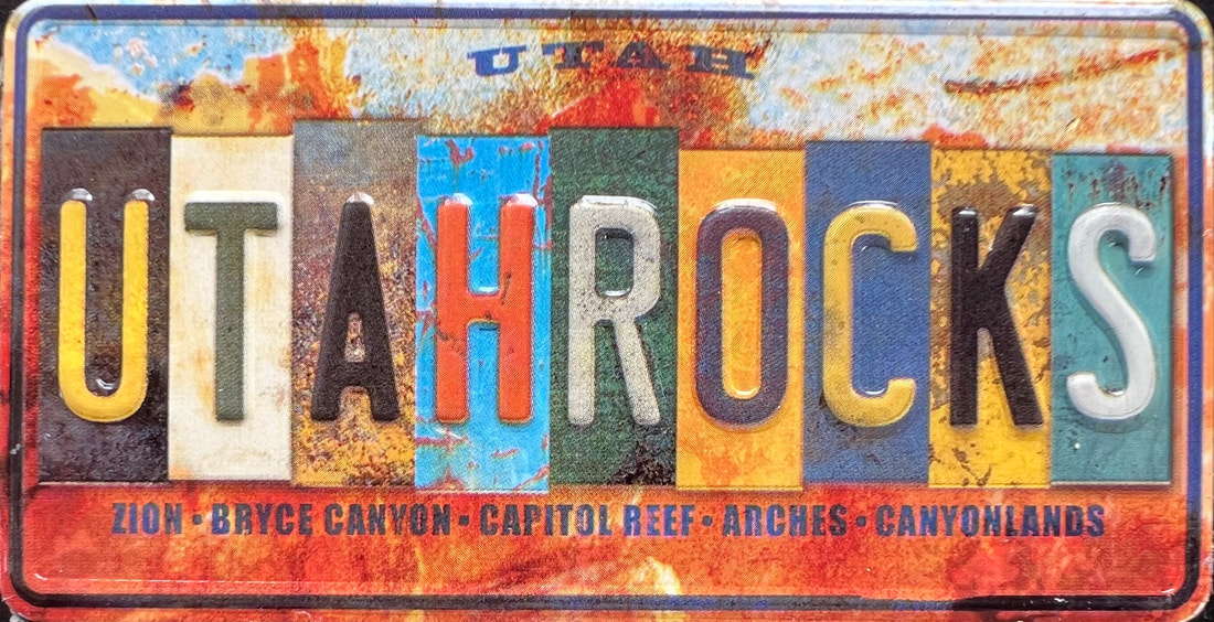
Utah, Nevada & Arizona RV Trip, Apr 14 to June 14, 2023
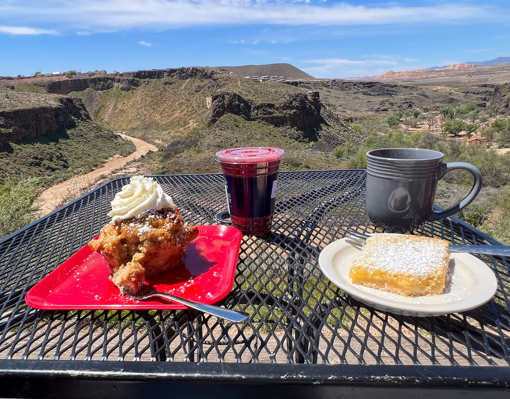
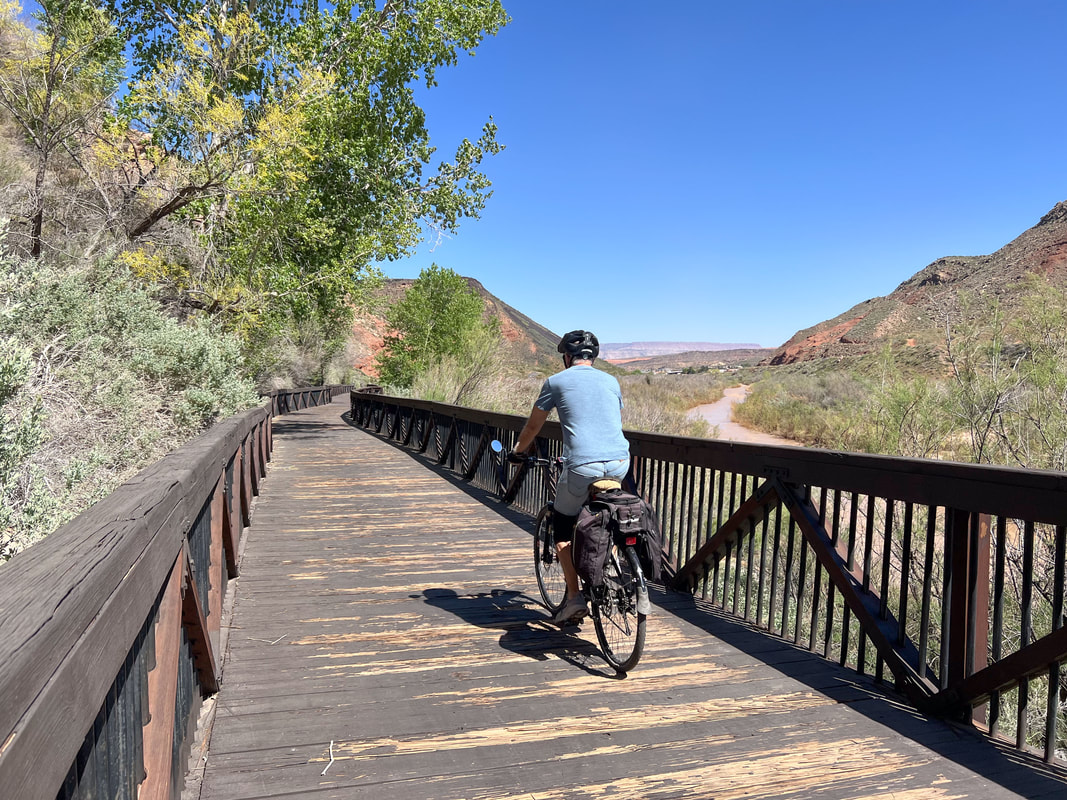
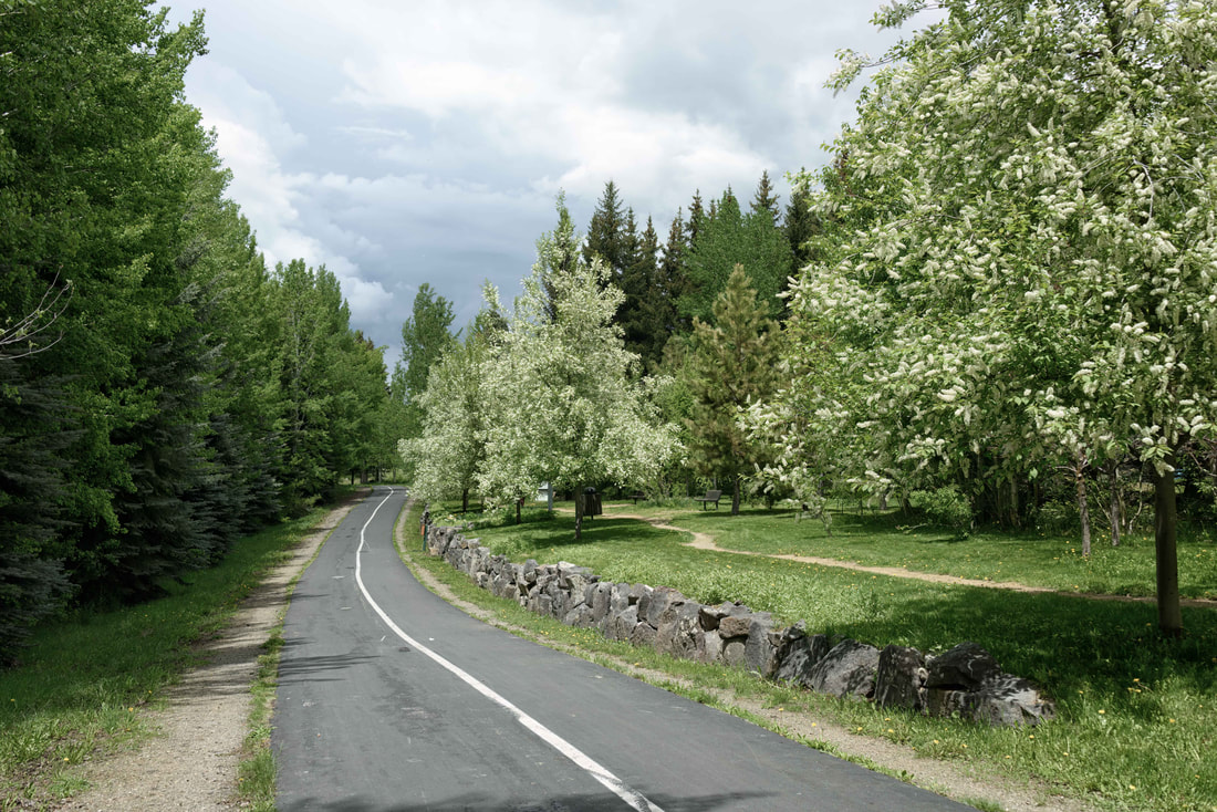
After our slow plod to get here, I was craving a coffee shop with character. This one met expectations with its cliffside view of the Virgin River. And then down the road there was an unexpected, paved path following the same river. A perfect day :) (Hurricane, UT, Apr 20/23)
|
|
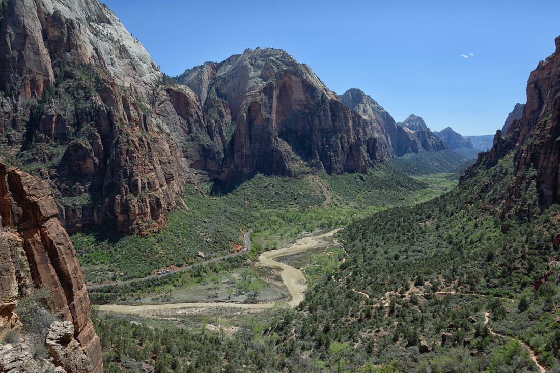
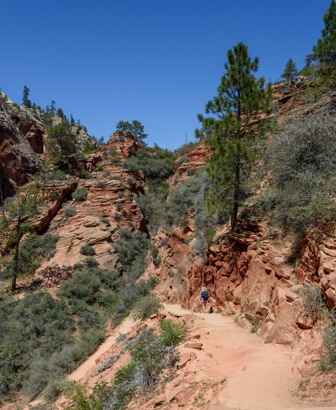
There was a Disneyland feel to Zion that at first put us off, but then we embraced the positives. A hop on/hop off shuttle slowly wound its way through the canyon dropping off hikers at various trailheads while a voice-over provided narratives about the history, flora, fauna and being conscientious custodians of the land. It was relaxing to just enjoy the scenery at a slow pace and then be dropped off at the lodge midway for a lazy beer after a hike. (Zion NP, UT, Apr 23-26/23)
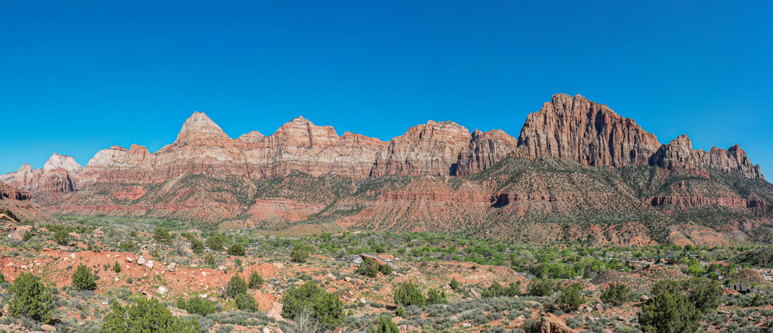
The view from our RV park was stunning, capturing a length of the giants that make up Zion NP. And Rick got to use his drone since this was taken from out of town and not considered the NP.
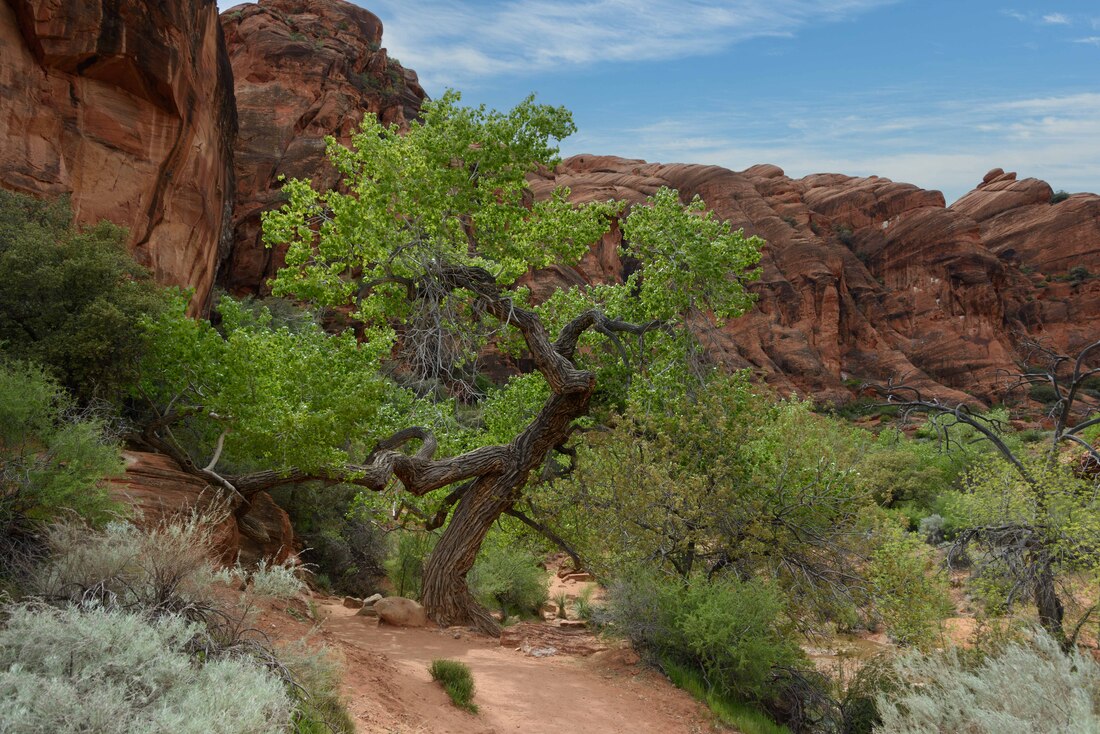
Although its no California Bloom, here the ubiquitous junipers are heavy with berries and pockets of white, purple and pink flowers are attracting the bees and hummingbirds. Seeing new green shoots everywhere is in stark comparison to our fall/winter trips that were weighted in the browns.
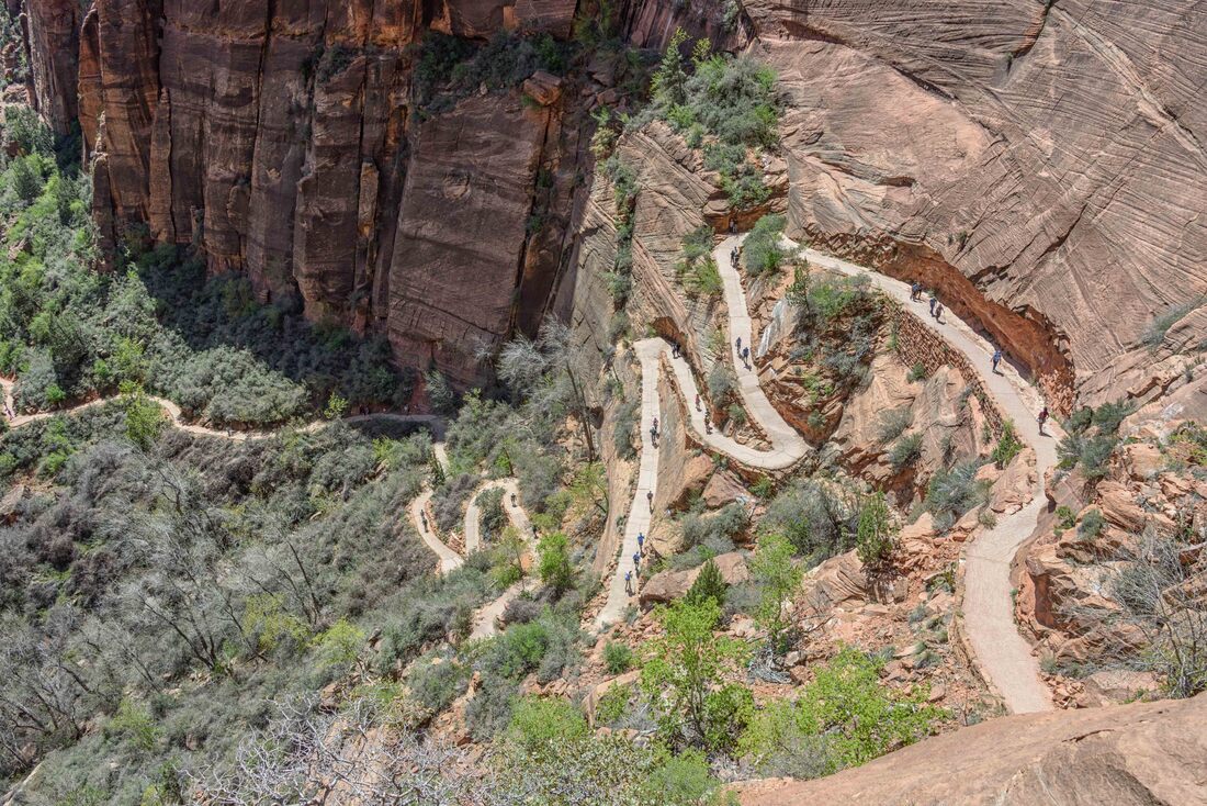
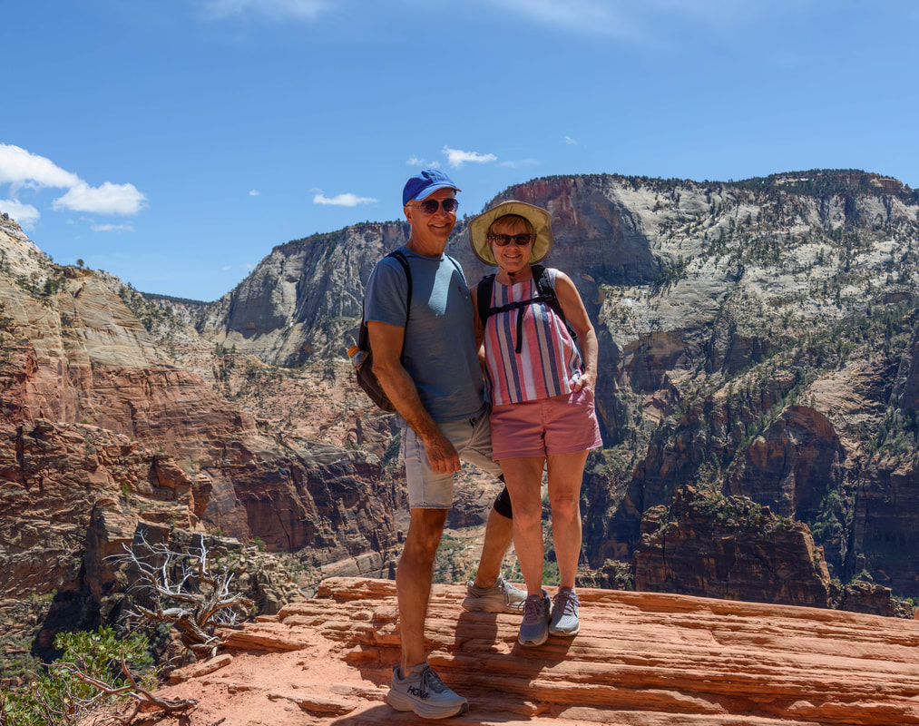
Angel’s Landing is THE hike in Zion. Twenty-one switchbacks to the viewpoint aren’t for the feint of lungs, but the final ascent to Angel’s Landing isn’t for the feint of heart. Hiker deaths while trying to make the final push for the landing aren’t uncommon and now permits are required to tackle it. We chose not to tempt fate and just enjoy the views from the main viewpoint and then another stunning panorama from a higher but less dangerous section than its coveted counterpart.
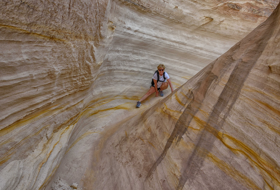
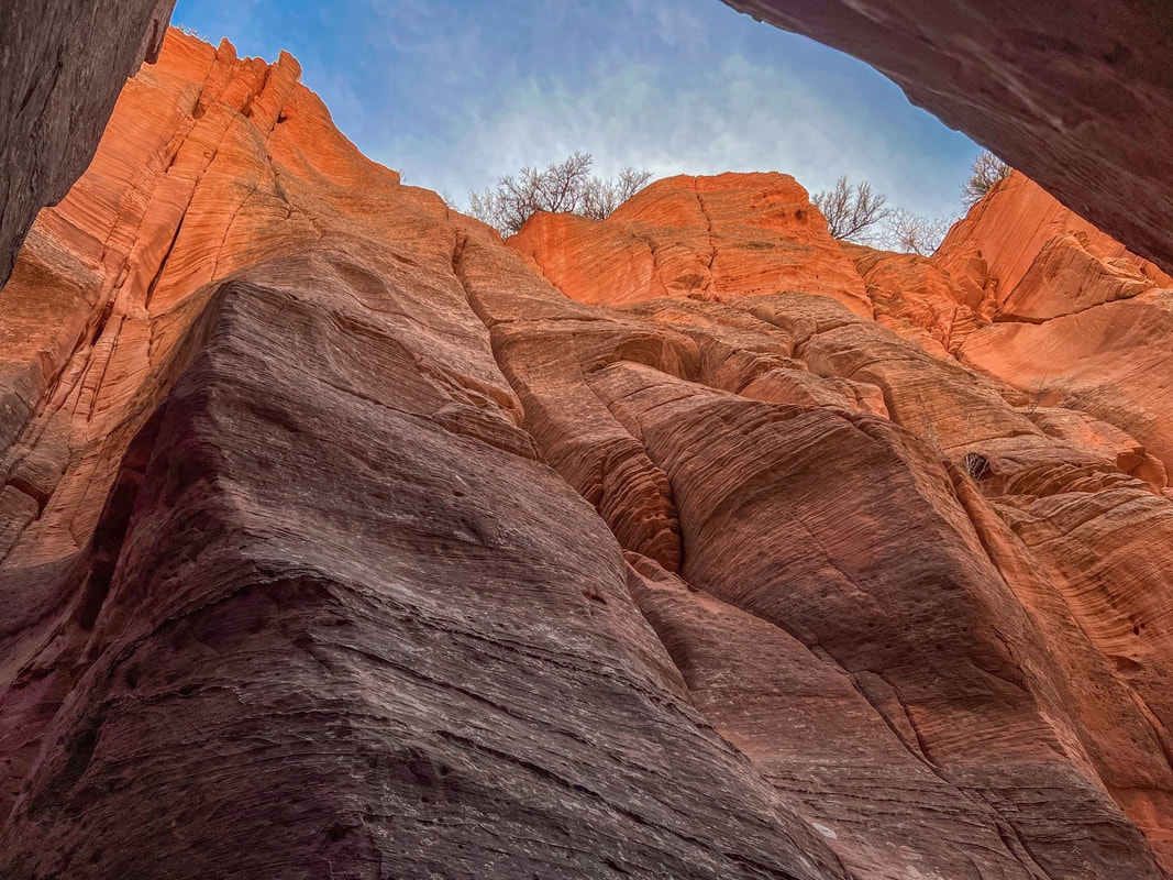
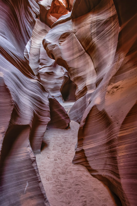
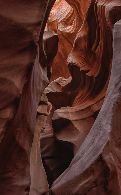
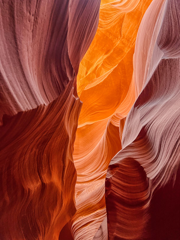
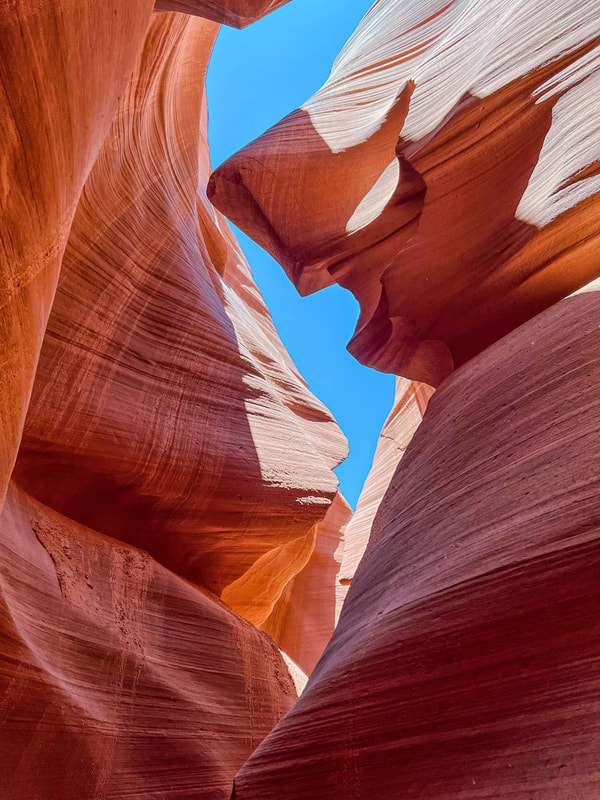
The chance to hike into and photograph the Wave is a long shot. A 3-day lottery process, each time with a fee, enters you into the running and there’s only a 2% chance of winning. An enthusiastic visitor centre employee assured us that other sites haven’t been marketed as well, but they’re destination worthy, far less crowded and you can take photos without being rushed or trying to dodge crowds. Above: Red Hollow Slot Canyon and below the Nautilus Slot Canyon. (Kanab, UT, Apr 27/23)
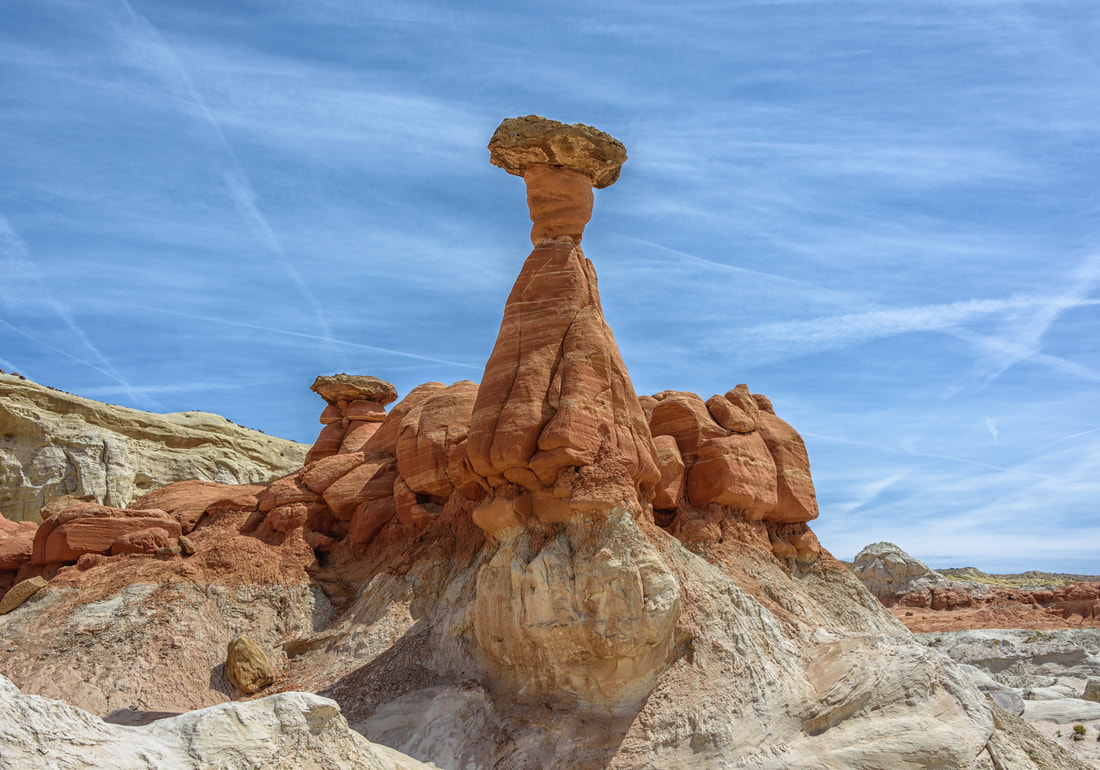
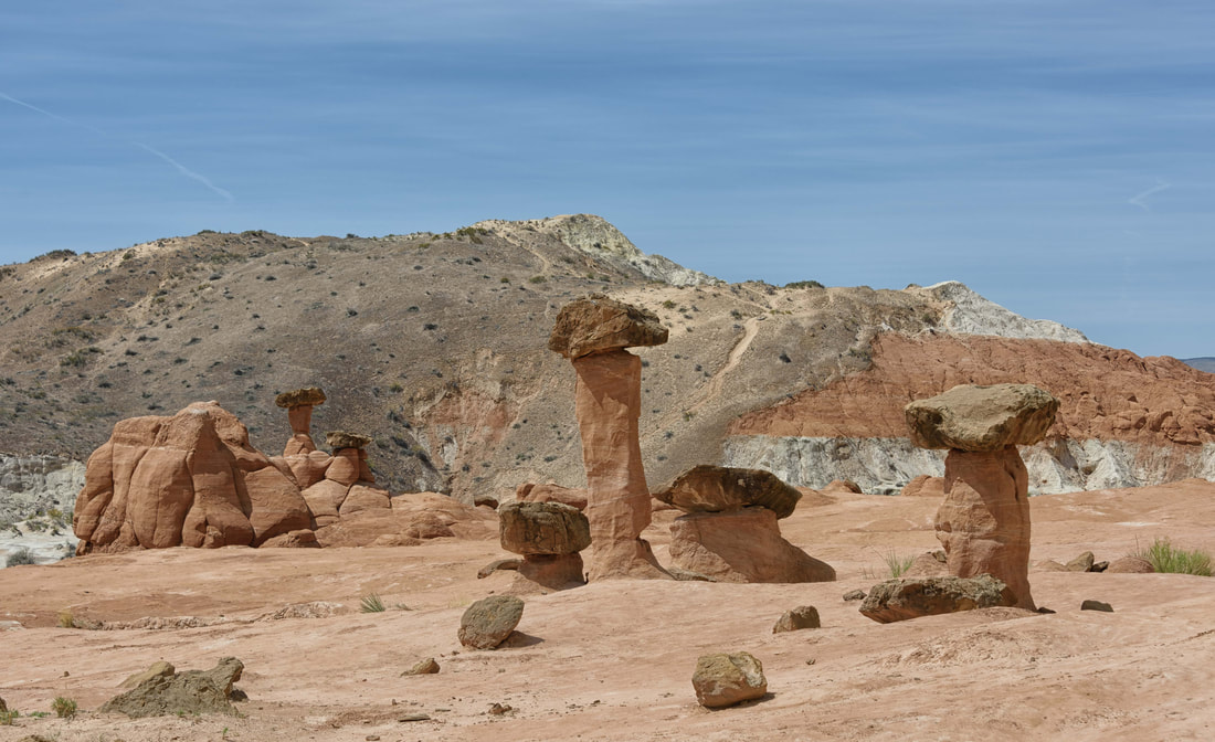
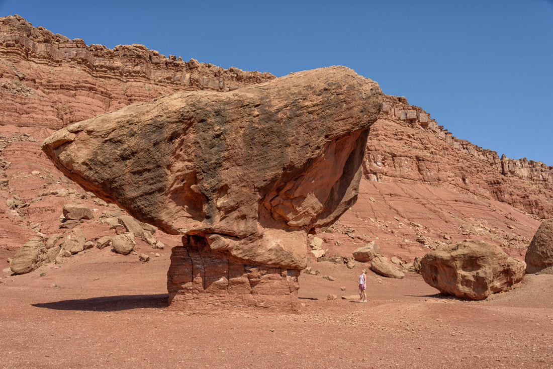
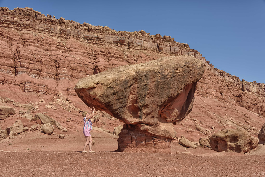
Located in the perfect conditions to form toadstools - wind and water erode the softer lower rock while leaving a stronger sandstone boulder atop. Current toadstools are eroding, while others we could see were in the early stages of development. (Toadstools, Kanab, UT, Apr 28/23)
|
|
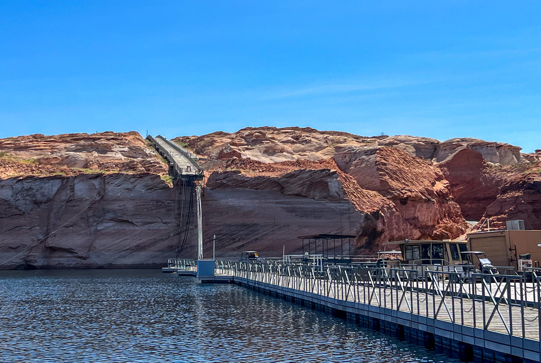
Lake Powell and nearby Lake Mead are the 2 largest reservoirs in the US. The former’s water levels are the lowest since the man-made lake was created in the early ‘60’s. The unusable boat launch - hanging at the cliff’s edge in the pic above - leaves kayakers like us lugging our gear down and up a 50’ sandy, steep cliff to access the put-in. (Lake Powell, Antelope Canyon branch, AZ, Apr 29/23)
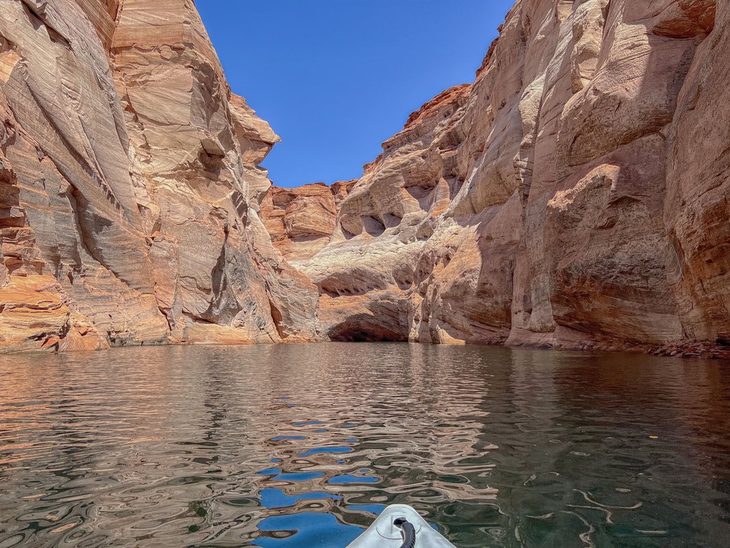
Once we got into the water the paddling was stunning. Instead of kayaking 50' higher past sandy beaches, our views were the canyon-like cliffs now exposed with the drop in water.
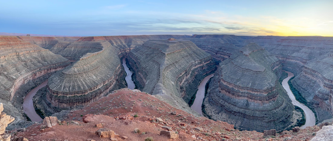
Horseshoe Bend gets the fanfare, but the 3 huge bends in the San Juan River at this state park were impressive. A million years ago the river meandered on a relatively flat plain, and then the Colorado Plateau slowly uplifted leaving the river below. A BLM/state park campground allowed all campers a cliffside view. (Goosenecks State Park, UT, Apr 30/23)
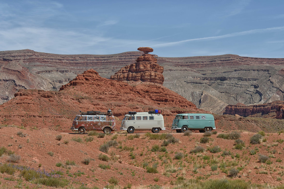
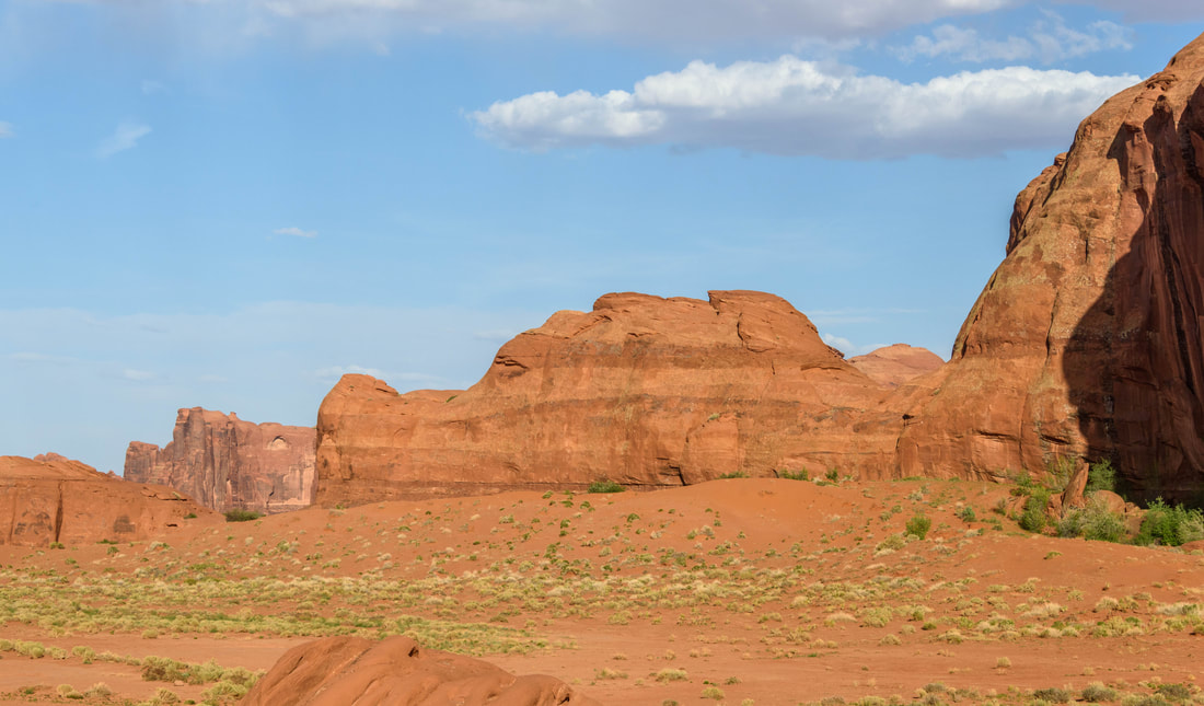
Three road warriors unwittingly pose in front of the Mexican Hat formation in Monument Valley (MV). The Navajo Reservation owns MV and the Mexican Hat is one of the few formations that can be seen without a guide. (Monument Valley, UT, May 1/23)
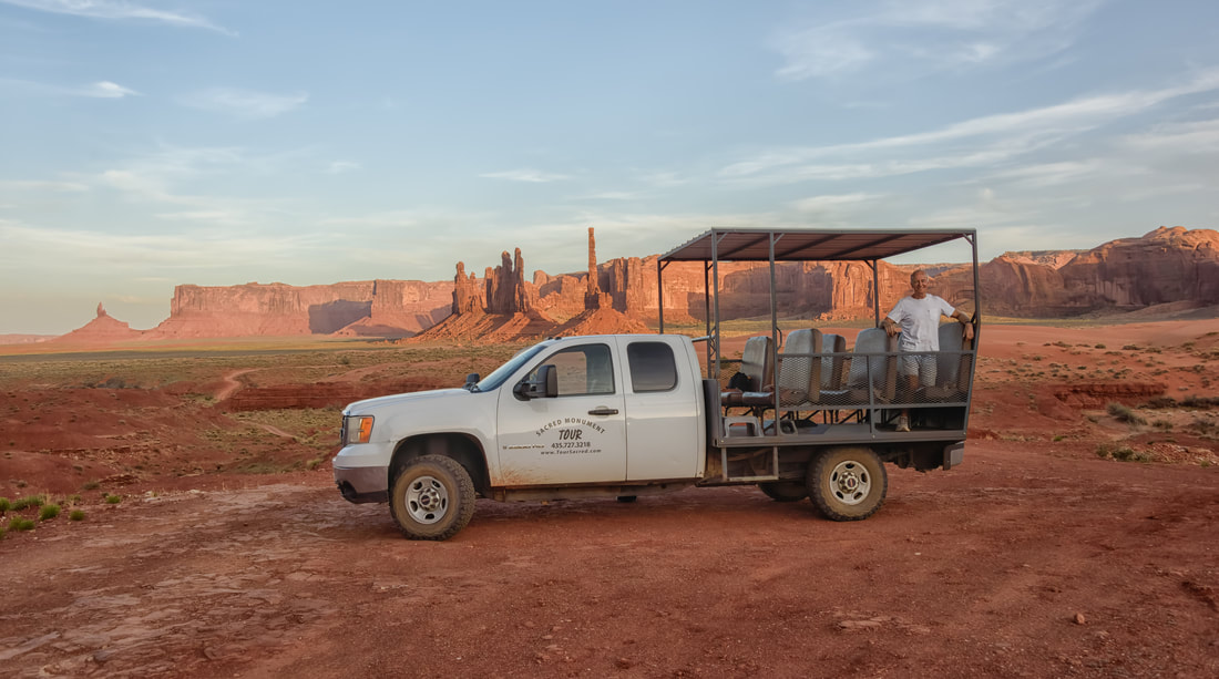
We wanted to see more than the classic MV photo of a highway bisecting the iconic rock formations, so we opted for the 2.5hr sunset ‘Spirit Tour’ that ventured into the ‘road closed’ areas prime for photographs. A warm breeze kept us cool while being driven past one formation after another, each with their own name. It was such a peaceful experience taking in the enormity of the valley and watching the light change the colours of the rocks as the sun set.
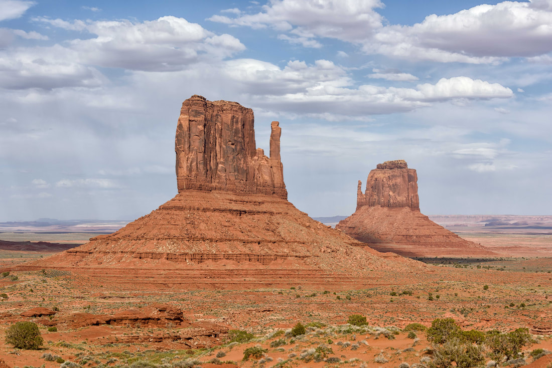
It was interesting that the Navajo didn’t confine the rock names to only those given by their people. A couple were named after early prospectors, one after John Wayne and another after his director John Ford who made a few western movies here in days gone by. Above: Sleeping Dragon. Below: Mittens
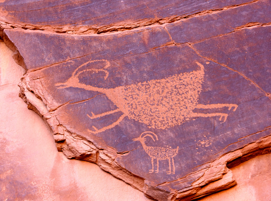
Petroglyphs left behind by cliff dwellers from about the 1400’s. Apparently, they were an exceptionally diminutive people judging by the handprints and entrances to their caves in the rocks.
A weeklong detour to attend Uncle Larry’s celebration of life back home. As expected, it was an emotional family-only gathering to celebrate a kind man who led a rich life.
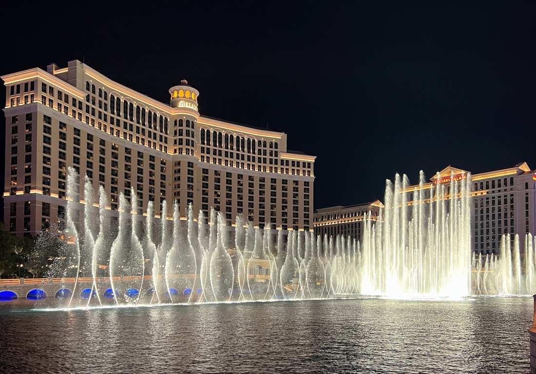
The Las Vegas strip and Freemont Street added some city time to an otherwise nature-centric road trip. We only visited our fave Strip experiences, plus an exhibition - the Bellagio for its flowers and fountains, followed by Paris’s dueling pianos to wrap up the night. Our first visit to Freemont made us feel uncomfortable with its focus on peddling flesh - something it has become known for based on the 'stop exploitation' posters around. (Las Vegas, NV, May 3-5 & 8-9/23)

There was a Princess Diana exhibition which of course included clothes.

A renowned paper artist recreated Diana’s wedding dress and shoes. The effect looked liked silk. Seeing the ornateness of the shoes reflects the fairy-tale the wedding was made out to be.
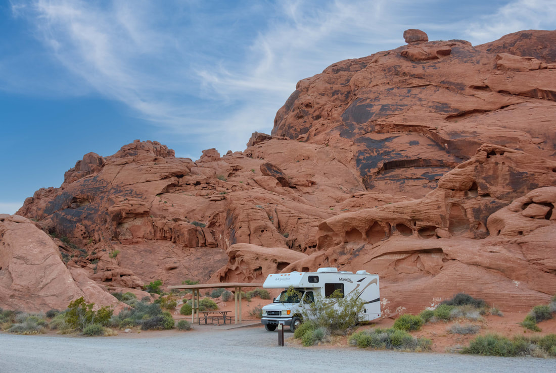
Named for the colour the rocks take just before sunset. (Valley of Fire SP, Mohave Desert, NV, May 10/23)
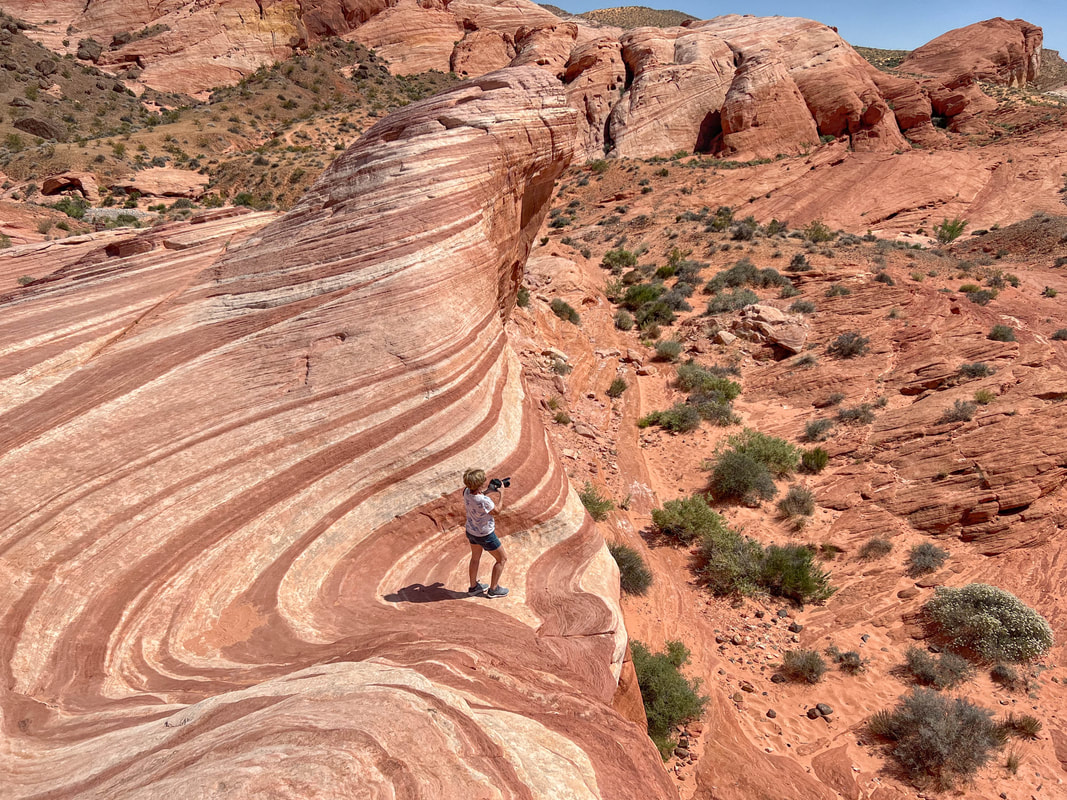
The First Wave trail map warns that walks feel longer than listed with the heat and soft sand. The longest, a mere 2.5km, actually closes from June to Oct due to the heat radiating off the rocks.
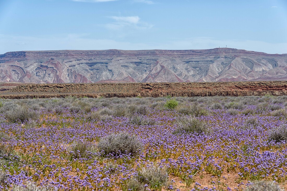
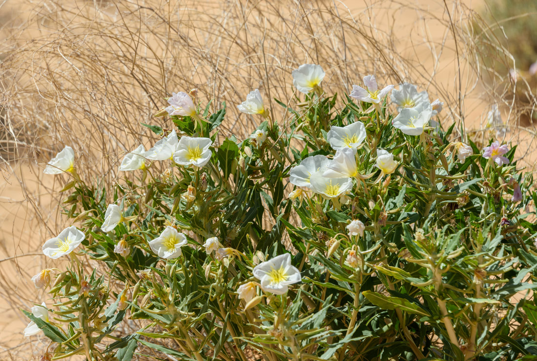
Seeing so many flowers in bloom, from the hardy to the surprisingly delicate has been such a treat on this trip.
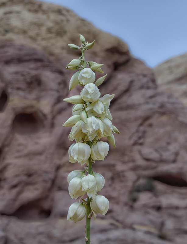
The soaptree yucca is even in bloom. The roots of this plant were boiled and reduced into a lather and then used as soap by the first nations people.
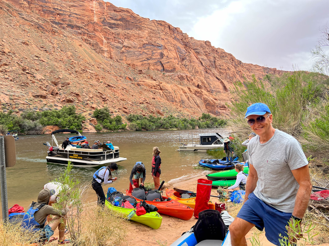
A boat shuttle service took us 15mi up the Colorado River so we and others could kayak back down and through the iconic Horseshoe Bend. What usually takes up to 7hrs came in more like 5hrs of paddling and floating with ‘current assist’. Despite the pic, by the time we all found our pace, everyone had their own slice of paradise. (Lee’s Ferry Campground, AZ, May 11-13/23)
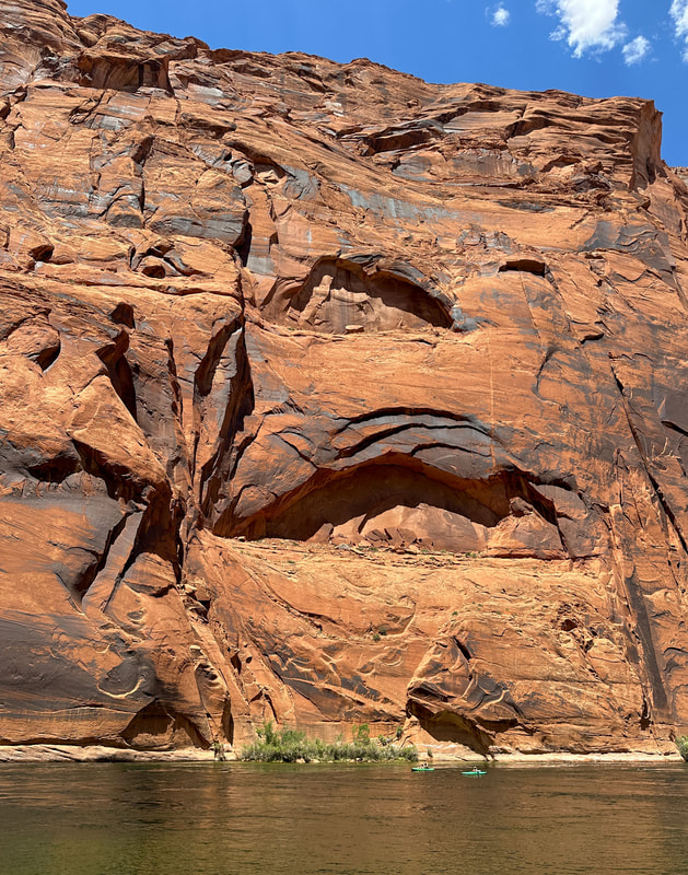
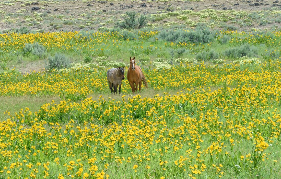
The river twisted so much we weren’t sure exactly which turn was Horseshoe Bend, but with the bird sounds travelling across the water, stunning rock walls and a couple of wild horse sightings, it was a highlight day.
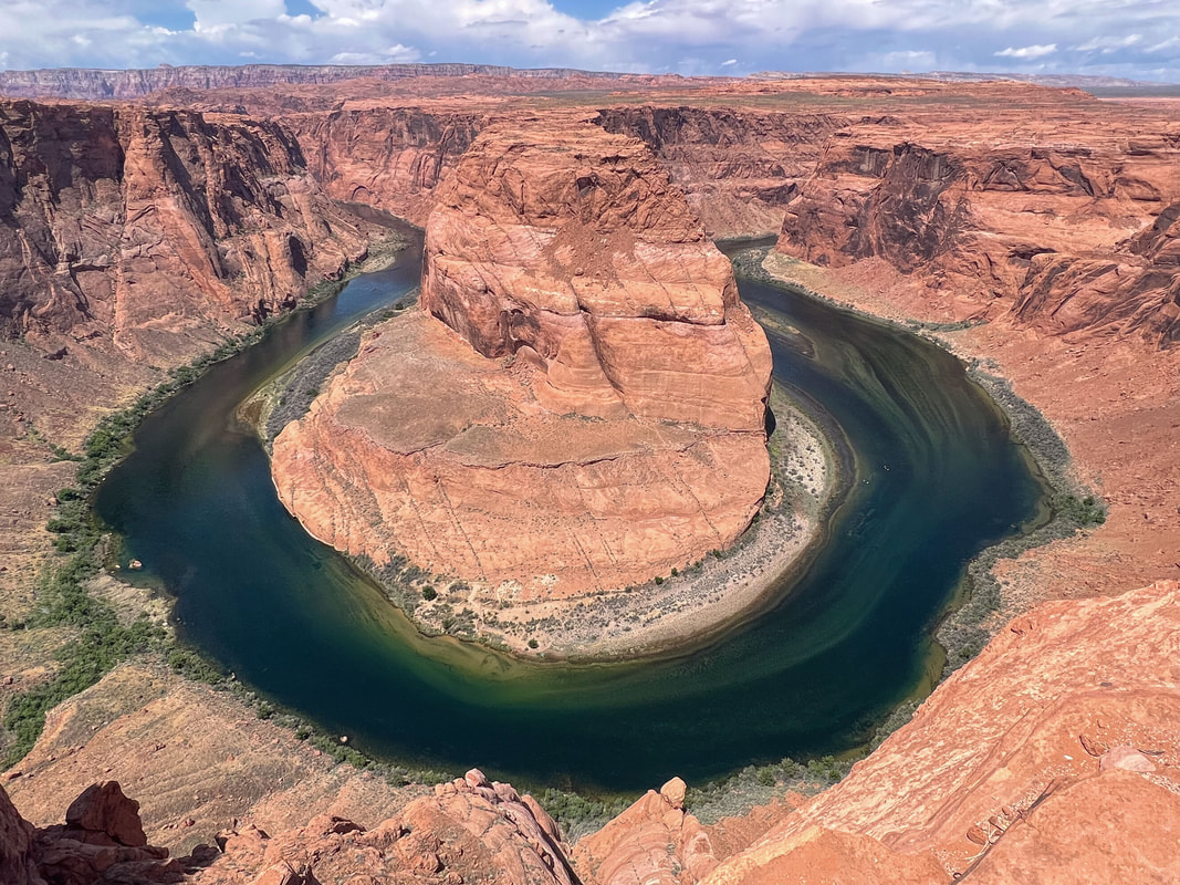
We joined the steady procession of tourists to get a birds-eye view of the same Horseshoe Bend we’d paddled yesterday. (Horseshoe Bend Lookout, May 14/23)
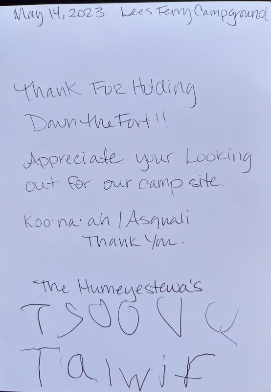
Yesterday there was a sudden strong wind & rainstorm, so we stored undercover the belongings of the neighbour’s 2 tents (they were away). They returned to find 2 strangers holding down their tents. This morning the mom & young twins dropped off this card - so thoughtful! They were Navajo and I made the mistake of calling the children girls because they had braided hair down to their waists. The one little guy advised me that boys can have long hair too, to which I promptly replied that yes, they can and girls can have short hair just like me :)
|
|
A little fun with POV with this 30' high rock at Ferry's Landing.
Our reservations were made 2 weeks ago for this highlight of the trip. But today my cold was too bad for me to join the tour – so disappointed. The Upper Antelope Canyon is known as the easier to reach, but the Lower is the one for photographers and Rick took some stunning shots. The slot canyon was so narrow as you weave your way through gorgeous water and wind sculpted rock. (Lower Antelope Canyon, AZ, May 14/23)
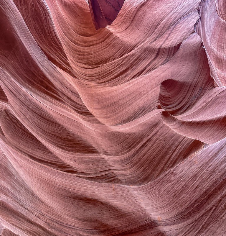
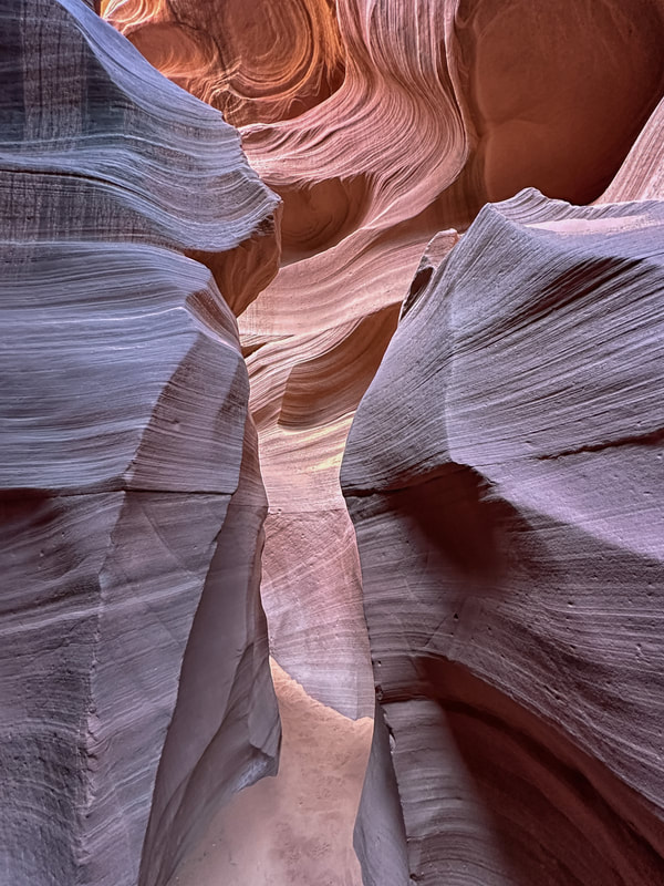
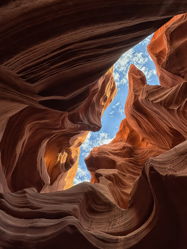
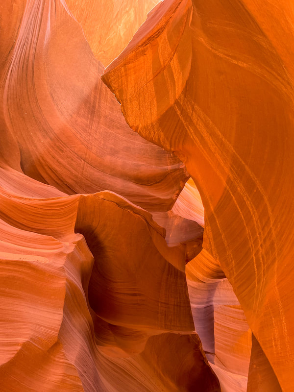
Two days later, I was fortunate that the guiding outfit allowed me to use my ticket. My time slot was at 10-11am, considered to be the best for lighting. The smooth lines of the canyon walls are caused by water erosion, while the upper and rougher layers are eroded by wind. Rick and I took about 250 photos. No two looked alike and it was difficult to pare them down. This was definitely a highlight of this road trip. (Antelope Canyon, AZ, May 16/23)
The light hit the rock just at the right spot to give 'The Shark' its eye.
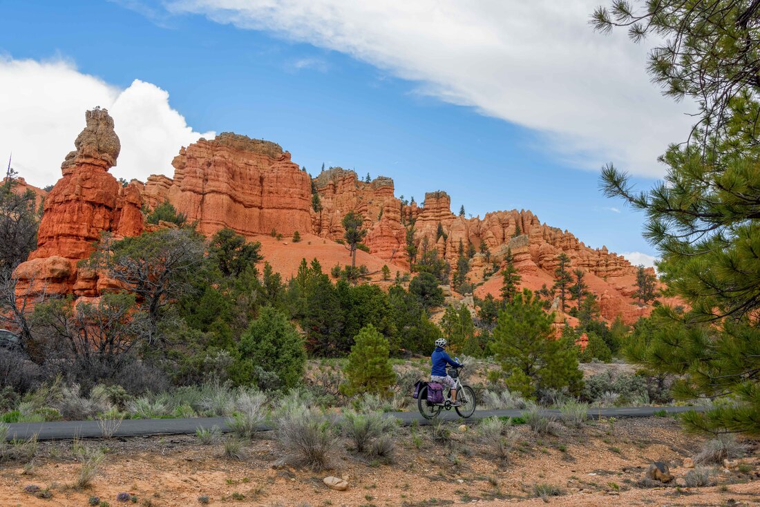
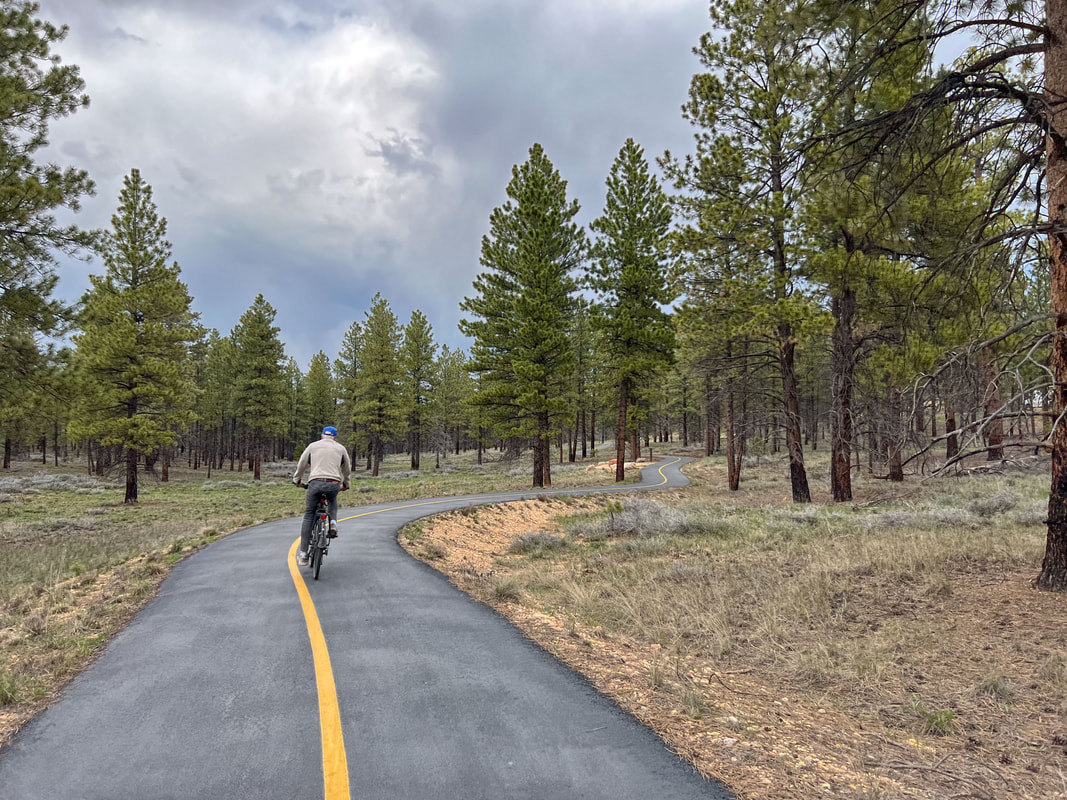
About 24km south of Bryce Canyon lies Red Canyon, named for the blazing red-orange of the landscape. A paved bike path separated from the road made for a great ride between here and Bryce City and a western style diner with homemade pie made it even better. Rick rented an e-bike for the first time. He’s still going to stick with a non-motorized for now, but the e-bike sure was sweet when we needed to outrun a storm. (Red Canyon, UT, May 16/23)
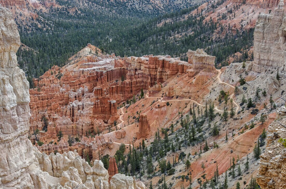
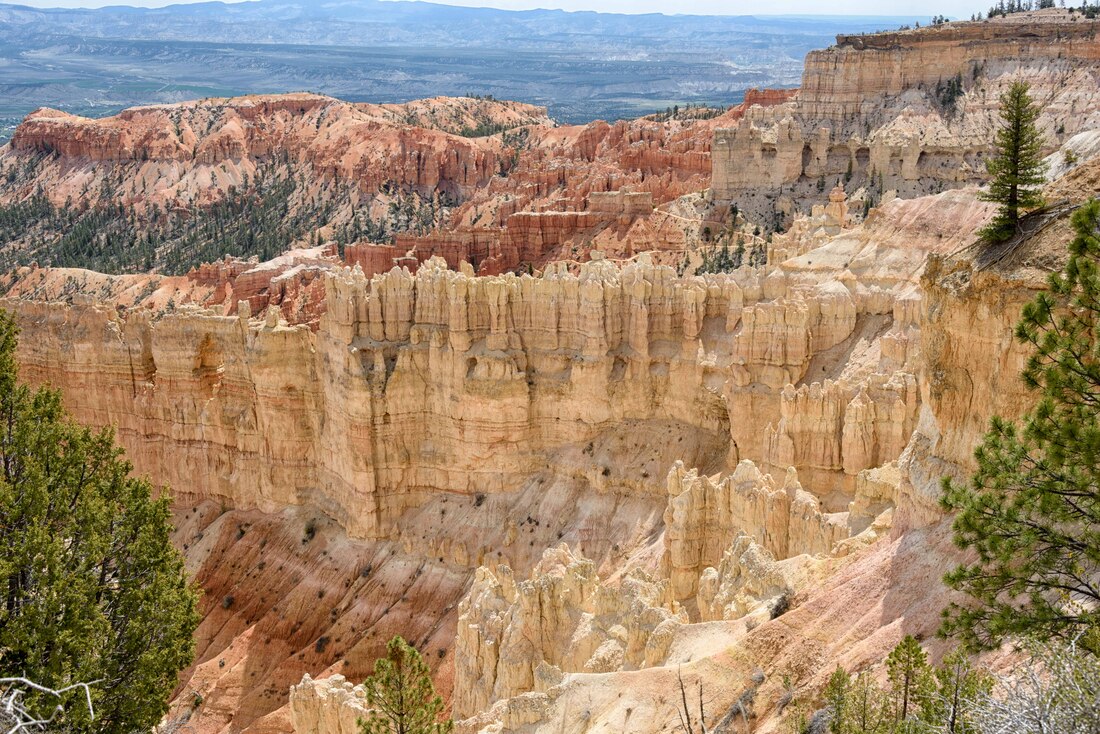
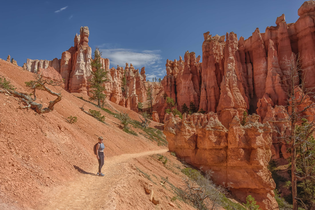
We loved Bryce Canyon NP! Between stunning scenery, photography, hiking, biking and horseback riding, it offered everything. We could have stayed longer. The canyon has the largest concentration of hoodoos in the world. (Bryce Canyon NP, UT, May 17-22/23)
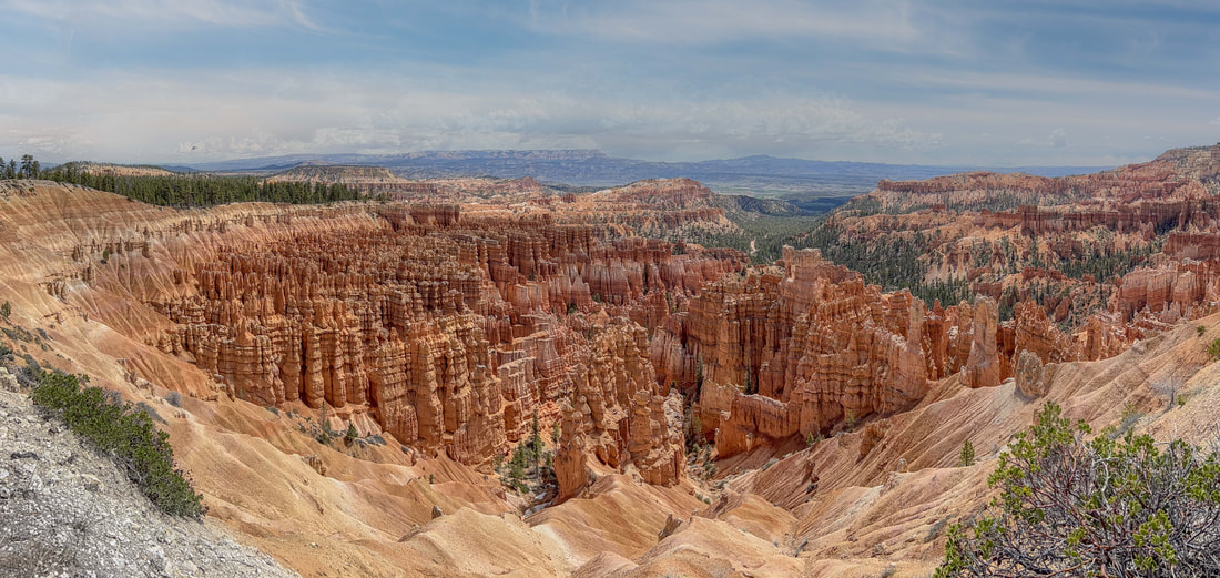
The bowl shape of the canyon is aptly named the amphitheatre. It almost looks as though a geode was cracked in half to reveal spires of delicate hoodoos in place of colorful crystals. The Rim Trail runs much of the half-circle and those who walked it were rewarded with spectacular viewpoints and places to sit to take it all in.
Although a shuttle between Bryce City and into the park dropped you off at each trailhead or main viewpoint, a scenic paved bike path took us about an hour from our campground to the furthest viewpoint inside the park. And a beer at either the 100yr old lodge or picnic style at the historic general store felt all the more earned.
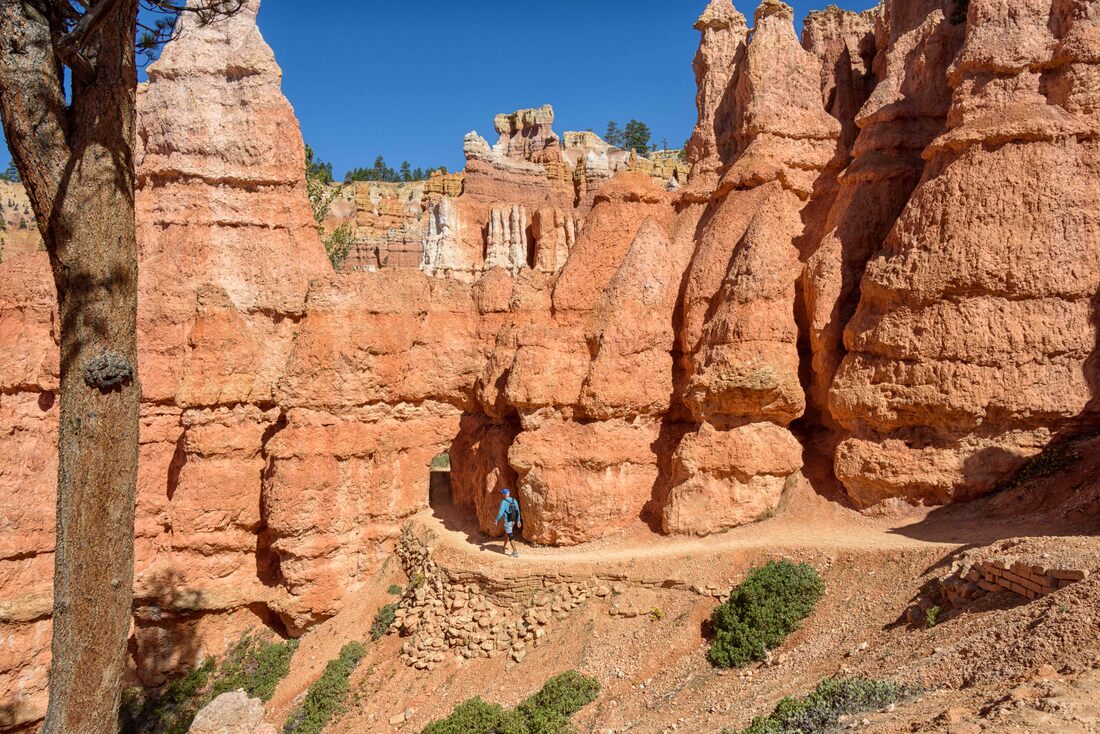
The Queen’s Garden trail paired with the Navajo Loop made for a 3hr hike down into the valley floor past monolithic hoodoos. With a little imagination some of the hoodoo caps had the jagged look of a queen’s crown. High elevation has been the norm in the locations we’re hiking in Utah. Its noticeable as we start hikes and have to adjust our breathing slightly. Bryce was between 2,100 – 2,400m and fighting a cold for the past 2 weeks has added to the challenge.
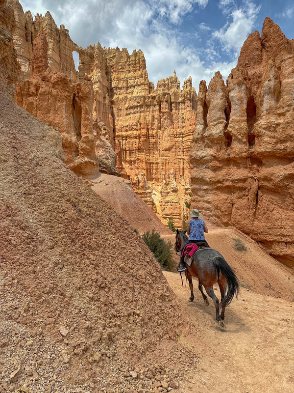
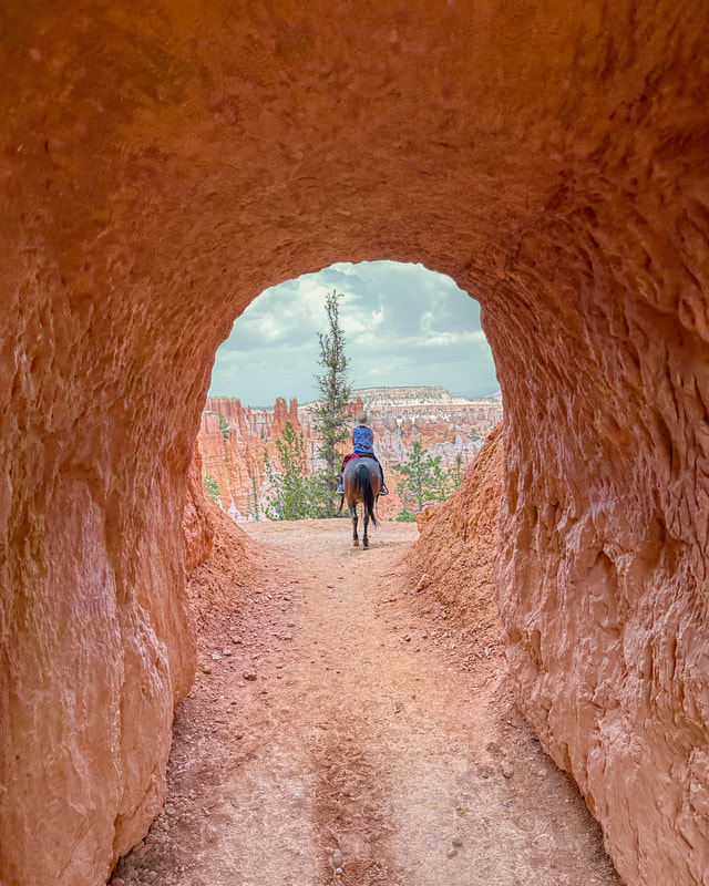
An in-park concessionaire runs the horseback riding outfit, so the prices were fair, the horses looked well cared for and we were able to ride a route parallel to one of the premier hikes – the Peekaboo Loop.
It turned out that my horse was the lead up until 2 years ago, so she needed very little convincing to keep up with the lead guide which gave me the best photography vantage point. And our guide was a pro bronc rider up until covid which made for an interesting conversation about rodeo life.
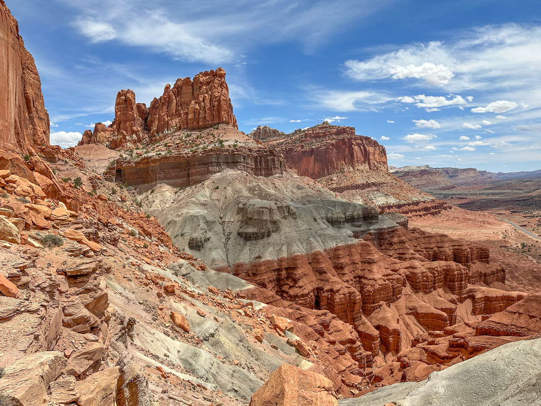
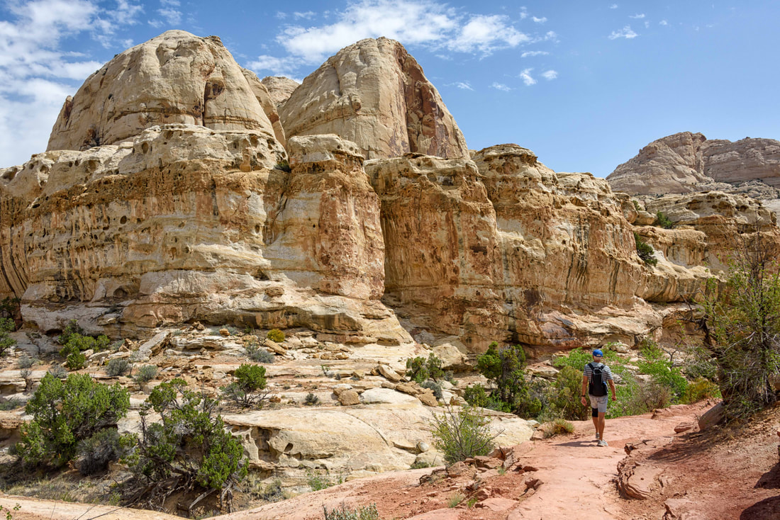
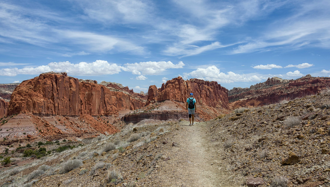
The Capital Reef NP rounded out the park destinations for this road trip. Much smaller than Zion or Bryce there wasn’t a shuttle or a lodge, but a small general store-cum-museum was a magnet for those who wanted excellent fruit pies. You had to be there before noon to even have a chance of any selection. The place was hopping! (Capital Reef NP, UT, May 23-26/23)
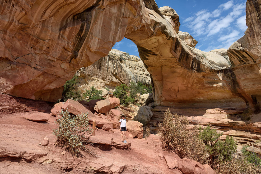
The Hickman Bridge trail passed under its namesake bridge - the largest we’ve ever seen.
The trifecta of trails, the Chimney Rock Loop had elevation gain for a workout, viewpoints throughout and a scenic ridge line filled with new and dead juniper trees. These junipers can live as long as 700yrs and when they die, they often make a striking silhouette.
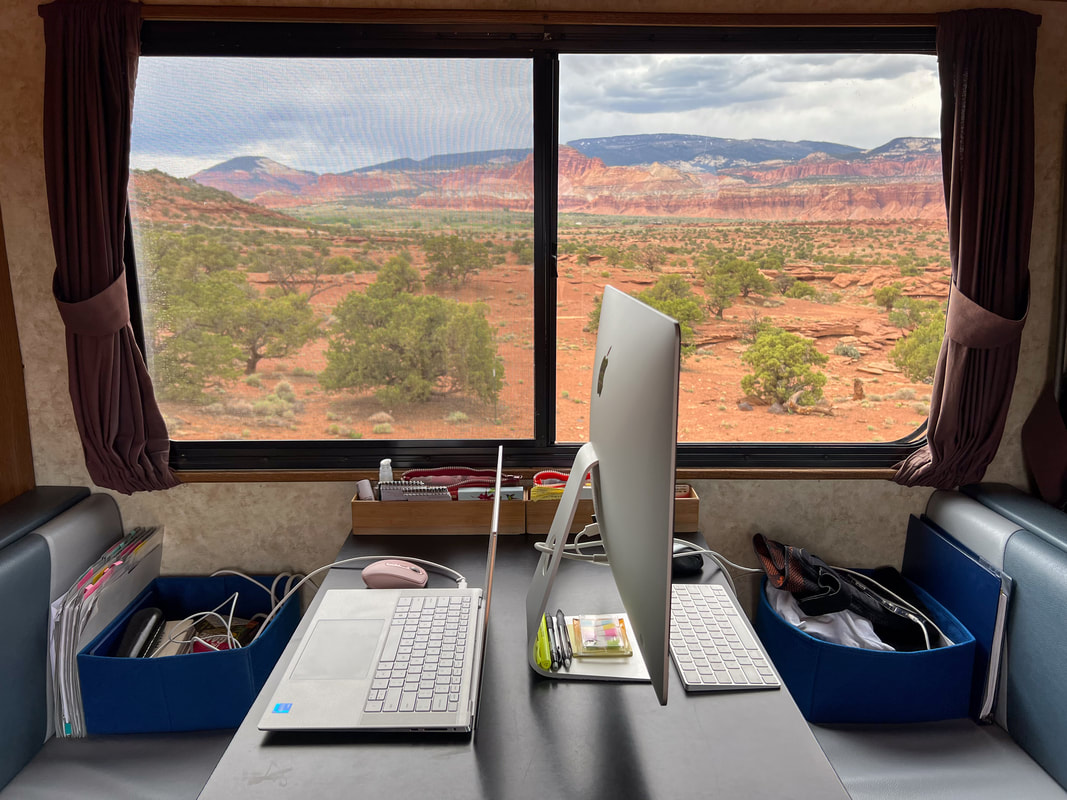
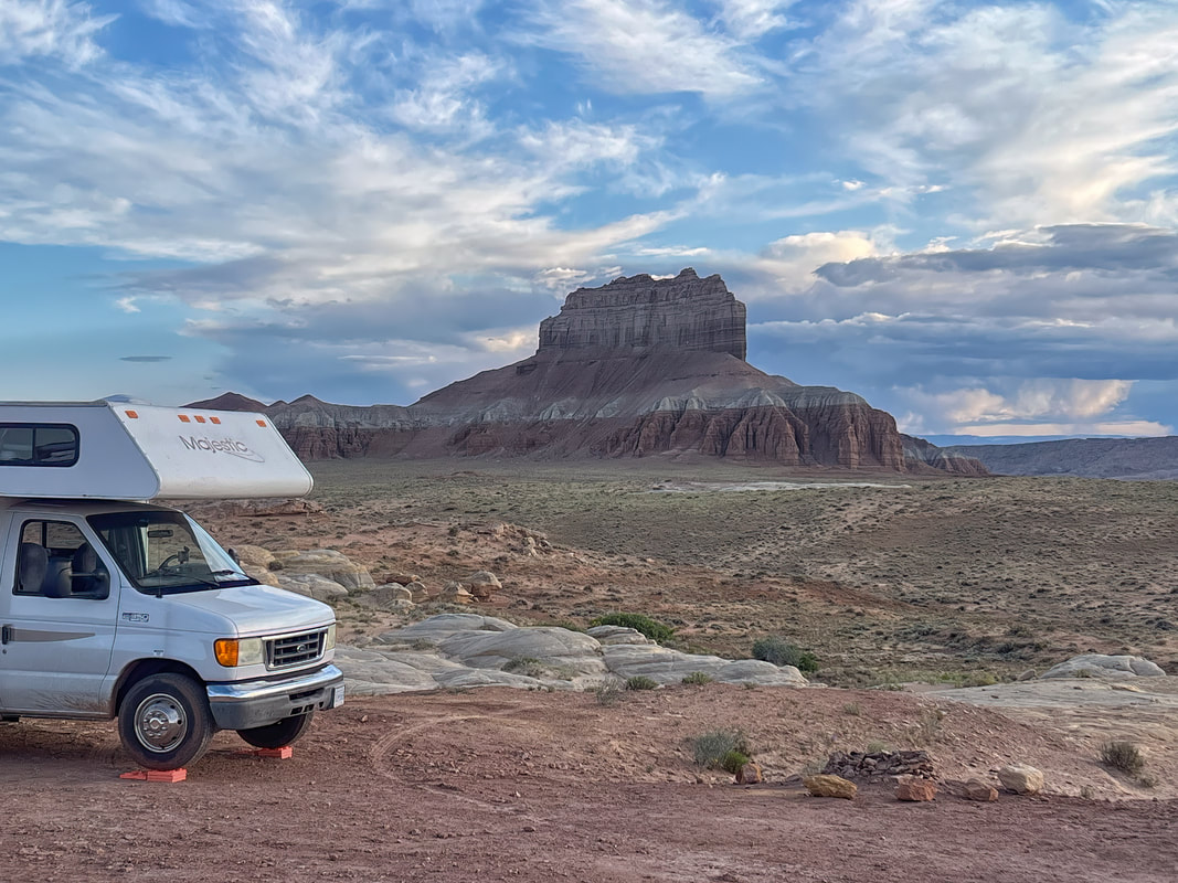
BLM free camping near the park entrance was so scenic we forfeited the money we spent on an in-town campground to stay in this quiet spot where each camper got their own slice of cliff top views. Sitting in this peaceful setting was perfect for planning the next 2 weeks (cycling coming up) and Rick to edit pics while I update our digital scrapbook. (1280 East Rd/E Beas Lewis Flt Rd, between MM70 & 71 on Hwy 24).
We picked up this clever fridge magnet for the collection in the RV. Between this year and 2019 we’ve now seen all of Utah’s iconic national parks. Although they were all beautiful, our favourites were Arches and Bryce.
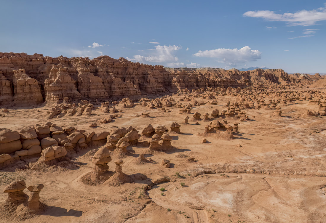
We’re on a BLM roll. Unable to get a campsite inside the Goblin Valley State Park, this one turned out to be even better just outside the park entrance. (Goblin Valley State Park, UT, May 26-27/23)
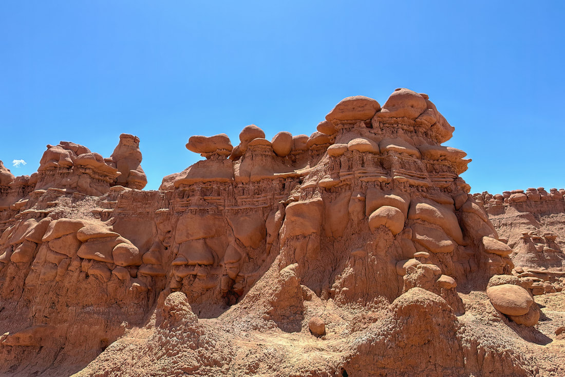
The Goblin Valley spanned 3 valleys, the 1st for the masses who took advantage of the lookout point and wandered a few close by rock formation ‘goblins’, and a 2nd and 3rd valley for those who were willing to walk a bit. The 2nd valley was the most impressive and we couldn’t believe visitors were allowed to walk among the goblins that looked so delicate. The park ranger told us that the formations are assessed each year and so far, there hasn’t been damage enough to change their policy.
And drones were ok with a permit, a rarity among national and state parks. These chocolate-pudding looking toadstools looked like something out of a Dr Seuss book.
These sunflower-like clusters have been in full bloom everywhere. Splashed across fields of sagebrush, climbing mountainsides and blanketing rangeland, they’ve been a highlight of drives between sights.
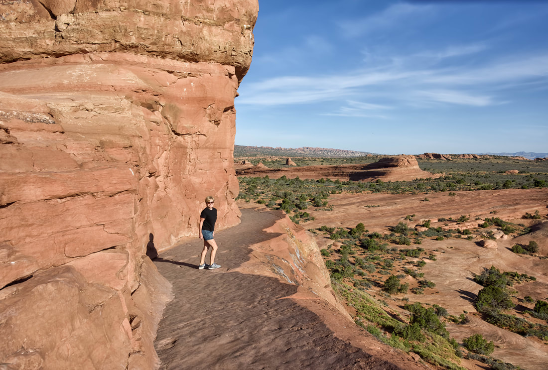
Although we spent several days at this park 3 years ago, it was just too close to our route to pass up an opportunity for a revisit. Just this year they started a time slot reservation system, and we think it’s time they adopted the shuttle bus model like Zion and Bryce. But if you arrived before 7am you could enter without a reservation. We arrived at 5:45am and drank our morning coffee watching the sun rise before heading out to do our favourite hike and to check out 3 more of the over 2,000 natural rock arches in the park. It’s the largest concentration in the world. Above: the hike to Delicate Arch is our favourite and walking this strip of path cantilevered on the edge of the rock is a little thrill. (Arches National Park, Moab, UT, May 28-29/23)
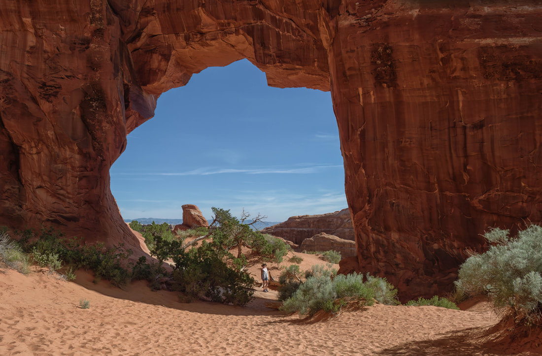
Pine Tree Arch, named for the pine tree(s) that it frames.
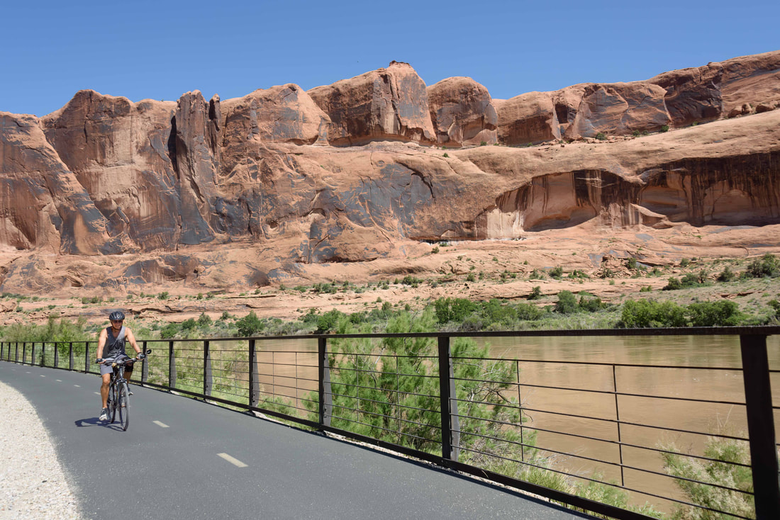
The Goose Island BLM sits just outside downtown Moab and the 45km roundtrip bike path runs through it and past Arches NP. By arriving early and waiting for someone to leave, we nabbed one of the few 1st come 1st served spots.
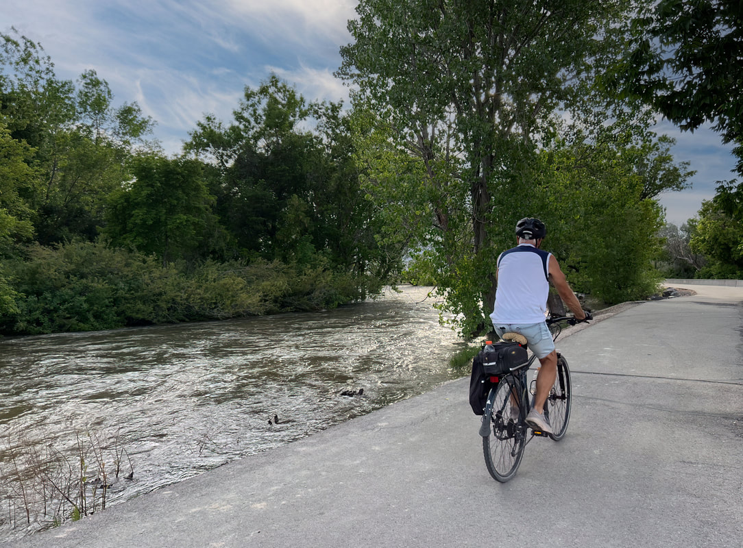
The return trip home will be all about riding the best rated paved bike paths along the way. Unfortunately, the plan right out of the gate was off to a rocky start - today’s ride/walk was gruelling. The Provo River Parkway trail ended up being a series of flooded out portions with unsigned detours. After struggling with those for quite a while we headed over to the Murdock Canal Trail where I got a flat tire. After walking a few kilometres to a bike shop we got it fixed, but they couldn’t sell us the wrench we need to remove the tire ourselves because it’s apparently not a common one for bikes. Sooo back into the heavy traffic and over to the backstreets to make it back to the RV park as the sun was low in the sky. It was only 62km but after 9 hours we were bushed. (Utah Lake State Park, UT, May 30-June 1/23)
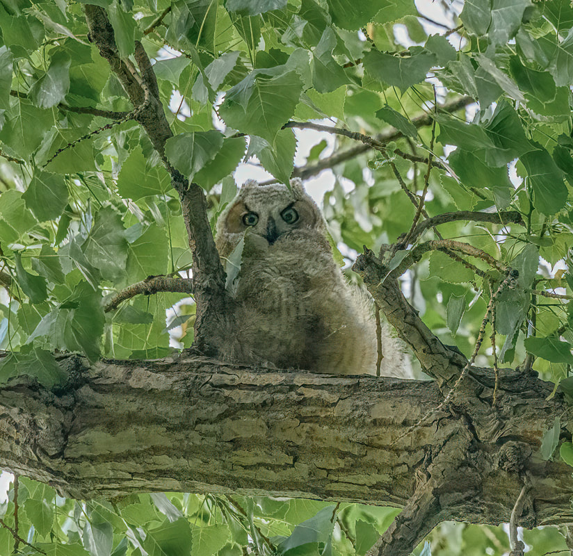
The one highlight was seeing this owl along with 3 of its companions watching us.
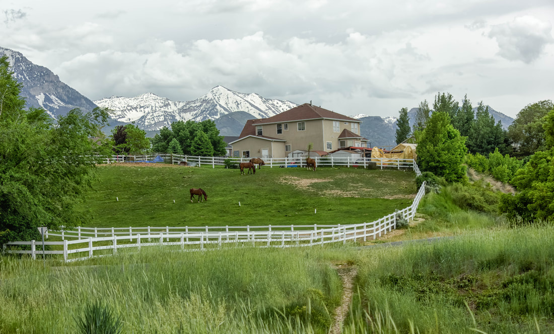
The full Murdock Canal Trail (50km return) the next day was blissful. It passed through a few bedroom communities outside Salt Lake City. The homes were huge and manicured and equestrian land, pools, basketball courts, and inground trampolines were the norm. Each community was anchored with a Church of Latter-Day Saints steeple.
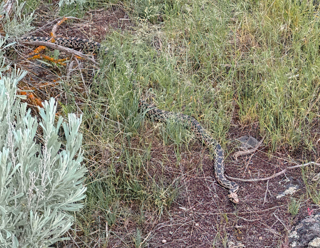
At a rest stop there were walking paths through a landscape of volcanic rock. Just after reading a signboard warning of rattlesnakes in the area, we spent ages watching this 3’ long one slither about over the warm rocks.
Idaho in the spring has been consistently scenic. Secondary roads to reach the bike paths often run through farm and range land, through forests and beside rivers - especially raging and swollen at this time of the year.
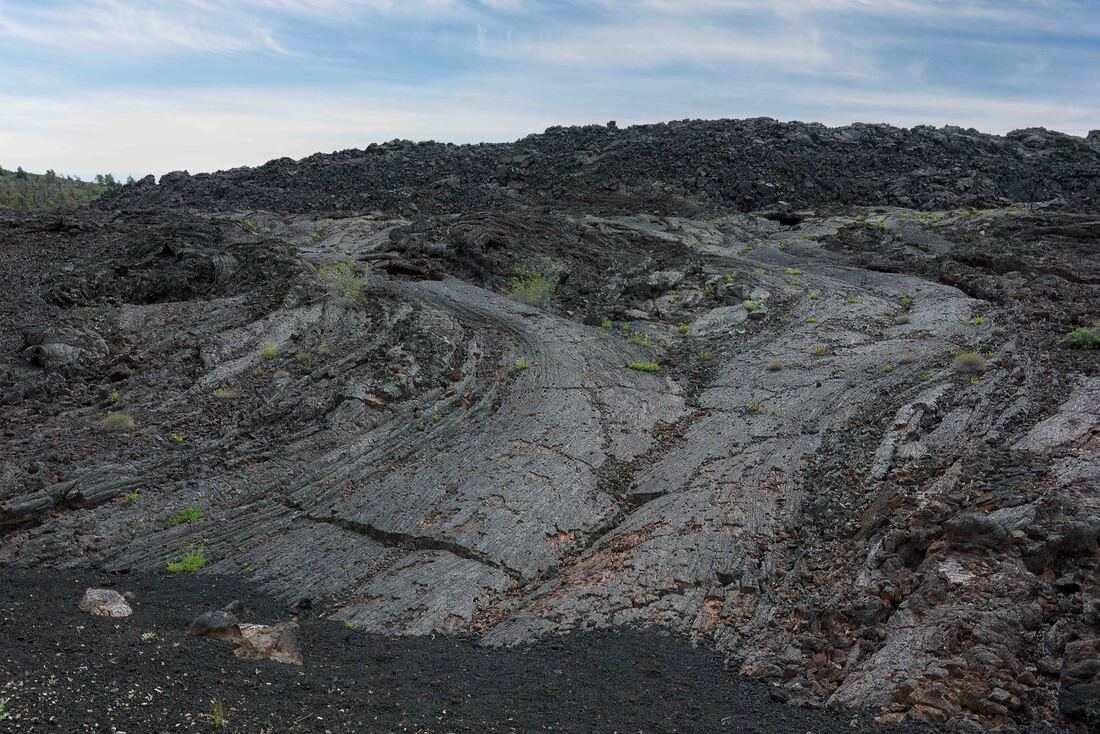
This national monument covers 3 major lava flows over 400 sq mi. The first eruptions were 15,000 years ago, the latest 2,000 years ago and another one anticipated within the next 1,000. Except for a scenic drive running through it and a small campground, the expanse has been left undisturbed. (Craters of the Moon National Monument, ID, June 3-4/23).
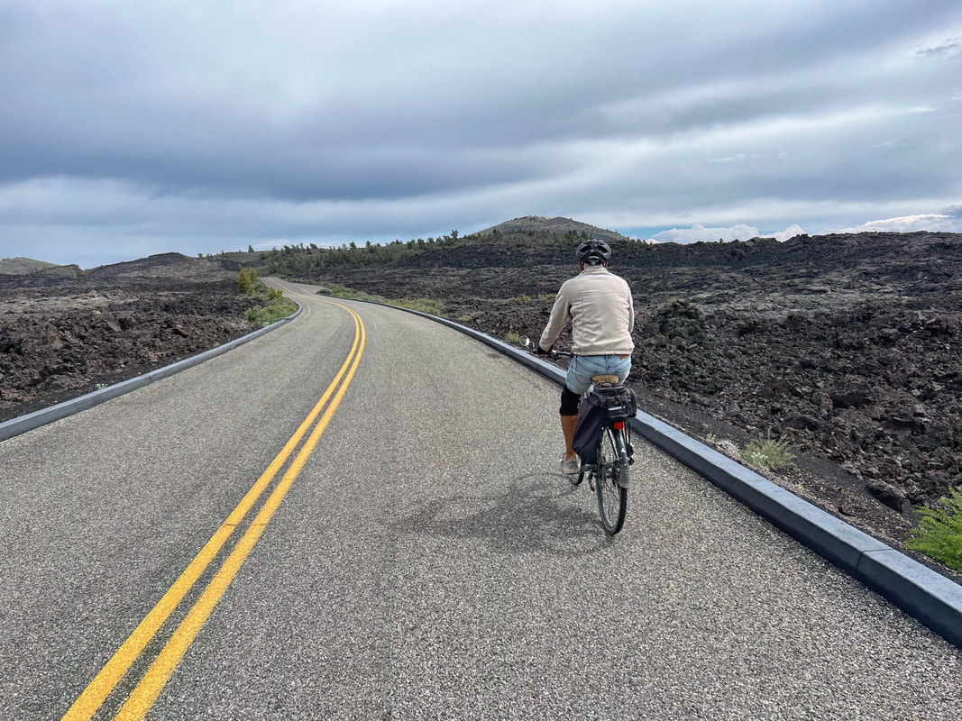
A ribbon of pavement winding through a sea of black hardened lava, punctuated by small clusters of pink flowers, it was a little surreal.
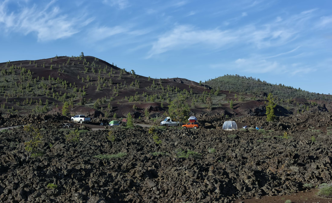
The Lava Flow Campground gives each camper an opportunity to overnight amongst the rocks.
The part of the Woods River Trail between Bellevue and the upmarket ski town of Ketchum we rode made up just 57km of the 100km return that’s paved. Large lilac hedges and fruit trees in blossom lined the path and of course there was a cute coffee shop at the halfway point. (Bellevue, ID, June 4/23)

It was one of those perfect weather, easy-ride paths where it was a little sad to see it end.