
Westjet Flight 1788. Ten passengers boarded and all but 3 of us chose to sit in first class, ignoring the 6' of social distancing recommended by the CDC and WHO. All of us wiped down our seats and eschewed the snacks and beverages. Attendants scattered about the cabin and hunkered down with their books. Plan A had been to fly to Vegas at the end of March to pick up our trip again.
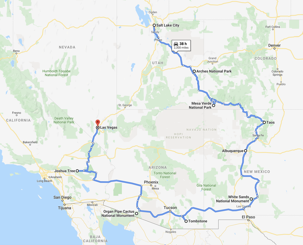
But, events around COVID-19 were changing so fast in BC that it became evident that if we didn't pick up our RV ASAP, it could well be stranded for an indefinite period of time. (Vancouver to Las Vegas, March 15/20)
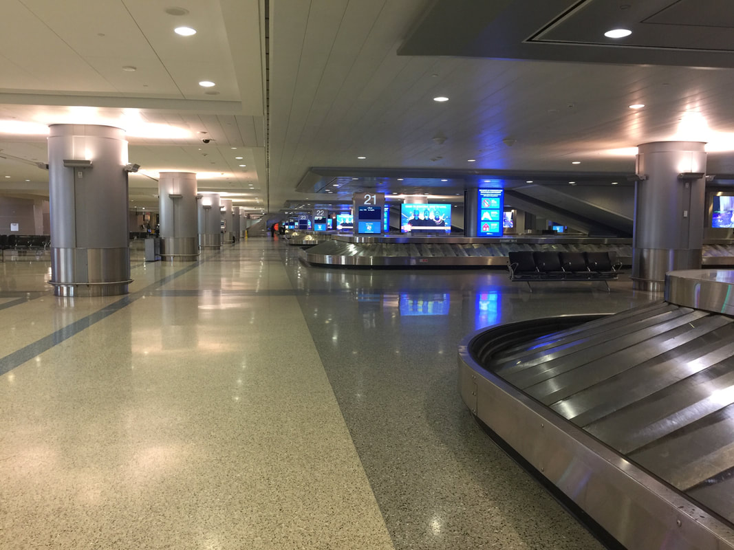
Walking to our baggage carousel was eerie and the taxi at the front of the airport lineup had waited for 3 hours for a passenger. He lucked out with our $75 ride.

A trip to Walmart was disturbing. Fellow shoppers scanned the aisles in disbelief. Although we weren't able to buy everything we wanted, we got enough to last for the road trip home.
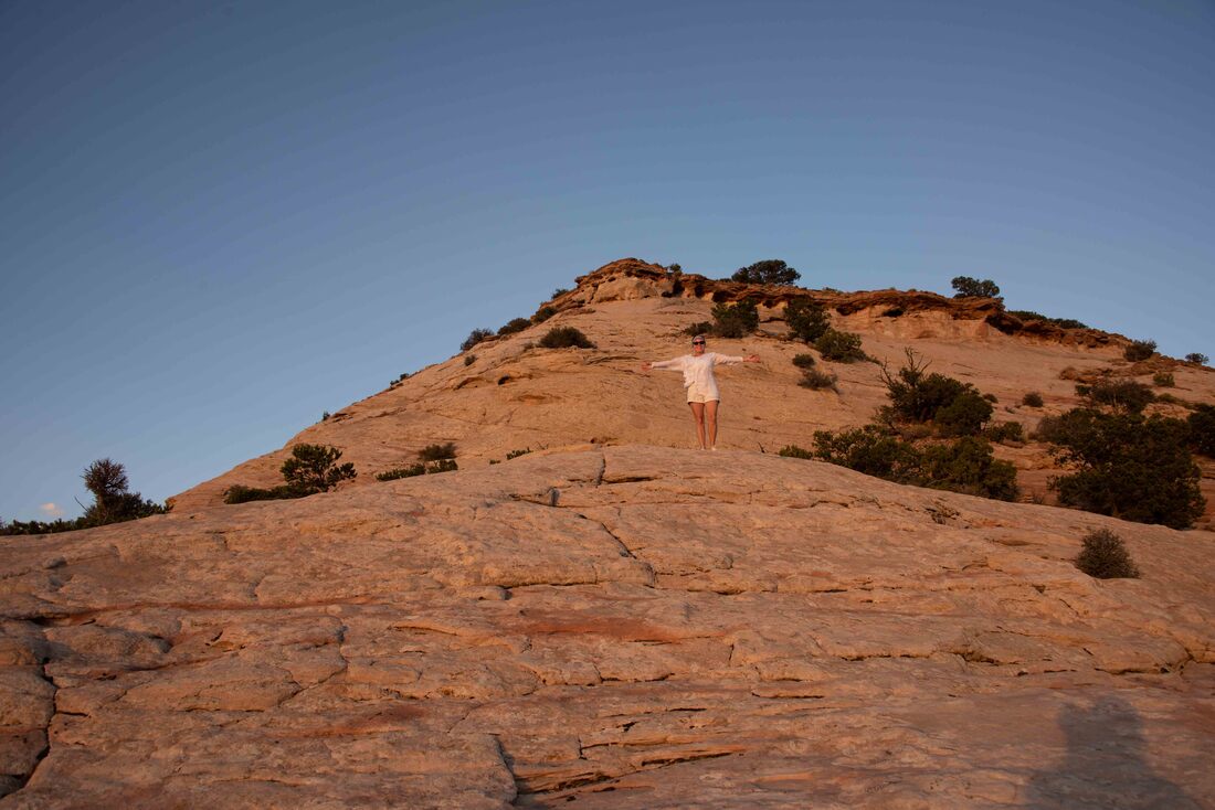
A scenic hike wrapped up our time in the great outdoors.
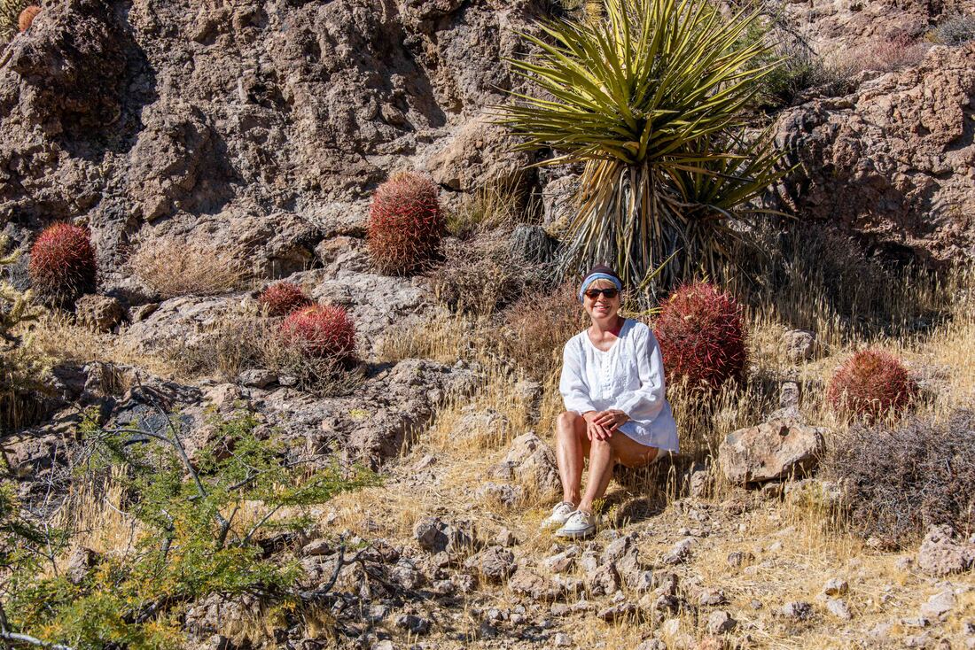
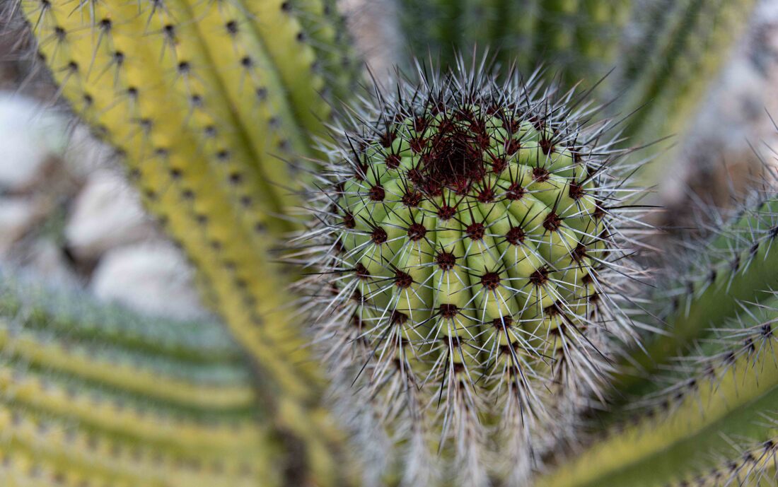
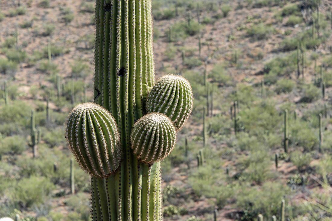
It's on to Las Vegas (where we'll park our RV) for a few days and then home-sweet-home. Above: surrounded by pretty red, pink and green barrel cactus. (Mojave National Preserve, Nov 6-8)
Majove yuccas, like the Joshua Trees, are pollinated by moths in a symbiotic relationship. The moth pollinates the yucca when she lays her eggs in its flower and then the larvae eat the fruit capsule, but leave enough seeds behind for the yucca to flower again. The plant was used by Native Americans for everything from soap to sandals and commercially it's used as a natural deodorizer and in herbal medications.
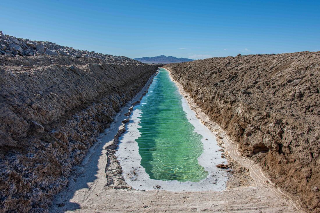
Salt left behind in this ancient dried lakebed is being harvested. Once canals have been dredged, they are filled with water which dissolves the salt. And then, depending on the amount of saline in the water, algae grows and takes on a certain colour. Apparently, the salt ponds in the San Francisco Bay are a brilliant red - another place to add to “the list”. (Bristol Lake In Amboy, CA, Nov 6)
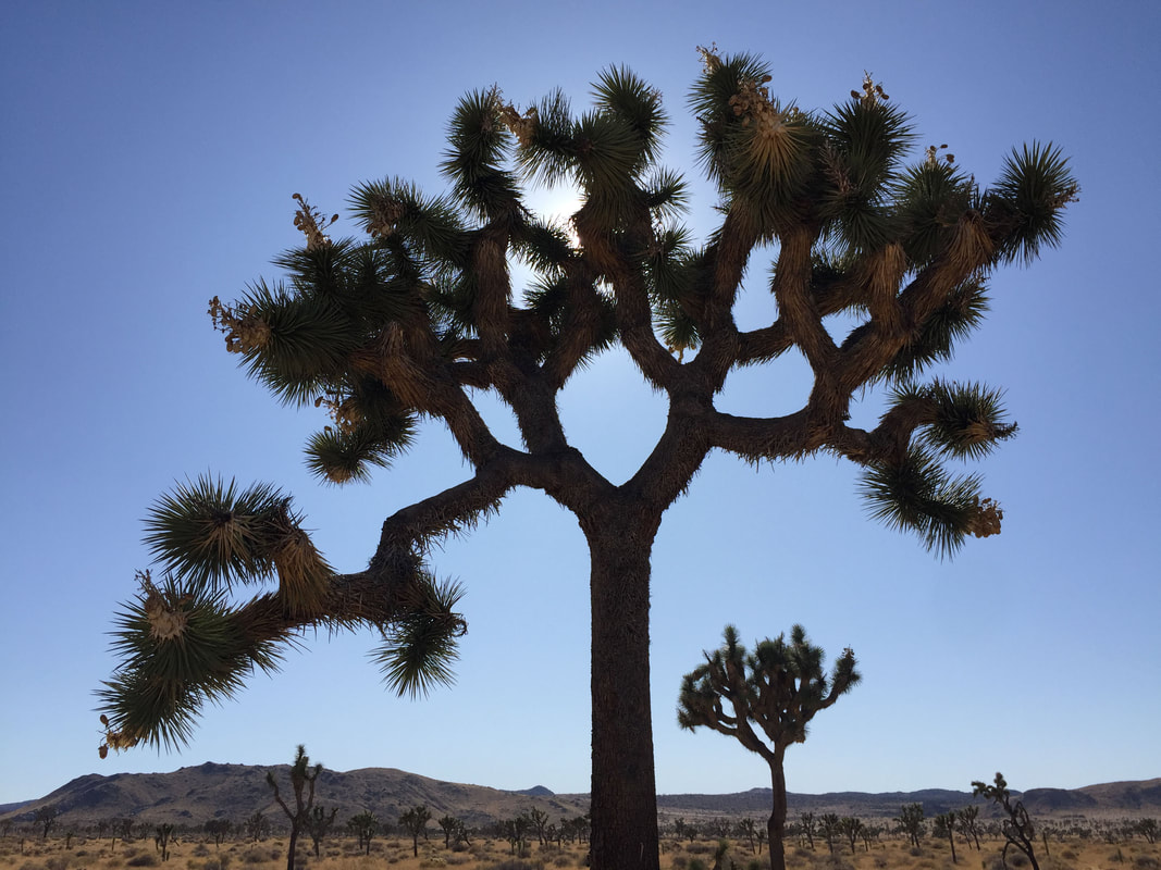
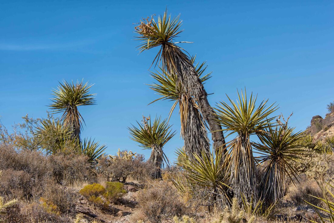
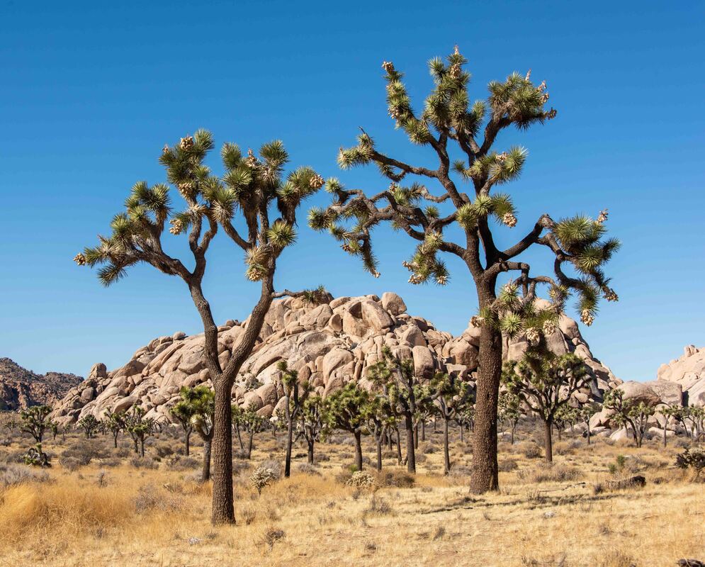
Although they’re called trees, the Joshua tree is part of the yucca plant family - the largest of the species. Growing only 1” per year, they can live hundreds of years, some up to a 1,000. But they’re fussy about where they’ll grow - mostly in the Mojave Desert and only at a specific elevation range. (Joshua Tree National Park, Nov 3-5)
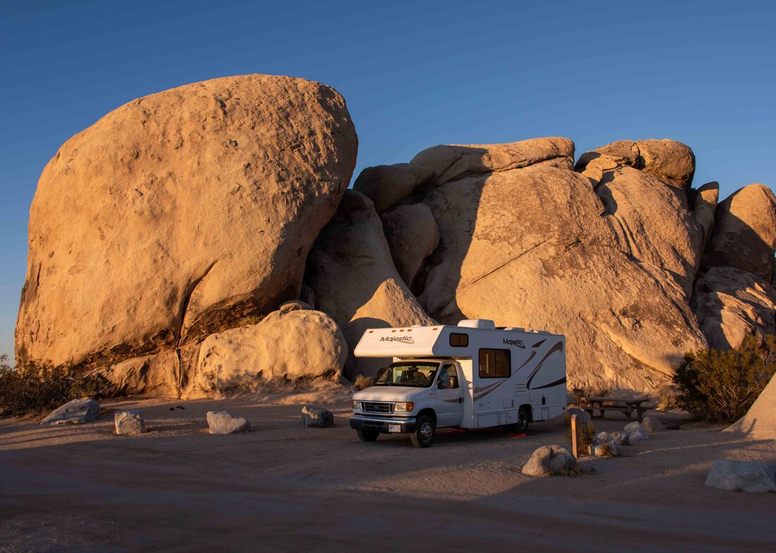
Learning and writing about the flora, fauna, history and geology adds another layer of appreciation for the places we visit. And being able to camp in parks surrounded by their star attractions feels like a privilege - the last 3 nights by this cluster of ancient rocks sitting incongruously amid Joshua trees. Eons ago magma forced its way into the upper layer of the earth’s crust where it cooled into hardened granite. After earthquakes, shifts in the earth and erosion took their toll, the granite finally rose to the earth’s surface where nature continues to shape the formations.
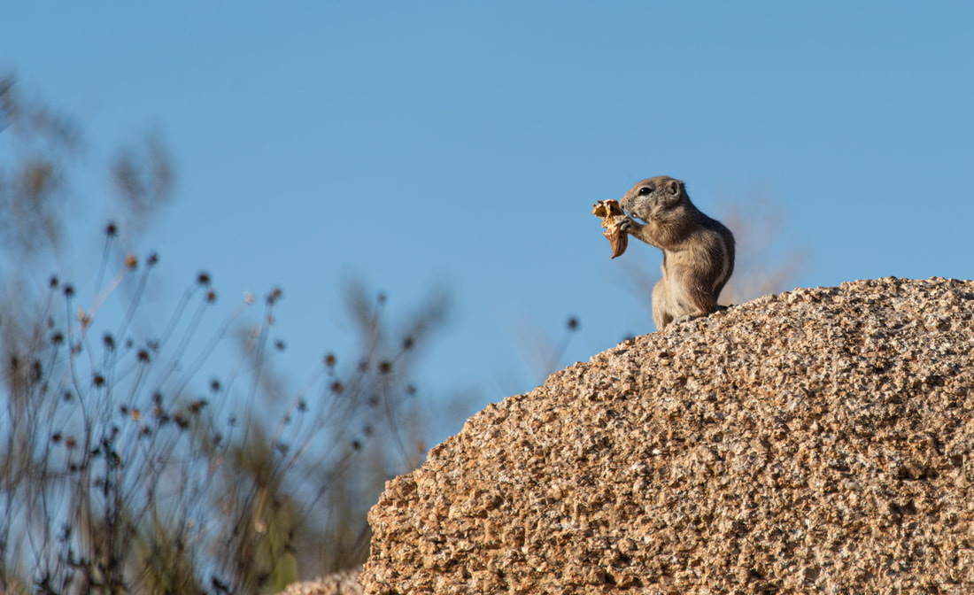
This antelope squirrel made such a racket munching on a seed pod, it was comical ... the antithesis of the ninja-like survival behavior one would expect from a critter so low on the food chain.
It’s thanks to one activist that these rare and unique yuccas have thrived. In the 1930’s Minerva Hoyt watched their numbers dwindle as locals used them for target practice or took them home to plant in their yards. She appealed to her powerful friends to create a national park and in 1936 FDR granted her wish.
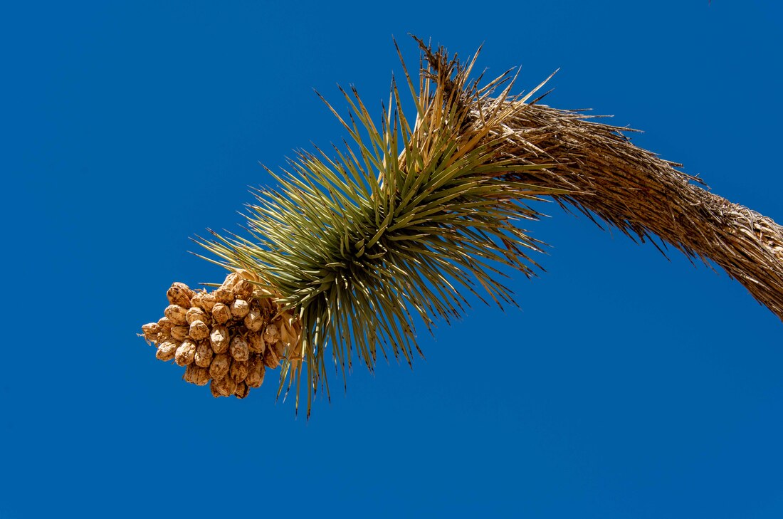
At this time of the year only the seed pods remain from the previous bloom. It would be great to see the flowers, but their schedule is difficult to predict - they don’t bloom annually, they require a rainfall at just the right time and there must be a winter freeze. Needless to say, this makes them vulnerable to climate change.
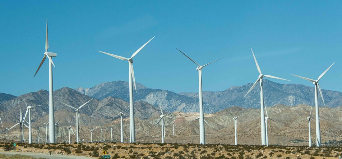
A mass of windmills (4,000!) flanked both sides of the highway and up the banks of the hills. They made for a slightly dizzying approach to the city. This impressive wind farm provides all the energy needs for Palm Springs and the surrounding valley (pop. 500,000). (Palm Springs, CA, Nov 3)
Ahhhh, enamored with cacti... a few days in a couple of national parks and so many pictures...
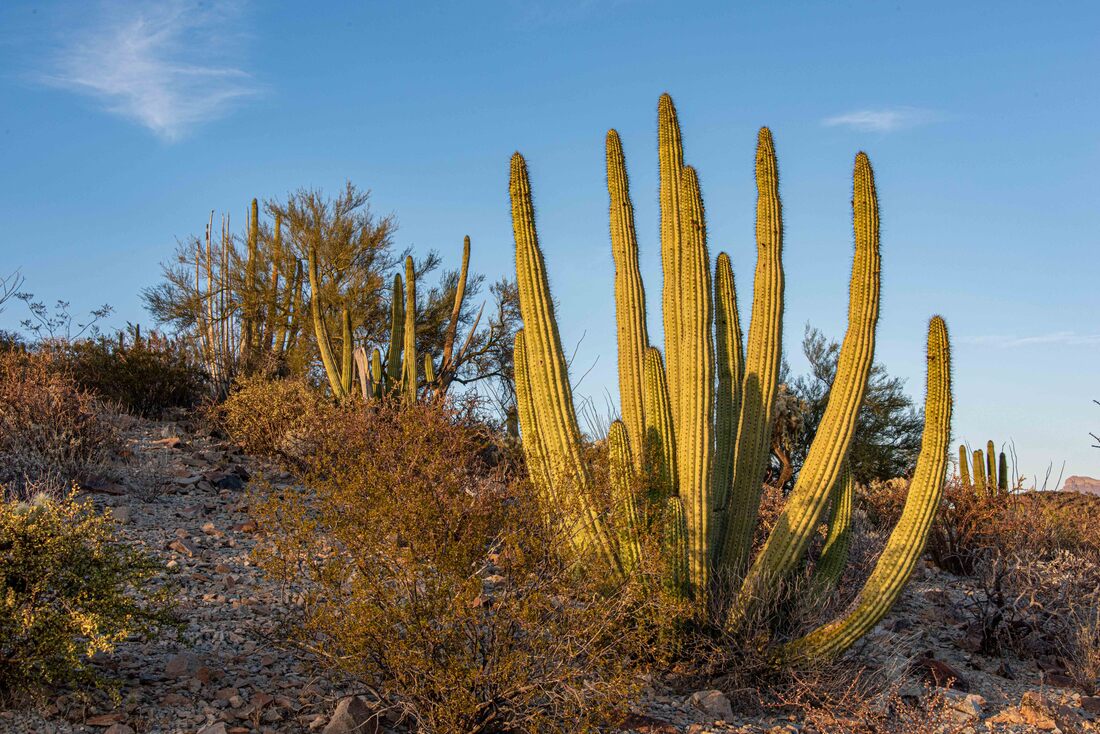
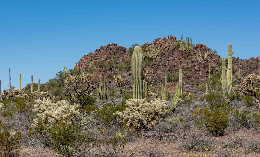
These monument lands protect 28 species of cactus, many of which surrounded the RV in the park campground. Above, the Organ Pipe cactus named for their resemblance to the pipes of an organ. Hiking meant you constantly had to be looking down and around to ensure you didn’t step on or bump into any cactus along the narrow trails. (Organ Pipe Cactus National Monument, AZ, Oct 30-Nov 1)
The organ pipe cactus grows a mere 2.5" a year.
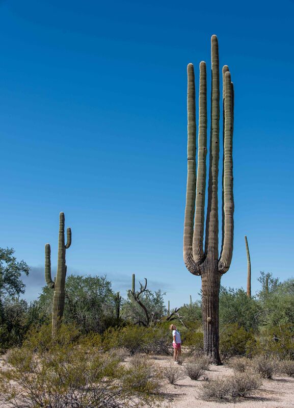
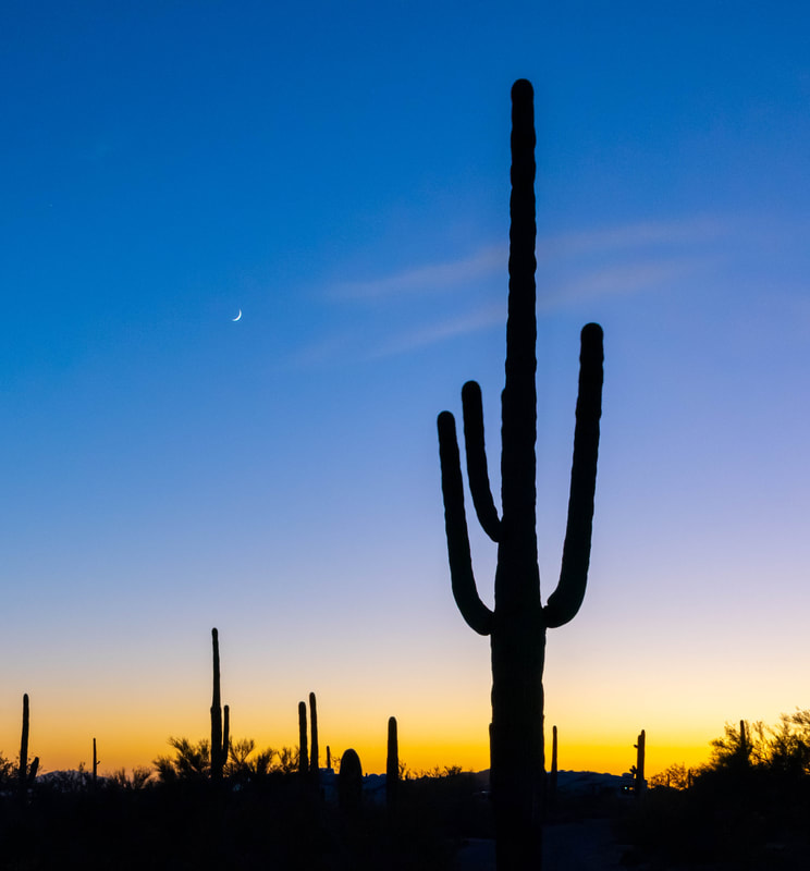
The largest of all cactus species, the saguaros can live up to 200 years. The tallest on record is 45’ but this one looked like a contender.
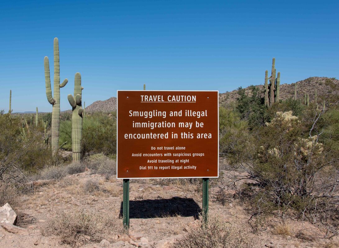
The Mexican border abutted the monument lands and there were reminders everywhere. Checkpoints monitored the road traffic, drones and a helicopter patrolled the sky and the area was crawling with border patrol and park ranger vehicles.
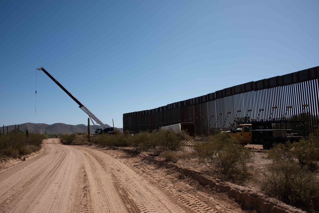
One of the park’s scenic roads ran along the border.
After hearing so much about The Wall, seeing the current low, ranch-style fence being replaced with this formidable structure was surreal.
The number and variety of cacti increased as we approached the Sonoran Desert, home to both the Saguaro National Park and Organ Pipe Cactus National Monument. The Saguaro cactus arms grow very slowly: it takes 15yrs to reach 1’ high, 50yrs to 7’ and a 100yrs to start growing arms. (Saguaro National Park, Oct 28-29)
A saguaro and chain fruit cholla cactus stood sentry while we planned the next part of our route. The cholla’s low hanging fruit is designed to easily detach and cling to animals that get too close, making the animal the method of transporting the plant’s seed elsewhere. One night, Rick was outside stowing our BBQ and his head accidentally grazed the cholla - OUCH! A cluster stuck and it took BBQ tongs and later tweezers to remove all the spines!! Since then, a pair of tweezers has joined our hiking first aid kit.
The Teddy Bear Chollas (foreground) appeared to glow in the sunshine. The effect was difficult to capture as they shone so much they just appeared as blown out blobs in photos.
Hardy Gila Woodpeckers peck holes into the saguaros making nests for themselves and over the years other birds take over the space. It's amazing that their bodies are not pierced by the cactus' needle-sharp spines.
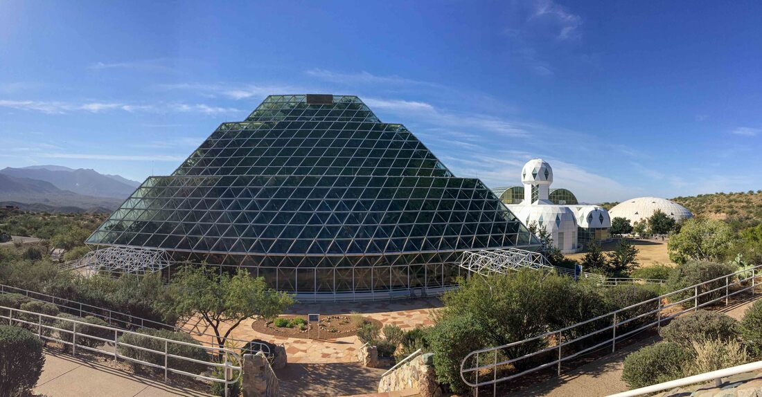
Back in the early 1990’s eight people volunteered to live for 2 years in a hermetically sealed structure - Biosphere 2 - built to contain an ocean, a tropical rainforest, a desert and a savanna. The plan was for them to be completely self-sufficient to see if humans could survive in this type of environment in space. Problems dogged the project and they learned that they have much to learn about the interplay of ecosystems. Above: The tropical rainforest presses against the glass. (Oracle, AZ, Oct 28)
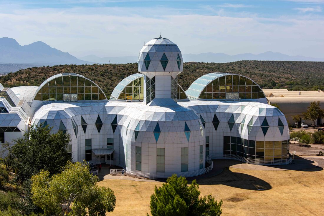
The facility is now owned by the University of Arizona and being used to carry out 3 controlled experiments to learn more about the effects of climate change: how drought affects a rainforest, what types of coral can survive in warming oceans and how varying levels of rainfall affect plant life and behavior in arid climates.
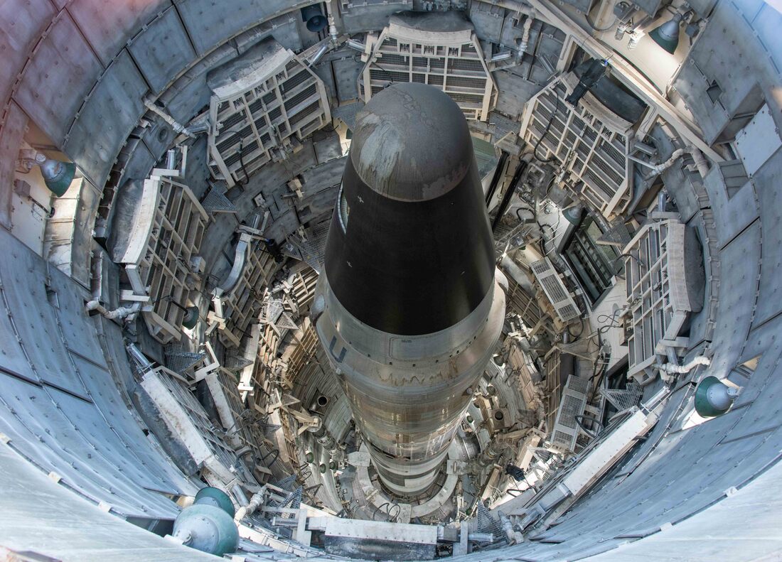
When the Cold War ended and the US and Russia reduced their nuclear arsenals, the US kept one of their Titan II missiles as a museum piece - their largest ever ICBM. The missile, along with the full underground command centre, is preserved in its original state. (Titan Missile Museum in Green Valley, Oct 27)

For 20 years this Command Center was manned 24/7, never to be called on to launch the ICBM by pushing the console’s green button. The 2 crew members in the Command Center wouldn’t be told who or where the target was, but they did have to wear guns in case their partner was reluctant to carry out the President’s order.
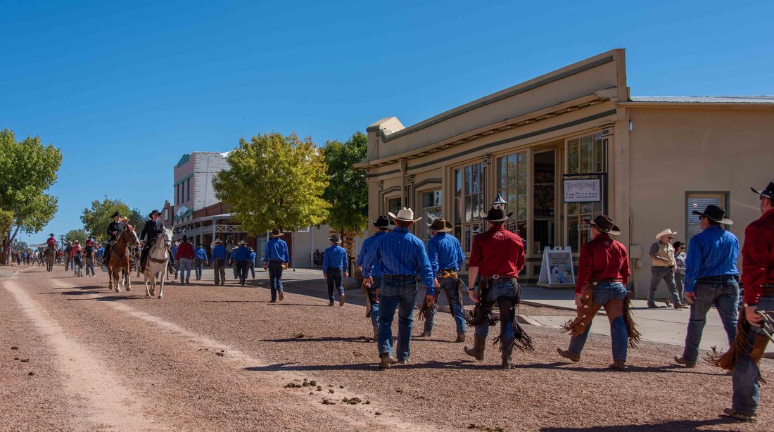
Tombstone has been nicknamed The Town Too Tough to Die, after one of the slew of movies that keep the place firmly entrenched on the tourist circuit. Because much of its Wild West infrastructure was left intact and the downtown core doesn’t allow cars, it retains its authentic feel despite the tourism. Above: a group of cowboys/girls hit town after a multi-day horseback ride. (Tombstone, AZ, Oct 26)
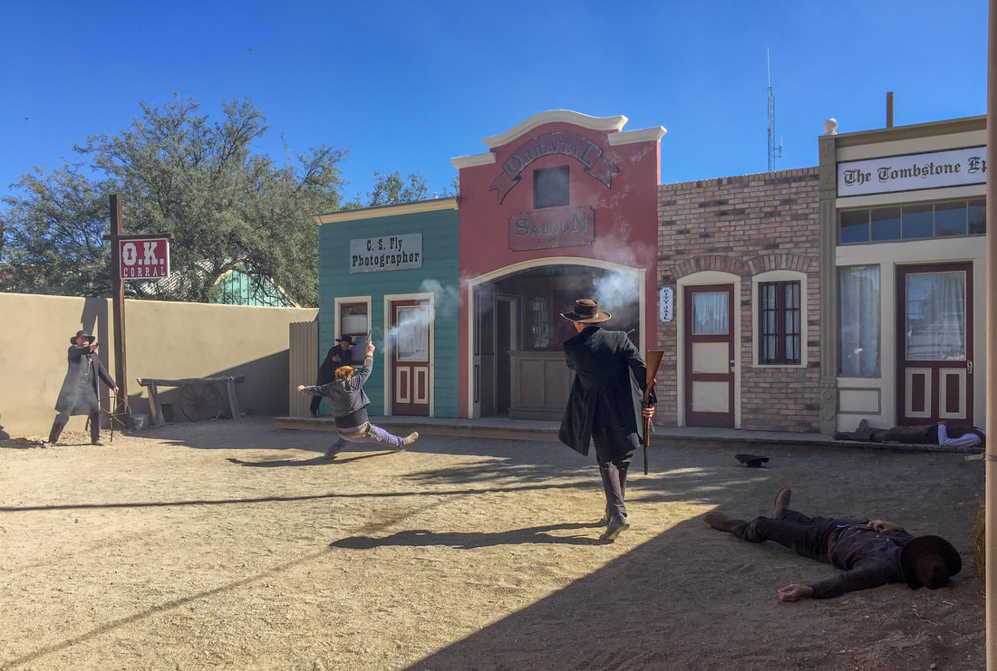
After Wyatt Earp had made a name for himself cleaning up Dodge City he moved to Tombstone to lay down his gun and set up a saloon with his 2 brothers in 1879. But law enforcement duties soon beckoned the family and Wyatt’s buddy Doc Holliday. This disrupted one gang’s cattle rustling and stagecoach robbery ‘business’ and death threats ensued. Eventually, words escalated to fateful action - The Gun Fight at the OK Corral. Within seconds the Earps and Doc Holliday had killed 3 men and wounded another 3. Daily reenactments keep the circumstances and the fight alive for we camera toting tourists. Surprisingly, Wyatt Earp went on to live to 80yrs old.
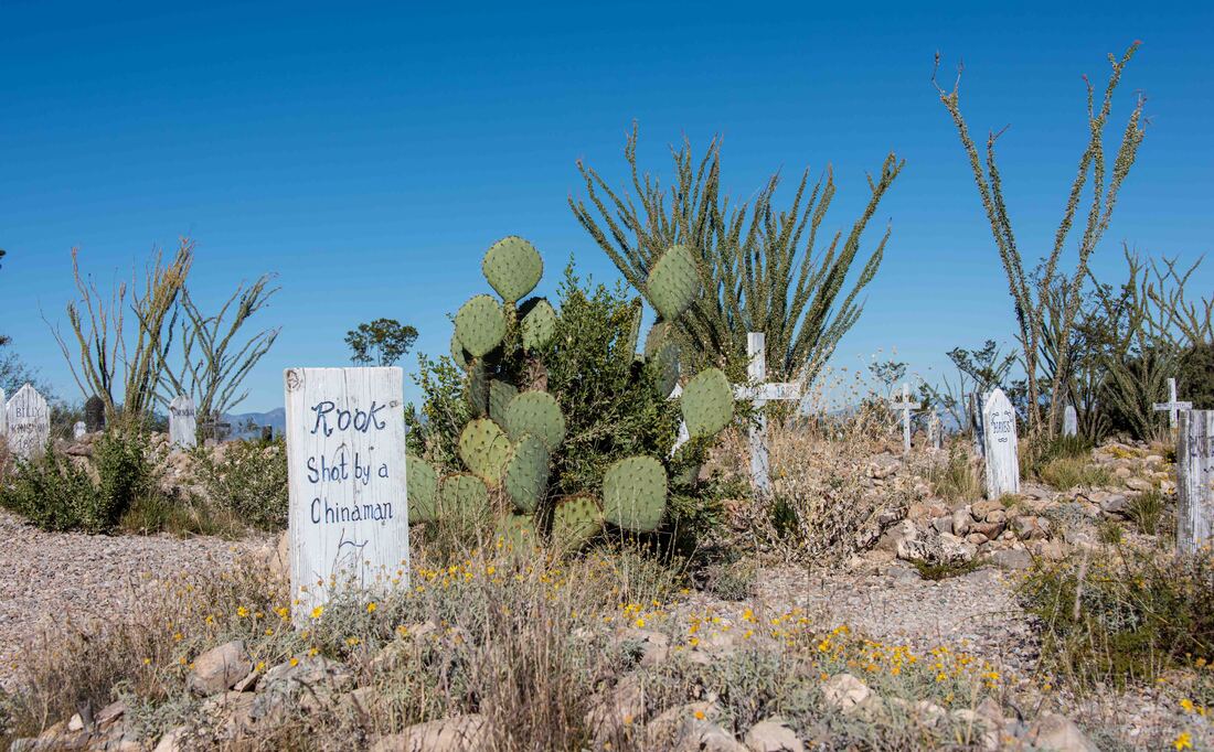
The town was established in 1879 and it didn’t take long for the bodies to start piling up. The town’s first burial grounds, Boothill Cemetery, painted a picture of the times with epitaphs such as shot, lynched, suicide, poisoned, stabbed and hanged - one unlucky soul was ‘hanged by mistake’. Suicide, by an overdose of laudanum, was often the sad way out for prostitutes whose beauty, and by extension their business, quickly faded in such hardscrabble times.
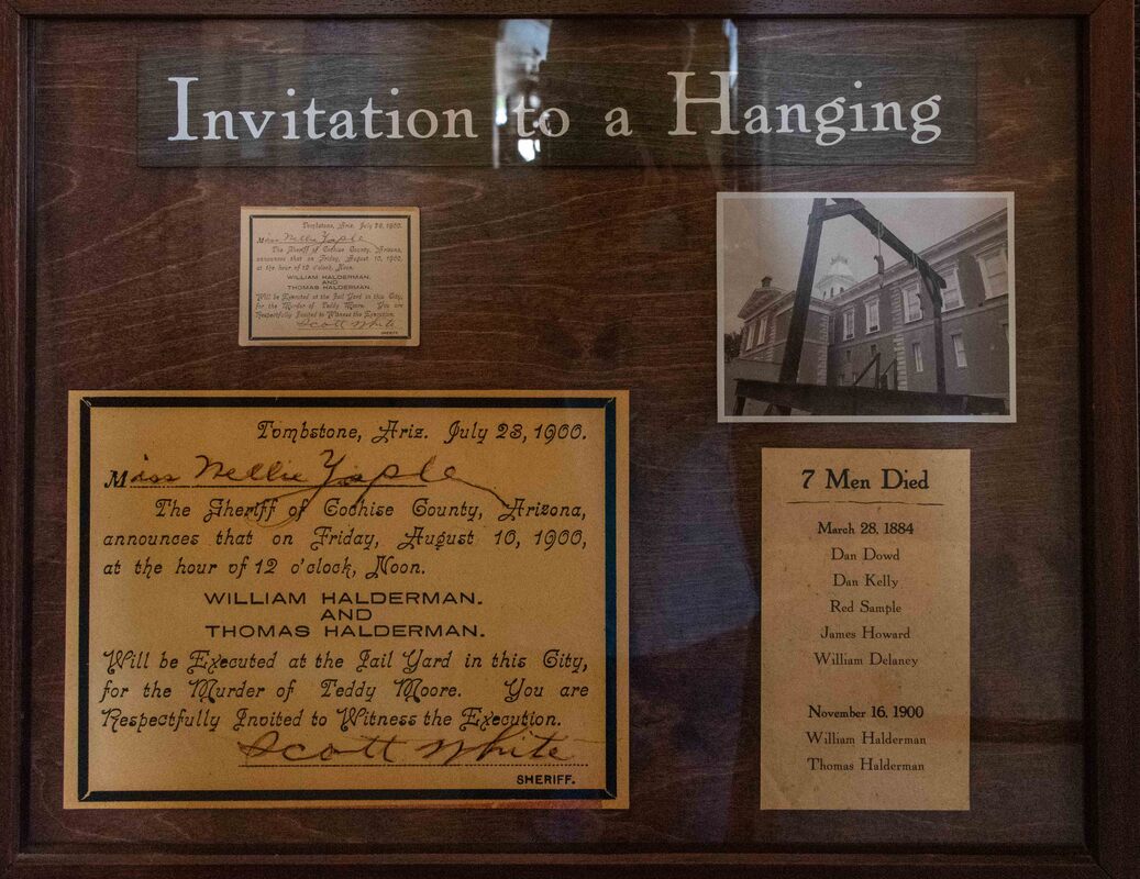
The invitation to a hanging reads like one for a wedding.
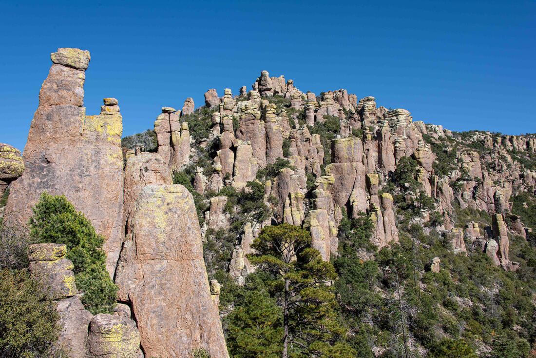
After driving hundreds of kilometers through the lowlands of the expansive Chihuahuan Desert, a cluster of isolated mountains appeared in the distance. Mountains like these that are not connected within a range are referred to as sky islands and the unique ecosystems within those in southern New Mexico and Arizona are among the most studied in the world. (Chircahua National Monument, AZ, Oct 25)
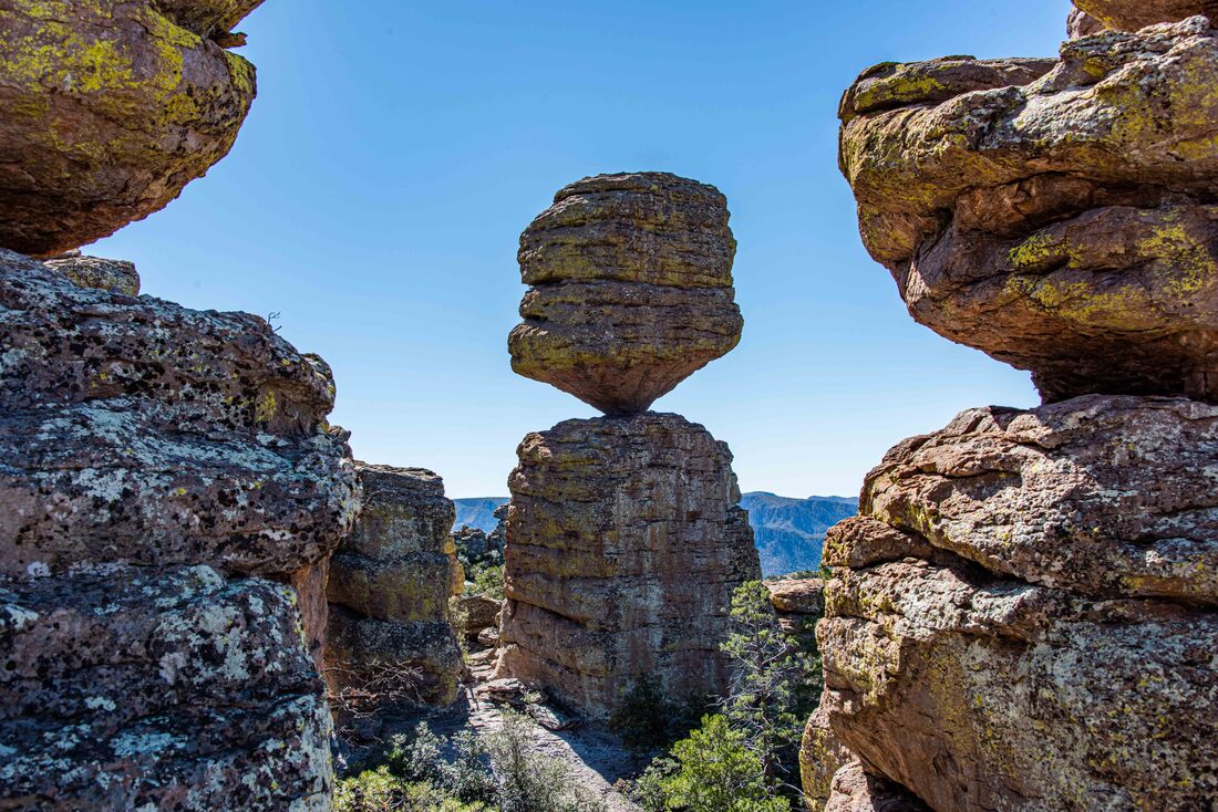
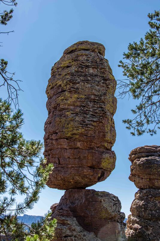
A 16km hike weaved through columns of rock formed when a nearby volcano erupted and its far-flung volcanic ash compacted into layers of gray rock. It cooled, the earth shifted and finally the wind and water did their handiwork, whisking away the weaker material and leaving behind the more solid rock spires, balanced rocks and various shapes.
So fun to turn a corner and see this through the trees - Pinnacle Balanced Rock.
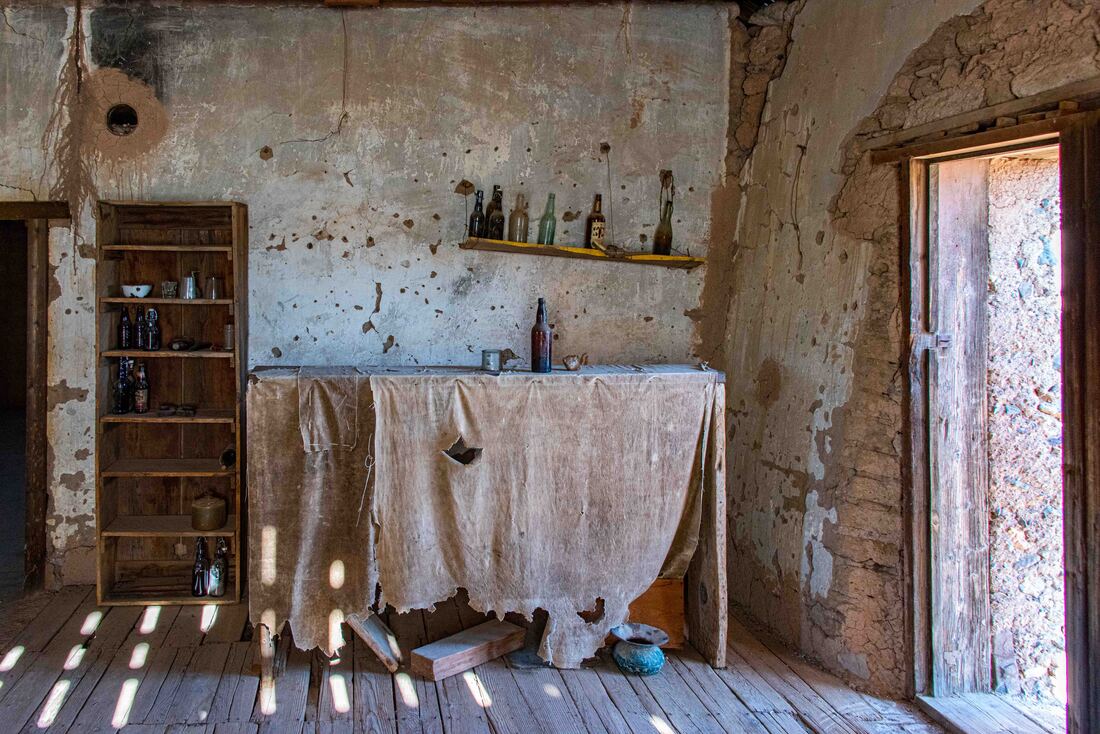
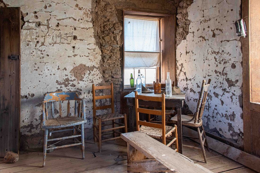
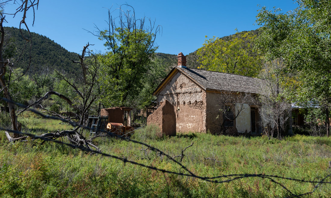
Another ghost town left behind from the sliver mining boon of the late 1880s. This one was unique in that for the past 100 years, three generations of a family have owned it and keep it locked unless you call ahead to visit. With just the two of us following around the tobacco spittin’, pistol wearing (snakes) family member, there was a lonely feel to the place. In its heyday the army used it as a mail delivery station and travellers stopped in to access clean water from the town’s natural spring. Above & below: the saloon was a modest affair with 3 tables, a stove to stave off the desert night’s chill and enough bullet holes in the walls to attest to some lively times. (Shakespeare, AZ, Oct 24)
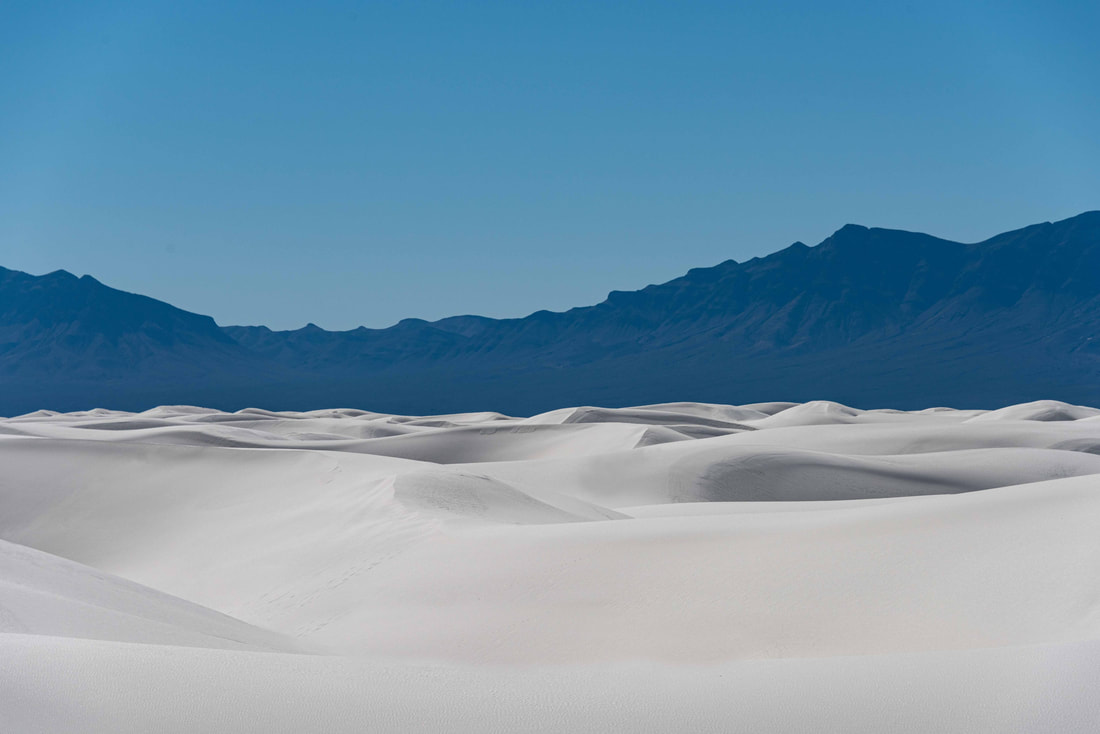
White Sands National Monument, covering 275 sq mi, is the largest gypsum dunefield in the world. (White Sands National Monument, Oct 20-21)
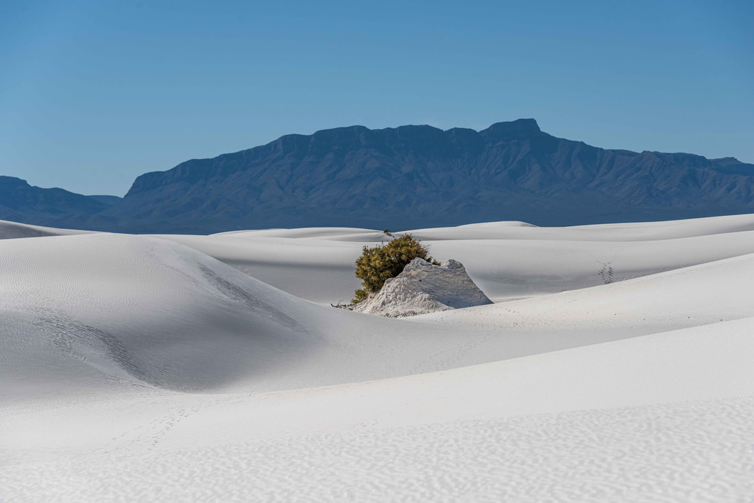
An ancient sea, displaced by the forces of nature, left behind deep layers of gypsum in what is today a lakebed only filled with water during the Summer monsoon season. As the water mixes with the gypsum and later evaporates, it leaves behind selenite crystals. Wind and more water break down the crystals until they become sand. Finally, strong winds blow the newly created sand onto these ever-changing dunes.
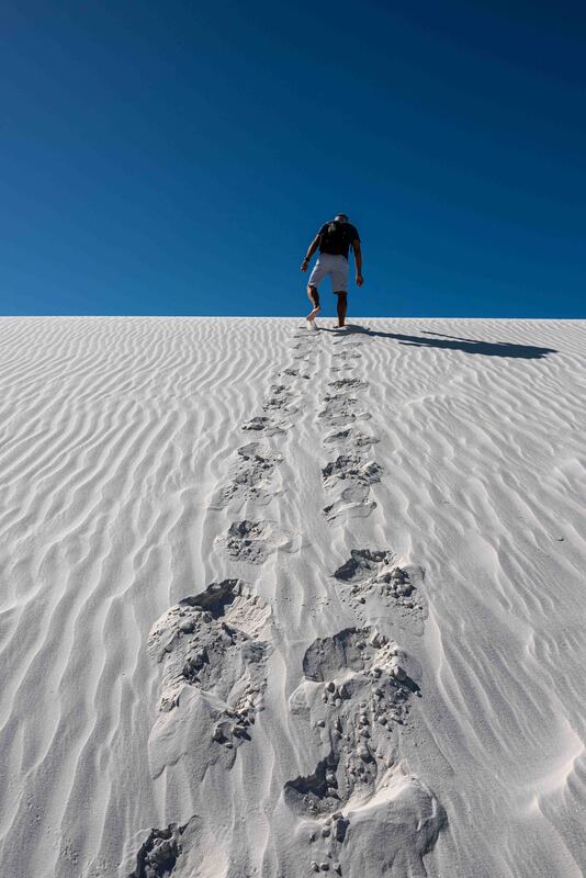
Gypsum retains moisture which prevents the dunes from blowing away from their boundaries, the Sacramento Mountains to the east and San Andres Mountains to the west. And it keeps them cool to walk on. Most visitors didn’t stray too far from the road, so an 8km hike guaranteed unblemished dunes (and a good calf workout with the constant ups and downs).
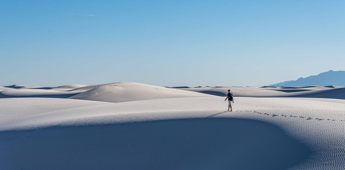
Other than a brief sighting of 3 others, we had the dunes to ourselves. Keeping the trail markers in sight, we each chose our own path to walk alone, enjoying the quiet solitude and leaving only our footprints behind. The night’s winds would sweep them away for the next hiker’s enjoyment.
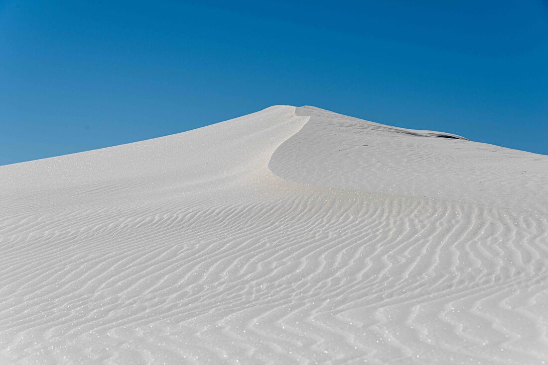
Adjacent to the monument land is the White Sands Missile Range where missiles are tested on a regular basis. Visitors to the dunes are advised not to touch any green glassy substance as it may be trinitite, a radioactive byproduct of the missile blasts. We didn't see any, but the late afternoon sun caught the glitter of the fragmented selenite crystals.
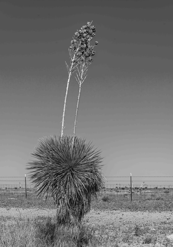
New Mexico's state flower, the blossom of the desert yucca plant. Much of southern New Mexico is an expanse of scrub land, with the stalk of the various yucca species the tallest thing around. Not only pretty to look at, it has many uses: the roots of a couple of species can be used in place of soap and shampoo, the stalks made into fences and many parts are edible.
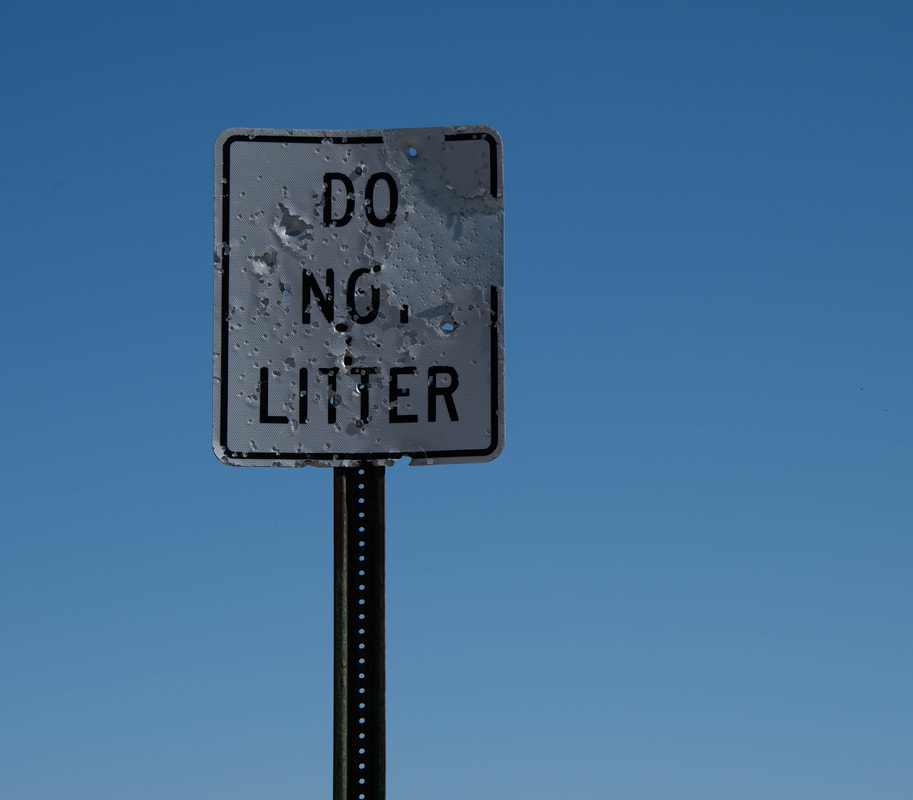
Bullet holes seem to be a rite of passage for road signs in southern New Mexico. A 20-something hair stylist I talked to told me she grew up in a small town and driving around shooting road signs was the pastime. This one, near a rest stop, didn't stand a chance.
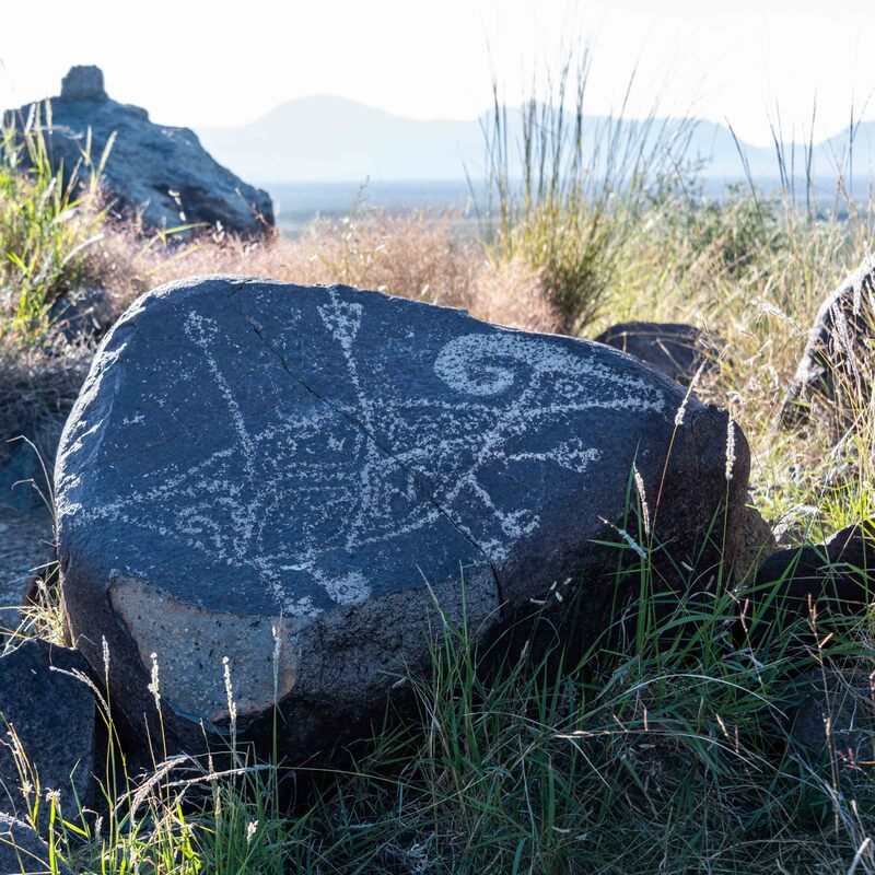
Rock outcroppings along a 1-mile trail contained over 21,000 petroglyphs! Although visitors could only see a few dozen, it was a privilege to be able to freely walk among the rocks looking for etchings. The Jornada Mogollon people's stories of hunts, astronomy and their surroundings have survived the elements for 600-1,100 years. (Three Rivers Petroglyph Site, NM, Oct 19)
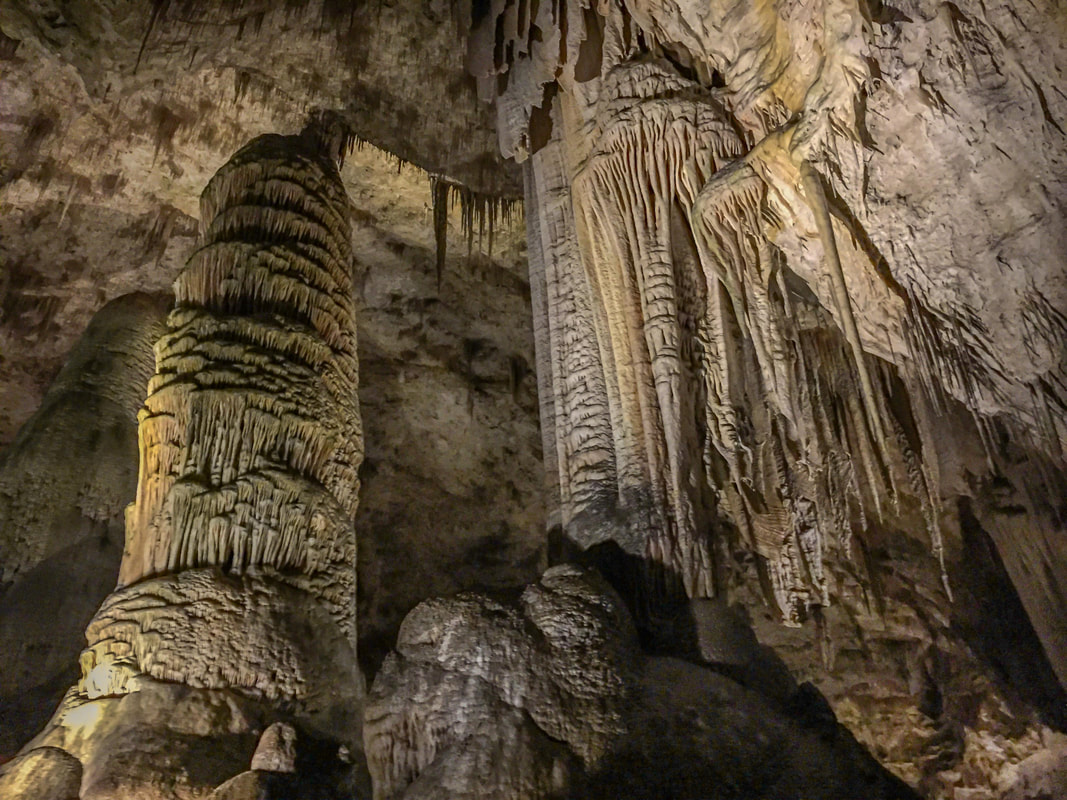
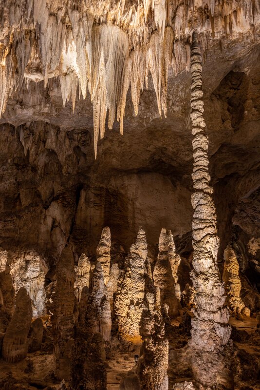
Carlsbad Caverns is only one of 116 caves in the greater area, but only 3 are open to the public. The main chamber that visitors can access is called the Big Room and for good reason - it’s floor space is about the size of 14 football fields. First stepping into the huge space feels like you’ve stumbled into a fairy tale with giant clusters of stalactites hanging from the ceiling, stalagmites and larger columns rising to meet them and all manner of unique formations in between. Photography was challenging with such low lighting, but here are a few for the memory book. (Carlsbad Caverns, NM, Oct 15-17)
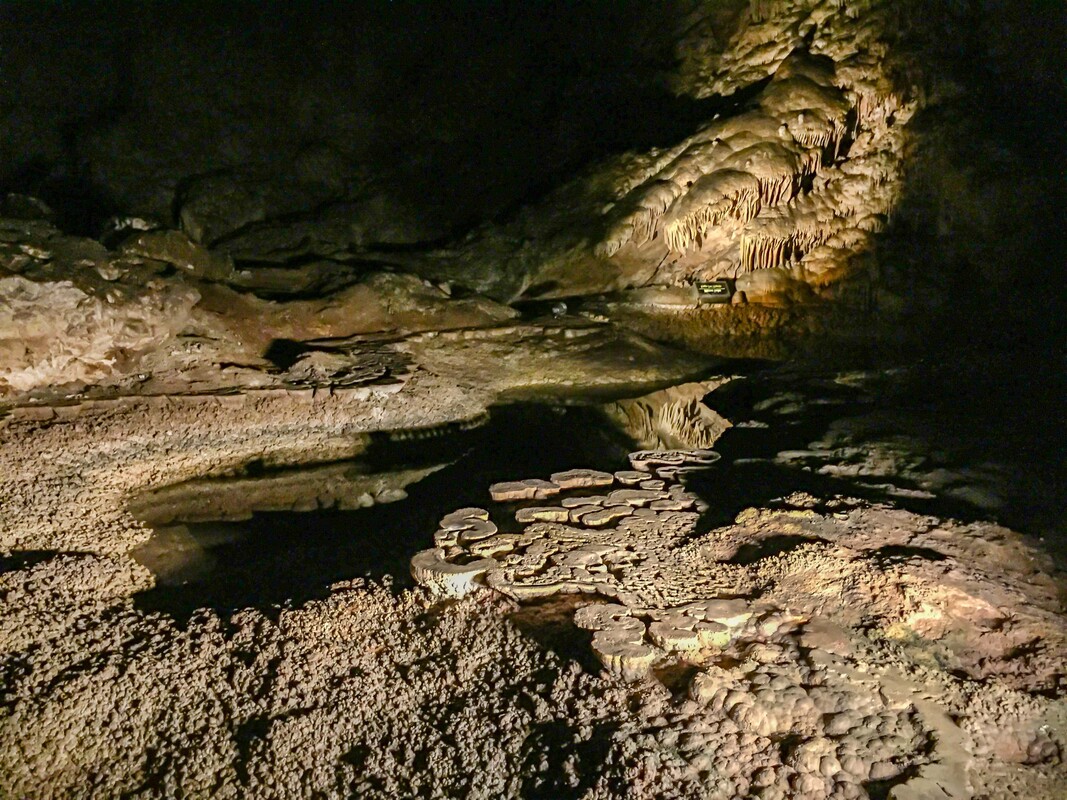
‘Lily pads’ formed on the surface of what used to be pools.
There were 2 ways to descend the 750’ into the Big Room; via an elevator or a set of steep switchbacks beginning at the cave’s natural entrance - much more fun and exercise too. At each sunset, bats swarmed out of the natural entrance for a night of insect feasting. If you wanted to view them, the rules were absolute silence and no photography - lovely listening to the subtle sounds of hundreds of thousands of bats.
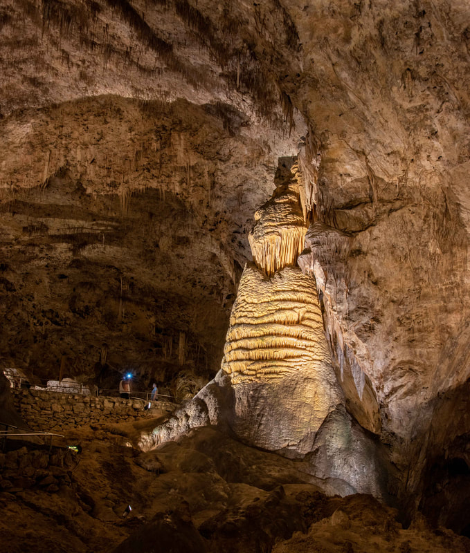
A favourite is the Rock of Ages. From a distance it looks like a giant teddy bear propped against a wall. The three people to its left give some sense of the scale.
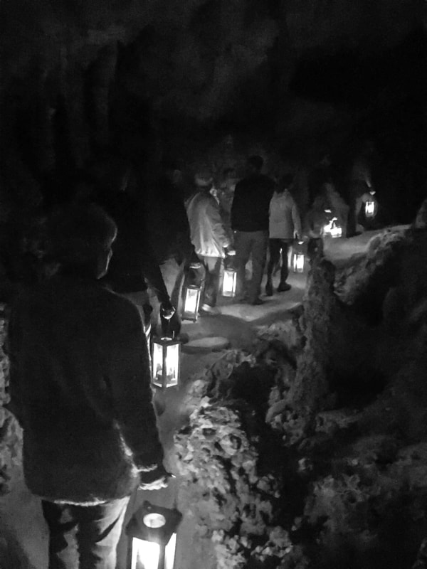
Seeing the cave early explorer style, carrying candle lit lanterns - hot and surprisingly heavy.
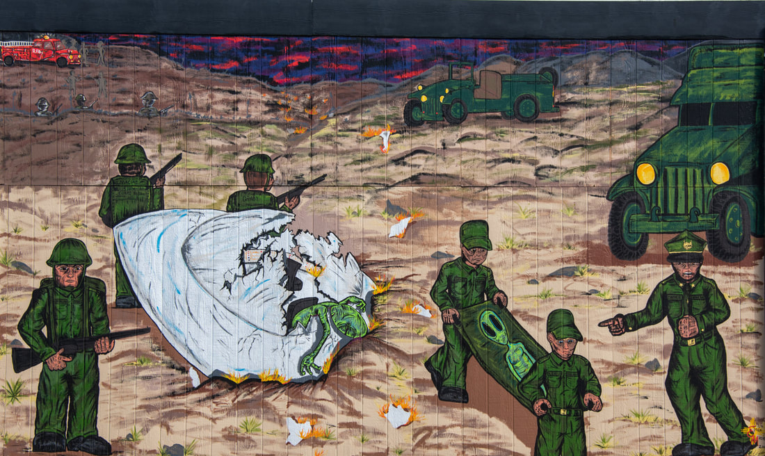
Everything changed for the town of Roswell on July 7, 1947, the day a UFO allegedly crashed on a nearby ranch. The International UFO Museum and Research Center claims the following chronology of events. On July 7th a rancher found unusual debris on his property and as news of the "tinfoil like debris stronger than any known material" started to spread the army stepped in to clean up the site. The RAAF public information officer was told to announce that the wreckage of a crashed disk had been found. By July 9th, reaction to the news attracted the attention of higher levels of government who changed the official story to a weather balloon crash. During those couple of days of confusion a nurse claims to have seen a body, unlike a human being, autopsied at her hospital. She drew pictures for a friend and within a couple of days the nurse was transferred to England, never to be heard from again. Conspiracy theories have reigned since. (Roswell, NM, Oct 14)
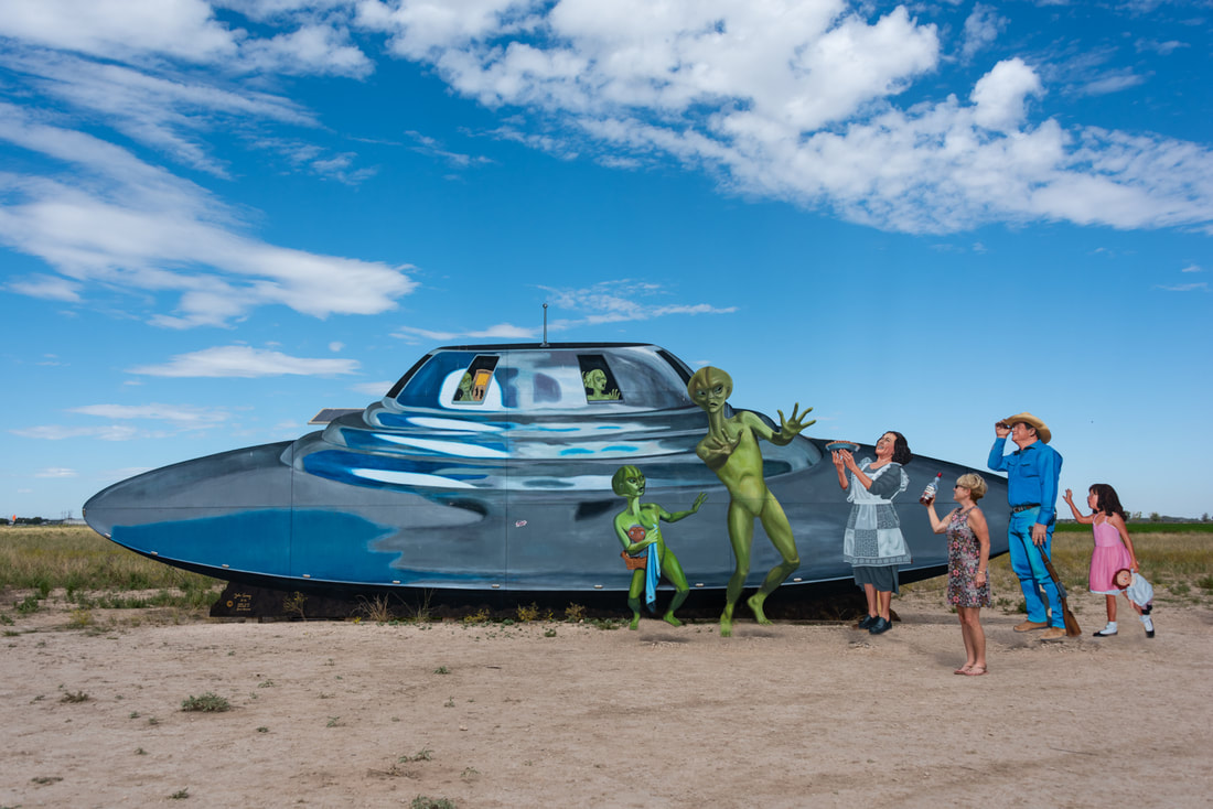
Roswell has fully embraced its UFO status with aliens scattered throughout the town and on all Welcome to Roswell road signs.

Driving along the highway we spotted a crop glinting in the sun. Yet another pull-off to the side of the road revealed it was cotton, a crop we’ve never seen before. It turns out that most of the world's supply is grown in the U.S. – almost all in the southern and western states.
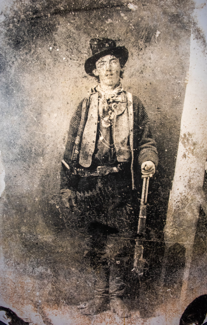
In the 1870s Lincoln County became a magnet for businessmen who saw the potential to increase their fortunes. Eventually a power struggle rose between two factions, each with their own town allegiances and a gunslinging gang to protect their interests. Billy the Kid chose his side and eventually led the gang that called themselves The Regulators. As avarice and tensions mounted, so did the death toll. In 1878, the president called the town “the most dangerous street in America”. It had to be cleaned up and that meant Billy & his gang had to be killed. The army was called in and blood was shed, but The Kid was still at large earning a living gambling and cattle rustling. Dead or Alive posters offering a $500 reward made Billy the most wanted (and famous) outlaw in New Mexico. Sheriff Pat Garrett, a former cowboy and buffalo hunter, was tasked with killing The Kid. On July 14, 1881, six months after being sworn in as Sheriff for the town of Lincoln, he did just that. Finally, there was relative peace in New Mexico. (Lincoln, Oct 13)
A 50mi scenic byway passed through the towns of Lincoln County where Billy the Kid spent his short, but notorious life. The town of Lincoln remains one of the best-preserved in the US - it’s entirety is considered a Historic Monument. If you erased the pavement and cars, it looked much the same as it did in the mid to late 1800s and today’s few residents are committed to keeping it authentic. The only tourist touch was one uninspiring trinket shop. The effect was pronounced - allowing for a peaceful stroll along the main street and further afield while imagining what life must have been like for the outlaws of the time hiding in the hills and rock outcroppings just outside the town.
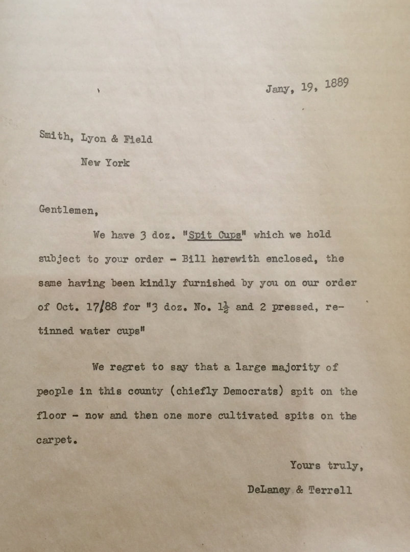
Among the many artifacts in town was this letter. There is some humour in noting that time has not changed the pettiness that politics has the capacity to stoop to.
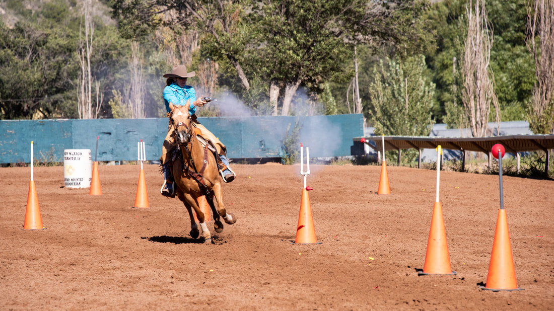
As luck would have it, this was the weekend for the annual Lincoln County Cowboy Symposium (unlike a rodeo). One challenge was the cowboy/girl mounted shooting. The day was windy and each rider, strapped with double holsters, had to ride as fast as possible while shooting each of 10 balloons, switching guns half-way through the challenge. (Ruidoso Downs, NM, Oct 12)
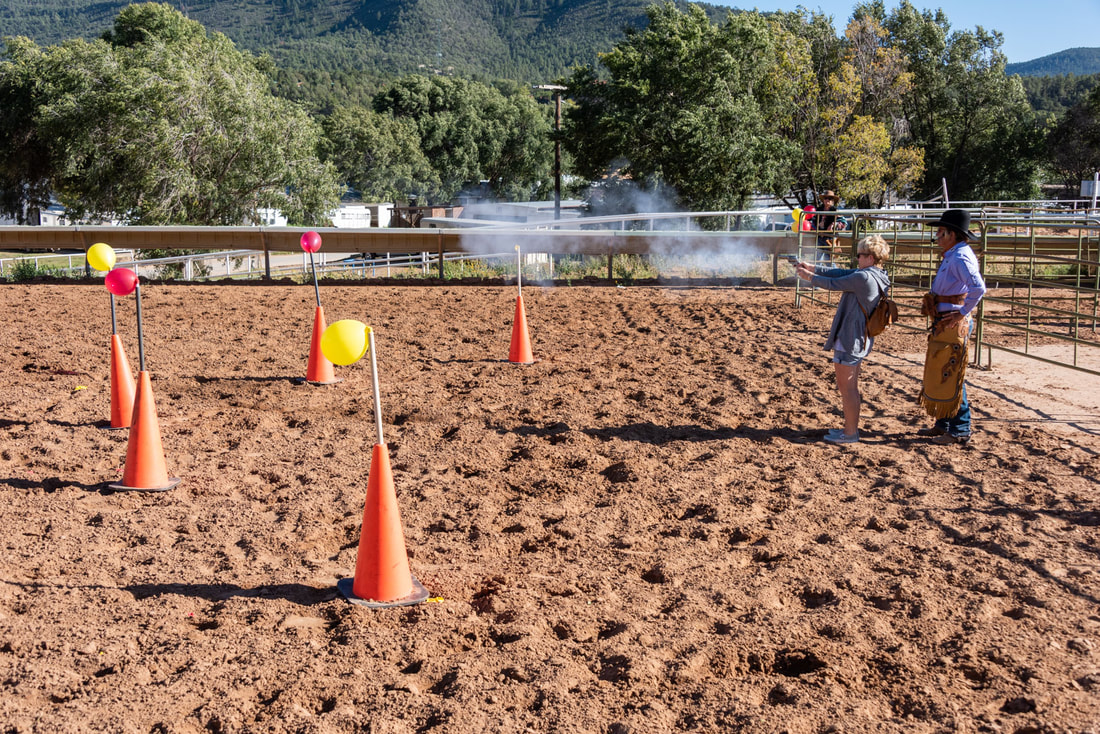
After, audience members were offered the chance to try their luck with the emcee’s revolver, 5 balloons and no horse. Four young rancher boys and I took up the challenge. The gun was heavy, it was hard to pull back the hammer and the surreal experience was a total adrenaline rush. I left the horse ring vibrating. Successfully shooting only 3 out of 5 balloons while standing still at close range gave me a whole new appreciation for the skill it took to shoot from a galloping horse.
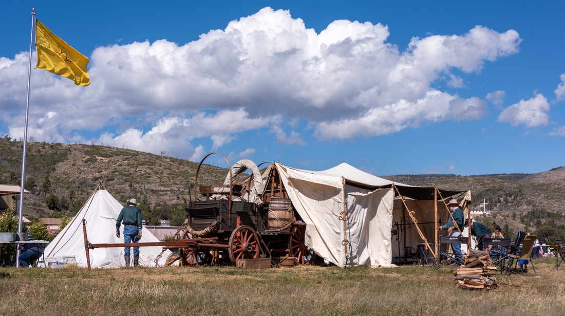
The Symposium also featured a chuckwagon cookoff. Participants were required to make an Old West-style meal using authentic cooking paraphernalia and wagons. Quite a scene walking amongst the “camps” with Dutch ovens filled with beans, biscuits and dessert hanging over fire pits.
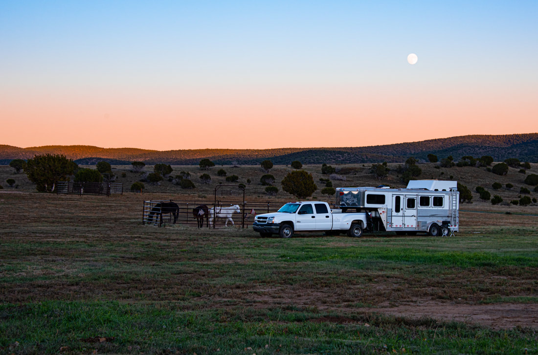
Overnighting in a forestry/equestrian campground made for a sweet dinner time view. New Mexico has been filled with (legal) picturesque places to overnight, whether they be small areas in state or national parks, national monument grounds or roadside. (Capitan, NM, Oct 11)
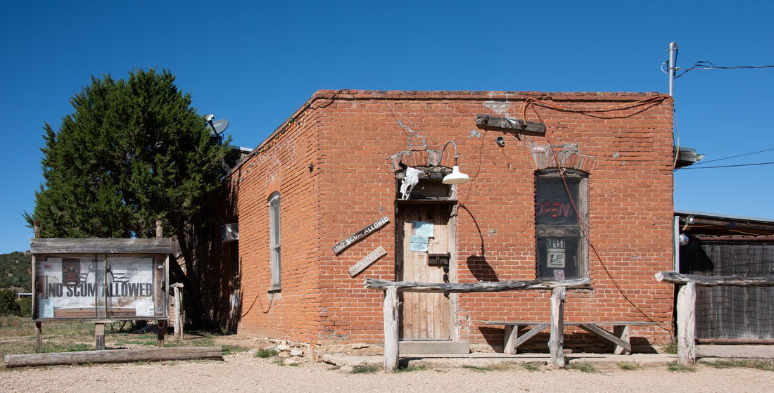
A ghost town... at its peak, 4,000 people lived here, all to make a living off the gold first discovered in the 1870s. Today, two dozen residents call it home, but the only business open is the No Scum Allowed Saloon – true kitsch junkies, we were drawn here because of the name. A potbellied stove kept the tiny building cozy just as it did 135 years ago. Appropriately, we drank whiskey (while eavesdropping on a couple of locals who knew and had an opinion about everyone within a 20 mi range :). (White Oaks, Oct 11)
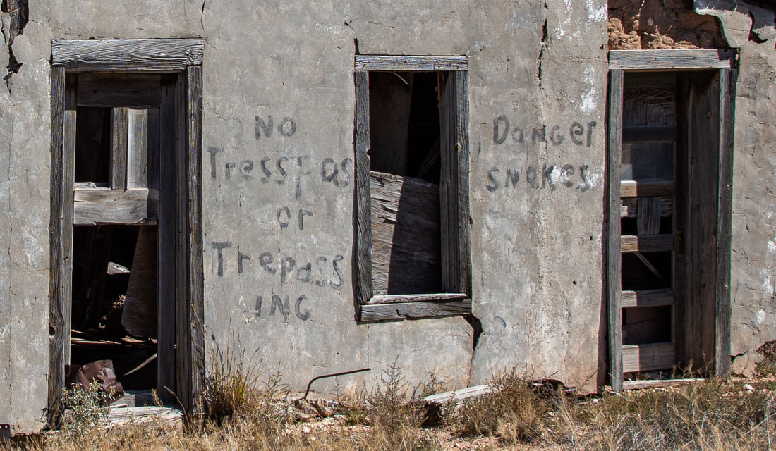
Rattlesnake warnings, whether on hiking trails, at rest stops or on vacant buildings, were a reminder to watch where you stepped. (Moriarty to Carrizozo, NM, Oct 11)
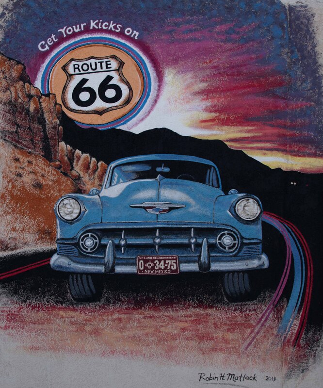
Established in 1926, Route 66 between Chicago, IL and Santa Monica, CA was one of the original highways. It was used as the route to California, first by the unemployed looking for agricultural work during the 1930's Dust Bowl years, then during WWII for war-related work and finally in the 1950's for vacationers seeking fun in Los Angeles. The increased traffic gave rise to fast food restaurants (eg. the first McDonalds restaurant), motor inns and roadside attractions. It inspired a song, a TV show and for many, a romanticized view of a road trip.
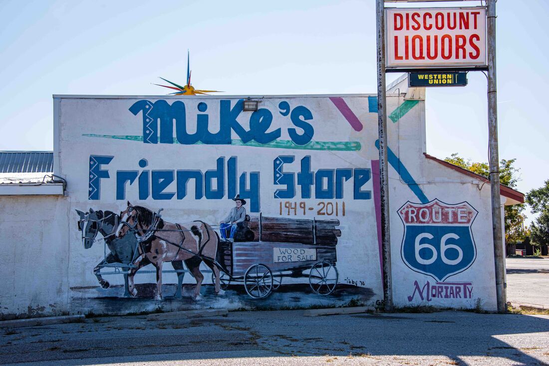
(Albuquerque to Moriarty, Oct 10)
Sixty years later the “The Mother Road” was replaced by interstate highways that crisscrossed America, choking off the the mom-and-pop businesses. Today, parts of the route have been designated as national scenic byways and folded into the US Bicycle Route System, with efforts made to retain some of the nostalgia.

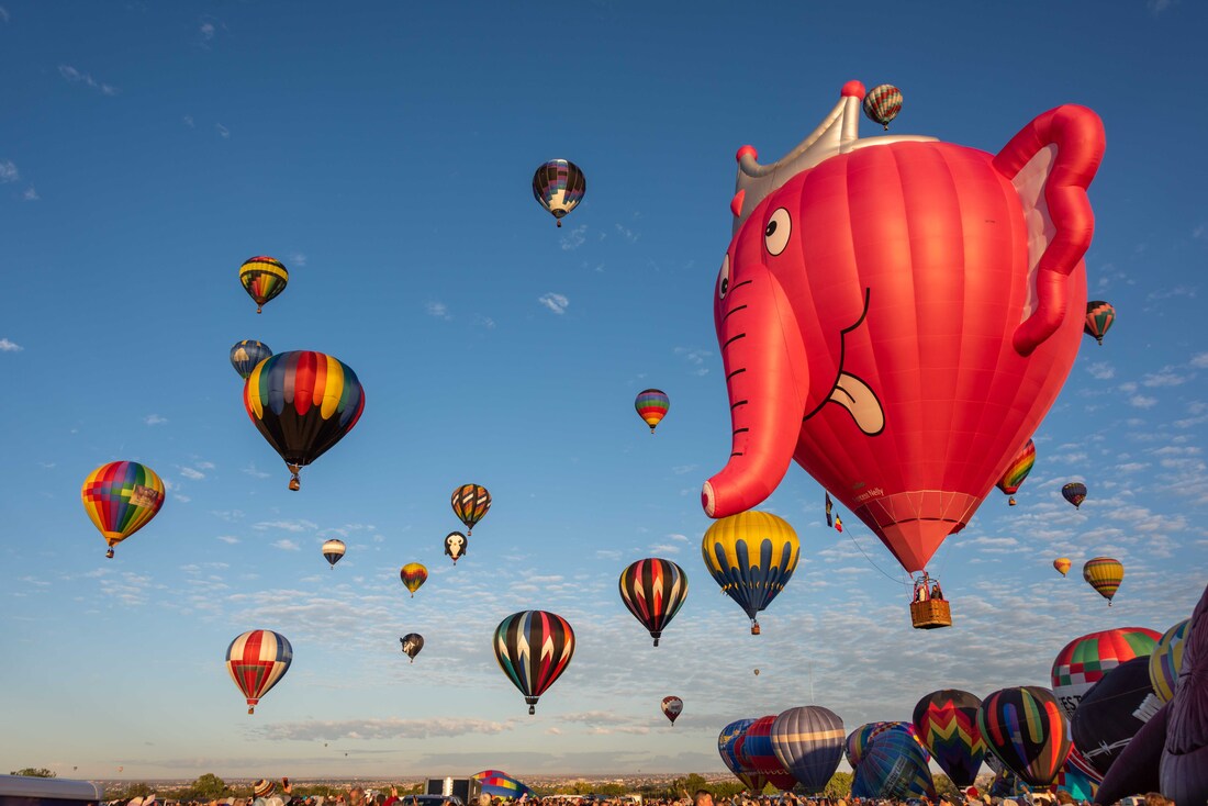
When the first balloon show hit Albuquerque’s skies in 1972 a few hundred people were expected to show up to watch 13 balloons. Instead, 20,000 came and the Albuquerque Balloon Fiesta was born. (Albuquerque, NM, Oct 8-10)
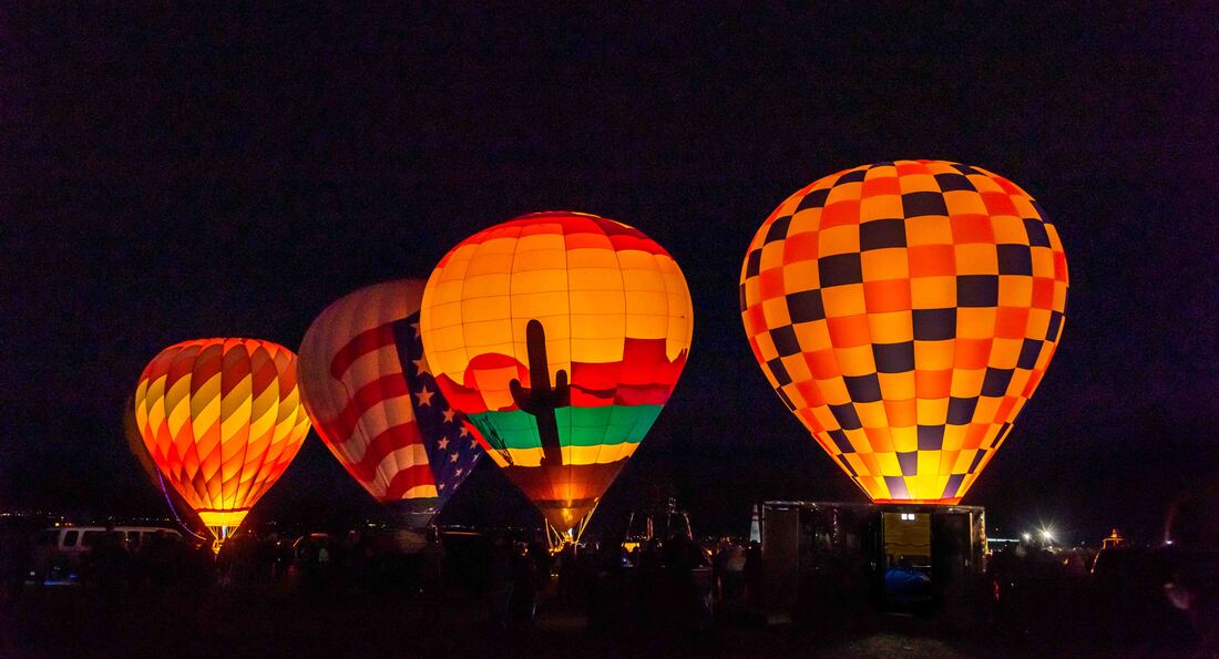
The fiesta started early. Each morning our alarm clock went off at 4:30am. After a quick coffee, we rode our bikes a couple of miles to the event. It was magical watching and listening to the flaming gas whoosh into the balloons, the only light in the pitch dark.
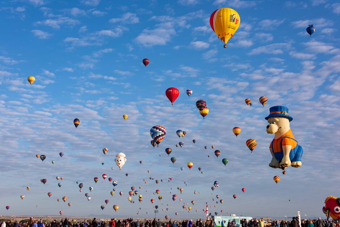
At sunrise, all the participating balloons took to the skies in waves, an event called the mass ascension. This year there were over 600! Chaser teams drove beyond the grounds to pick up balloons unable to return to the fiesta park. Residents who volunteered to lend their yards as safe landing spots were given large white X markers to lay out for the balloonists to see. It was so windy on Thursday that anyone could volunteer to be a chaser, your job being to hop in the chaser truck, track down the balloon and pack it back up onto the pickup truck's bed.

While the hundreds of balloons weren’t a surprise, the immersive experience was. Albuquerque’s fiesta is one of the few where spectators can walk amongst the balloons and ropes while they are being filled with hot air and later being deflated.

Another surprise was that as part of Canon Camera’s official sponsorship, they loaned spectators cameras, allowing the photographer to keep their SD card at days end. Most people wanted the easy point and shoots, which gave us the opportunity to use their highest end camera. It was great not having to continually share one, but the post editing was tough – over 600 shots taken and somehow they had to pared down to the best 100… a challenge.
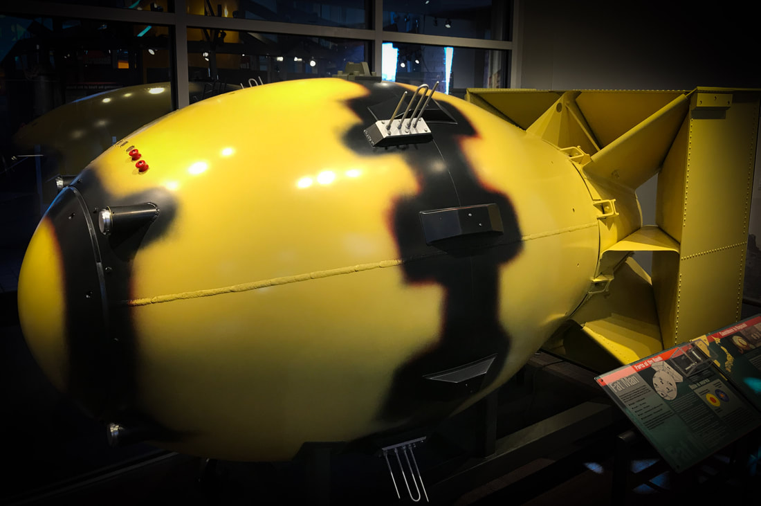
WWII was raging and the US government was frantic to build an atomic bomb in a top-secret facility. Set in a remote and geographically challenging location, the town of Los Alamos was chosen as the base for The Manhattan Project. The two bombs created were code named after the war leaders of the day: Fat Man, for Winston Churchill (replica above) and the Thin Man, after Theodore Roosevelt. (Los Alamos, NM, Oct 6)

When the leading scientists of the day found their slide rules weren’t up to their design tasks, this cumbersome Marchant calculator was used. If you wanted to start your calculation with a 7-digit number, for example, the 1st digit would be punched in the 7th column (#7 grey number along the bottom row), the 6th digit under the 6th, etc. After an operation was selected (eg multiply), the next number would be painstakingly input. With these rudimentary tools, it’s amazing that the atomic bomb was designed and built within 27 months!!
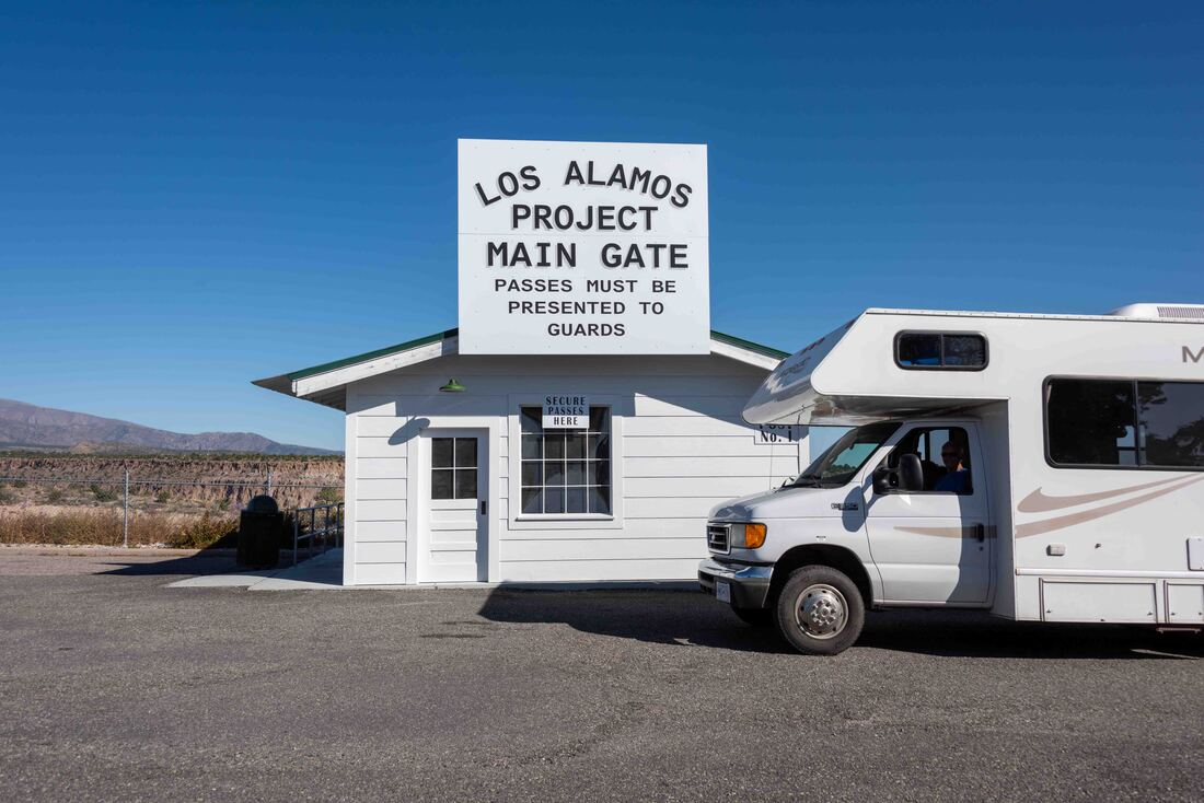
The operation was so high pressure and secret that the scientists couldn’t tell family and friends where they were, they worked 12-14hr days, 6 days a week and couldn’t vote or divorce while in Los Alamos - anything to keep the project off the radar. Above: the main gate once used to ensure that all who entered had the necessary security clearance.
Although the facility is no longer designing bombs, it attracts top scientists who work on projects ranging from medicine, alternative energy and 3D computing. Not surprisingly, the town has the highest per capita of PhD's in the USA.
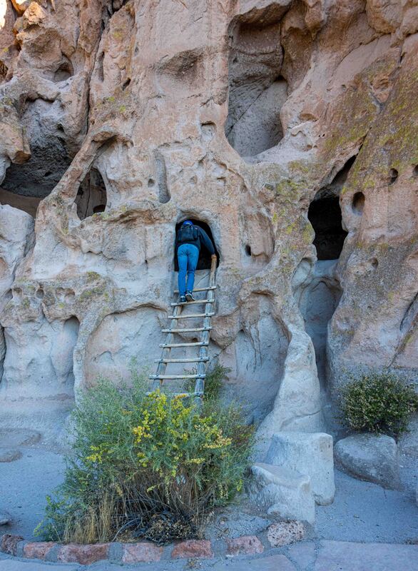
For the past week our route took us to important Ancestral Puebloan sites, providing an opportunity to explore the ruins they left behind. This site had a wilder feel as visitors were allowed to view the ruins outside of a structured tour. (Bandelier Nat’l Monument, NM, Oct 6)
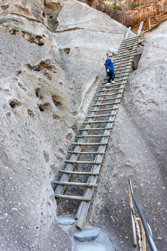
A series of ladders worked their way up from the canyon floor to a large cave dwelling, just as they had centuries ago.
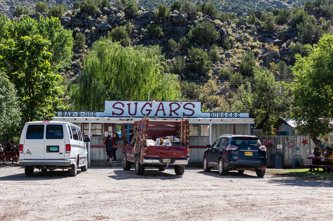
Sugars BBQ joint, serving the mere 385 locals of this tiny town, managed to make it into the top 10 of Gourmet magazine. The BBQ Brisket was excellent. (Embudo, NM, Oct 5)
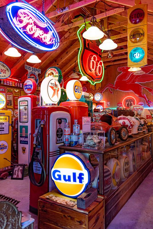
And 50m down the road sat some roadside kitsch at Classical Gas. All things Route 66 were lovingly displayed on every available shelf and yard space.
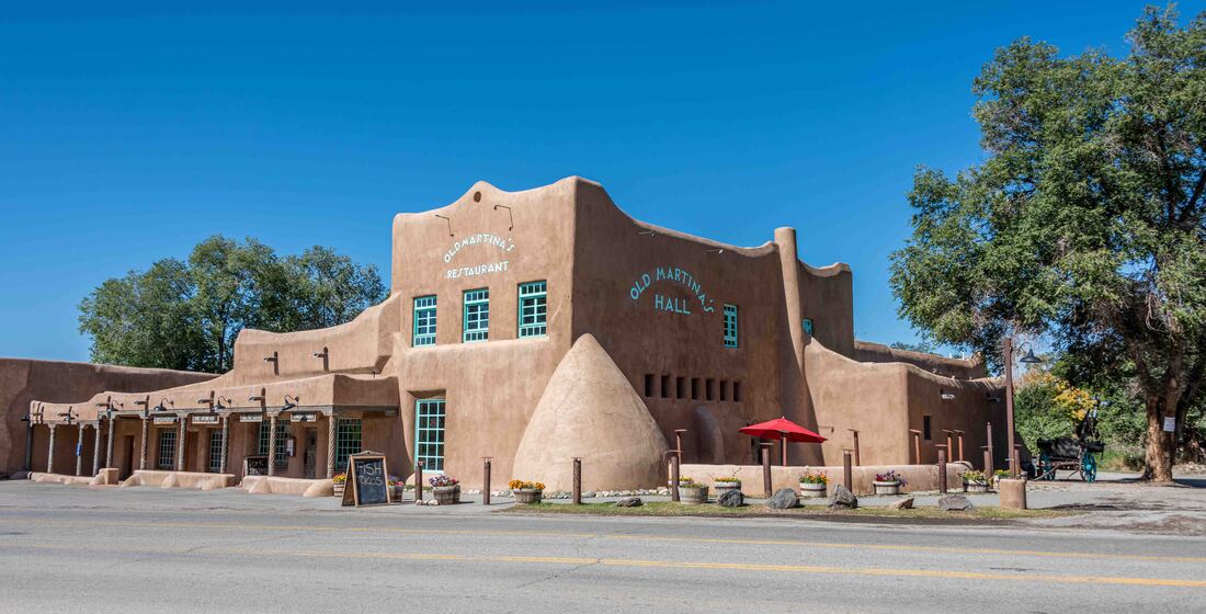
Sometimes driving through New Mexico felt like being in a different country. Above, a restored historic building. It hasn't been uncommon to see the architecture of private and commercial buildings continue to look like some scaled up or down version of the above. (Ranchos De Taos, NM, Oct 5)
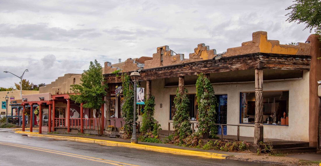
A funky town crammed with artists all holding court in historic buildings. Although the town is 400 years old, its neighbour the Taos Pueblo was built by Ancestral Peubloans a 1,000 years ago. Descendants reside there still, making it one of the longest continuously inhabited communities in the USA. (Taos, NM, Oct 5)
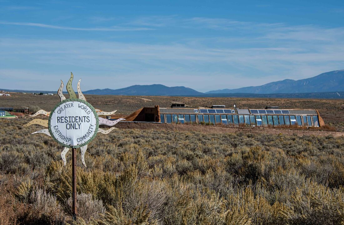
A semi-subterranean community dotted the landscape. Those looking to live off the grid built these Earthships; completely self-sustainable, eco-homes made from adobe and upcycled materials like tires, bottles and tin cans. The sun facing windows create a hothouse where produce is grown. (Taos, NM, Oct 4)
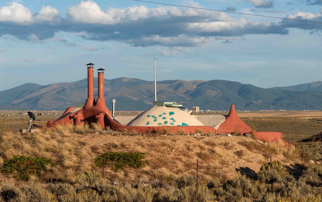
These unique homes provide optimum coolness in the summer and warmth in the winter. Additional communities have sprouted up in every US state and overseas (Japan, Australia, Belgium, etc). For the curious ...https://taos.org/places/earthship-biotecture/.
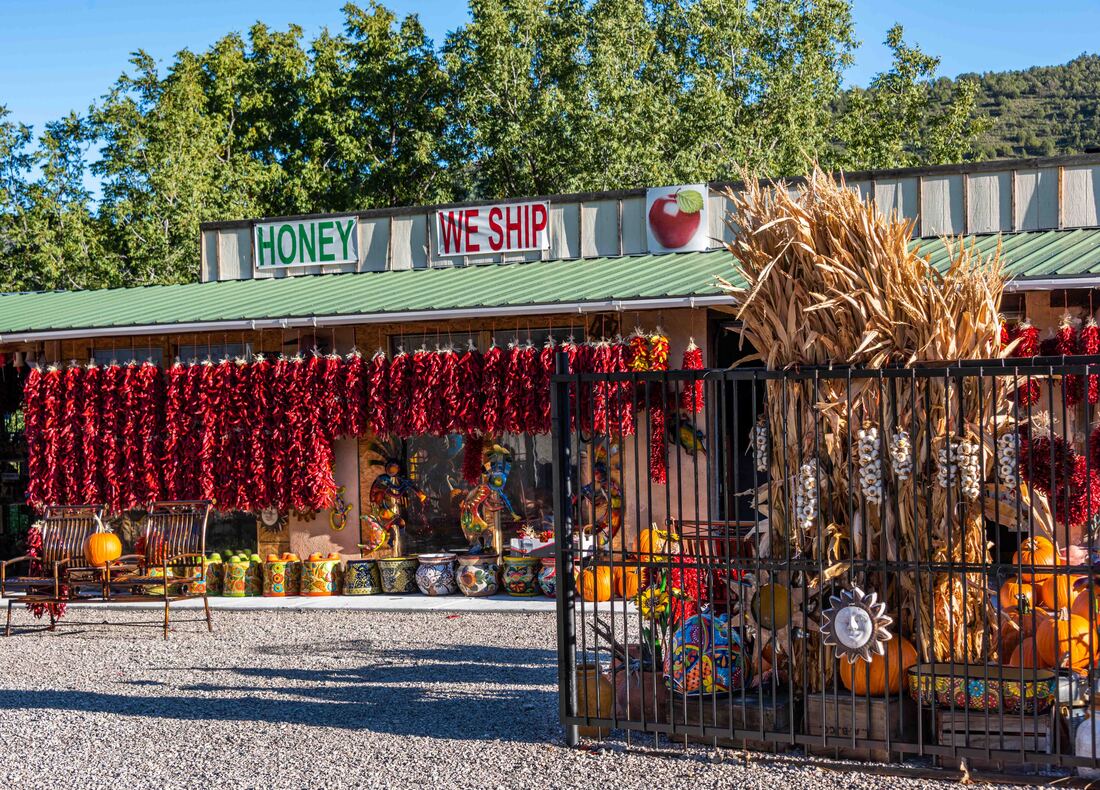
What more appropriate way to be greeted into New Mexico than a stop at a roadside produce stand decorated with ristras made with the states’s namesake chile peppers. They’re the equivalent of garlic braids in the north, to be used as kitchen decor or for cooking.
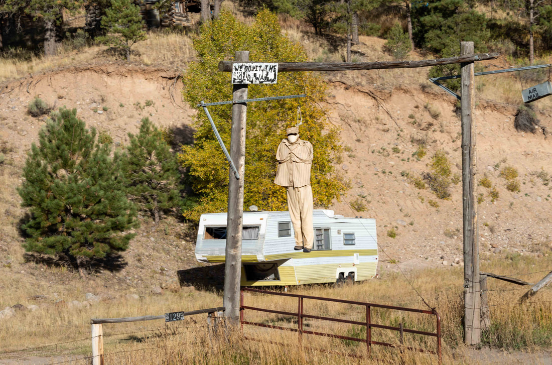
Hours later, after driving through miles of lonesome ranch land, a disturbing sight... “We Do It The Old Way” was scratched above the noose. (Hwy 64, NM, Oct 3)
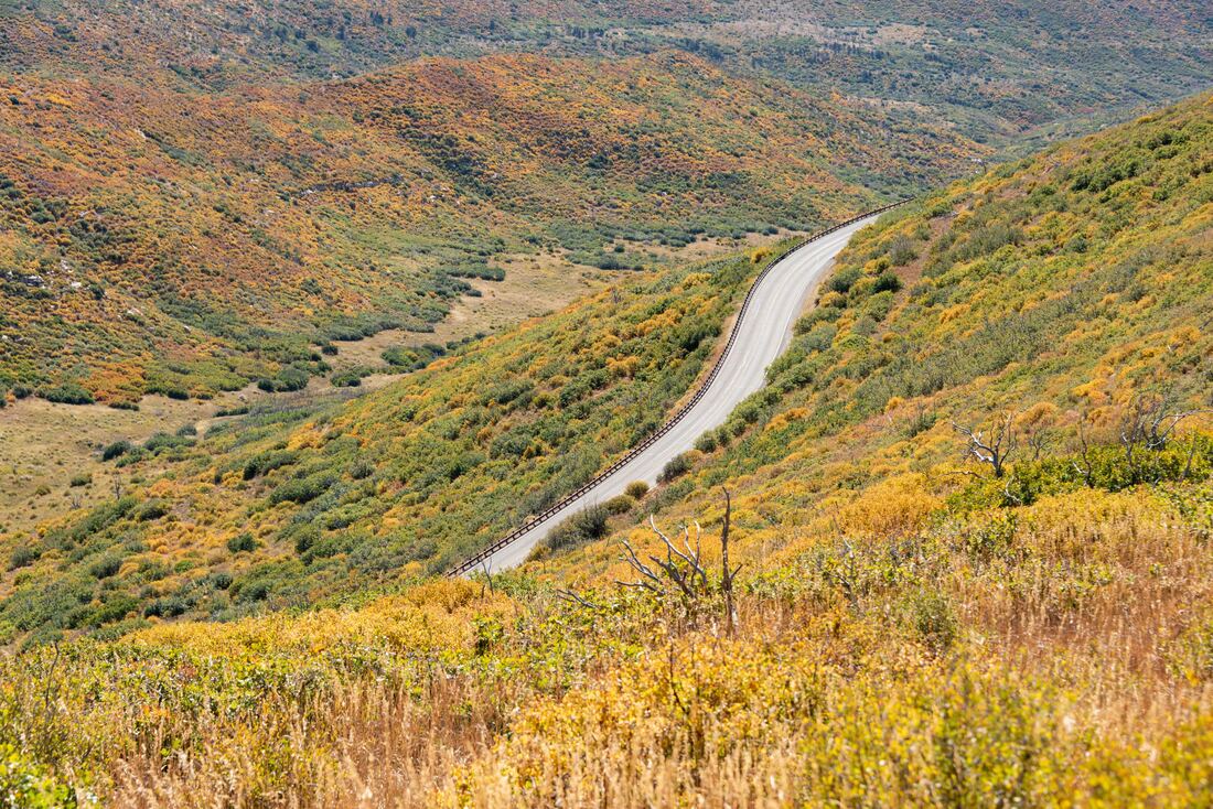
There may not be maple leaves here, but the Fall colours are still beautiful.
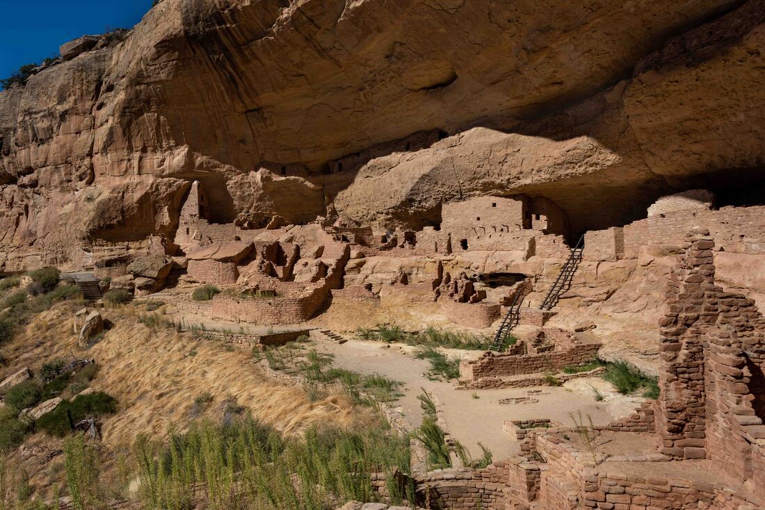
The Mesa Verde National Park contains over 600 Ancestral Puebloan cliff dwellings and numerous archeological sites from between 900-1300CE. After living in the area for over 750 years, the Ancestral Puebloans moved to Arizona and New Mexico where their descendants continue to live today. (Mesa Verde NP, CO, Oct 1-3)
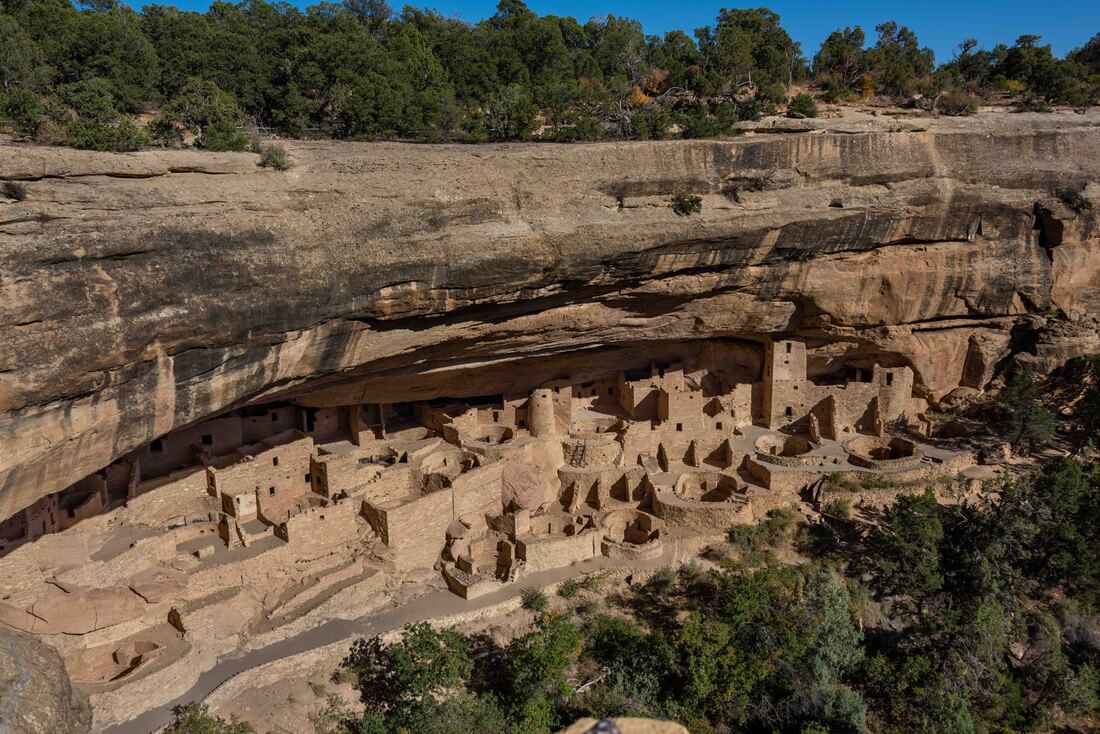
Referred to as The Cliff Palace, this is the largest (known) cliff dwelling in North America, extending much deeper than can be seen from this viewpoint. Fun facts: it’s 215’W x 90’D x 60’H, it housed 100-120 people and has 150 rooms plus 21 Kivas.
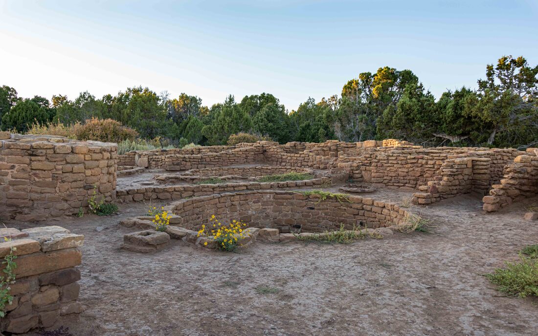
While some lived under the mesa in caves, others chose to live on top, close to where their corn, beans and squash crops grew. This area would have housed an extended family (roofs long gone). The deep, round dugout (center), is called a Kiva and is believed to have been used for ceremonies.
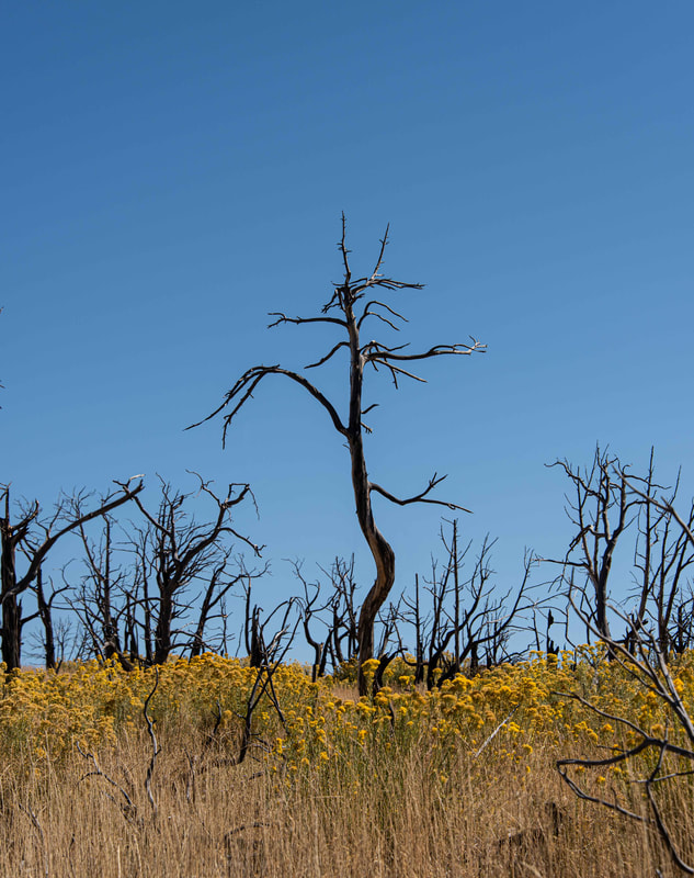
What was once a pine tree covered park is now blanketed with tall grasses punctuated by the skeletons of burnt trees. As the trees burn, oils are released that damage the soil. The continually warmer and drier climate has meant more lightening-caused forest fires and even if the efforts to mitigate future wildfires are successful, it will take 200-300 years for the soil to recover and new trees to grow.
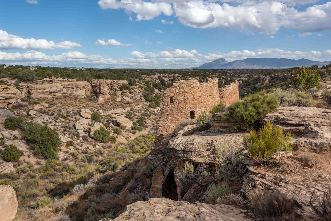
A collection of Ancestral Puebloan (ca 1150-1350) structures clung precariously to this canyon rim. Water was (and is) a scarce and precious commodity in the high dessert and some believe that these towers were used, in part, to protect water sources. (Hovenweep National Monument, UT, Sept 29)
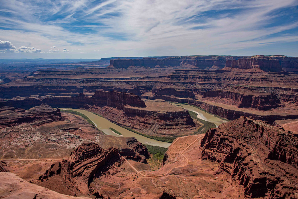
Dead Horse State Park - the story goes that cowboys built a corral at this point, which is at the end of a narrow strip of land. Then they’d herd wild horses up here knowing the horses would enter the corral rather than jump over the cliff into the Colorado River 2,000’ below. For some unknown reason, one year a few of the mustangs were left stranded in the corral where they died of thirst. (Dead Horse State Park, UT, Sept 26)
Potholes, often denoted by a black ring around a depression in the rock, are alive with shrimp embryos that ‘wake up’ after a rainfall. Stepping on them can kill them, so hiking was sometimes a game of hopscotch. Interestingly, the embryos can lay dormant for up to 50 years.
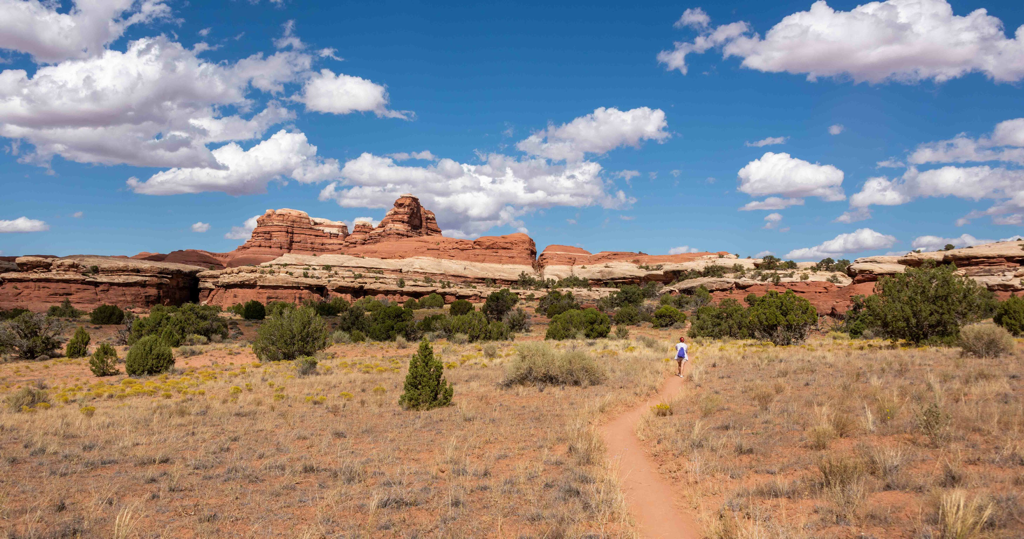
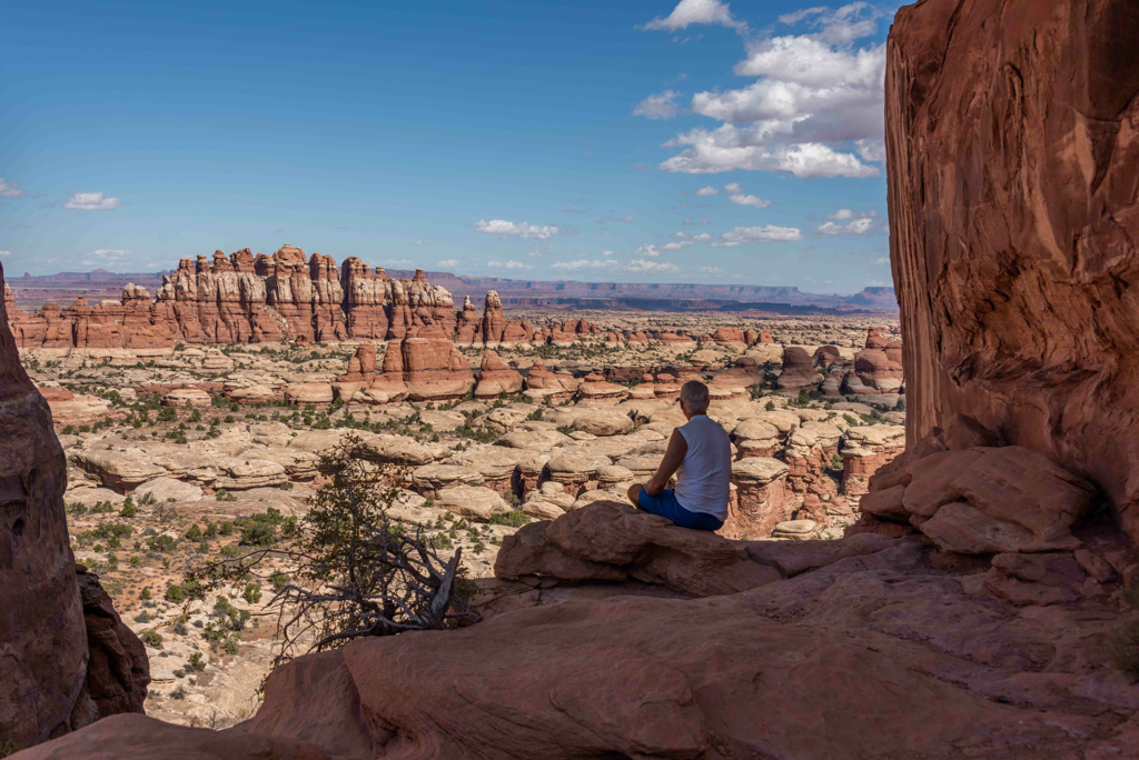
Canyonlands National Park, UT - partitioned into three sections, we only visited the two that were RV accessible: The Island in the Sky mesa & The Needles. (Sept 22-25)
The Needles (Chesler Park trail) - The following set of photos were taken in this less visited section of Canyonlands. A predawn wakeup meant we could tackle this strenuous 18km hike during some of the cooler hours, before the 30+ midday heat started to radiate off the rocks.
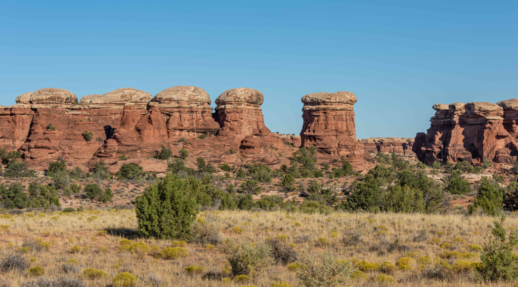
Wind erosion has formed these unique mushroom shaped rocks.
There’s just no way to make dirt look
pretty, but it is interesting. What appears as simply dirt clumps is the work of cyanobacteria and it covers the desert. When the bacteria moves it leaves behind a web of fibers that bond soil particles together, creating a defense against erosion while also trapping water and nutrients for the plants. Hikers are beseeched not to walk on it. We’ve been slammed by a few dust storms - the winds blow the trail’s fine loose soil, but leave the untrodden cyanobacteria soil intact.
Looking ahead to the next rock formation to ascend. The layered appearance of the rocks formed when the orange colored Entrada sand blew into the canyon from one direction and collided with the tan colored Navajo sand. When buried, they compressed over time to form sandstone.
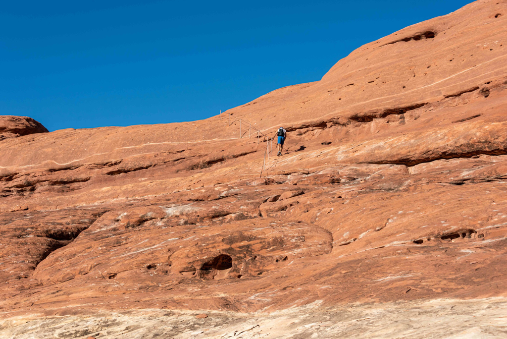
The only manmade handhold on all the slickrock we‘ve hiked. The story goes that slickrock got its name from early settlers - their horses hooves slipped easily on the slick rock making it a terrain to avoid, especially in the rain.
The destination, a wall of the needle-like formations that inspired the park’s name.
Celebrating the hike with a cold beverage and a simple meal while the sunset lights up the campground.
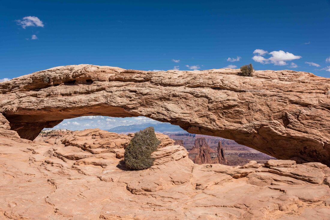
The Island in the Sky mesa - hikes with sweeping vistas from the rim of the mesa gave some idea of the vastness of southeast Utah’s high dessert. The following set of photos were taken in this section of Canyonlands. Above: Mesa Arch - the more ambitious get up before dawn to take a sunrise shot behind this arch.
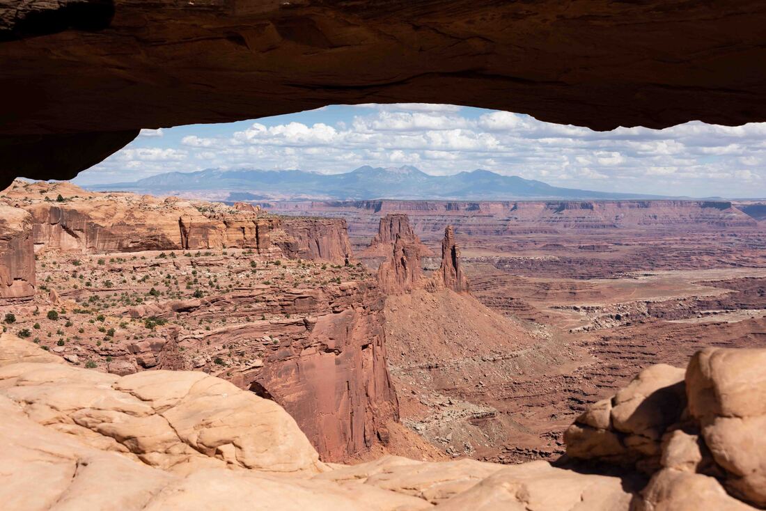
A closer peak through Mesa Arch offered a glimpse of the 340,000 acre Canyonlands.
Fewer visitors here meant we had this hike to ourselves. With a strong wind cooling off the 32-degree day, it was a fun scramble up Aztec Butte. Alcoves in the butte were once used to store the seed and grain harvests of the ancestral Puebloan people.
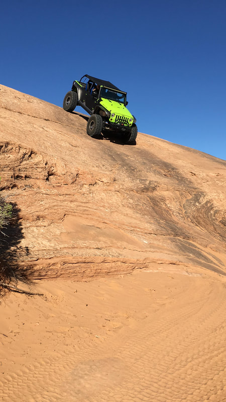
A different way to experience the slickrock... Rick and a driver spent a few hours ascending and descending rock formations with up to an 80% gravity defying grade.
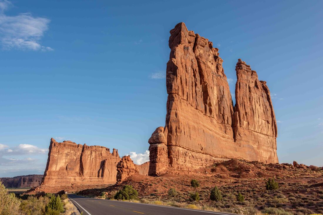
Arches National Park... the following is just a few of the over 2,000 arches and countless rock formations. Each day we drove here, armed with a plan to photograph formations at their most photogenic time of day, the beauty of the park always struck us with awe. (Arches National Park, UT, Sept 14-20)
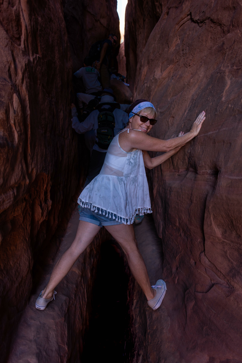
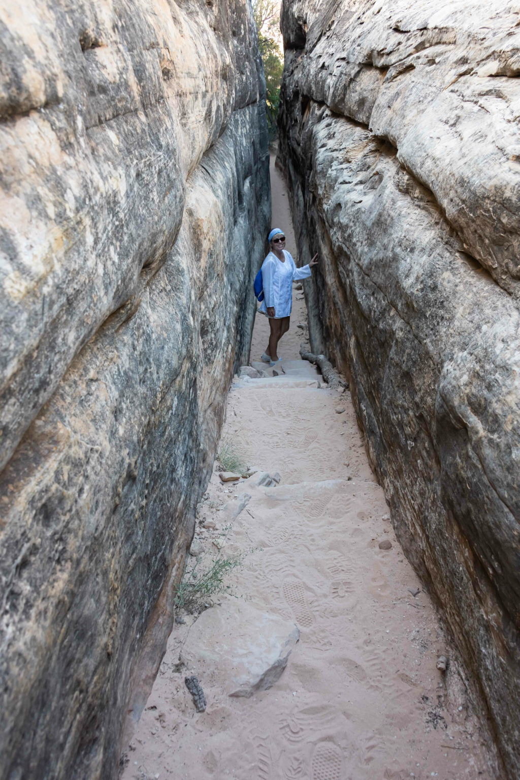
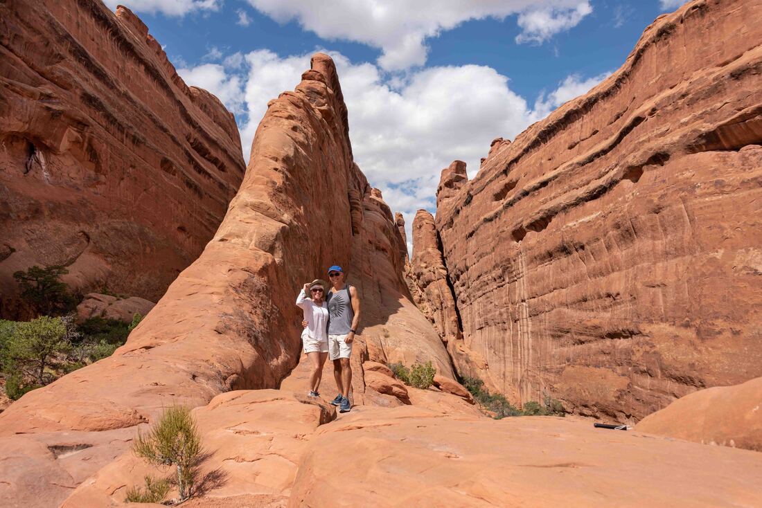
Fiery Furnace trail - due to its labyrinthine path, ranger led hikes were recommended. The gap looks worse than it was :)
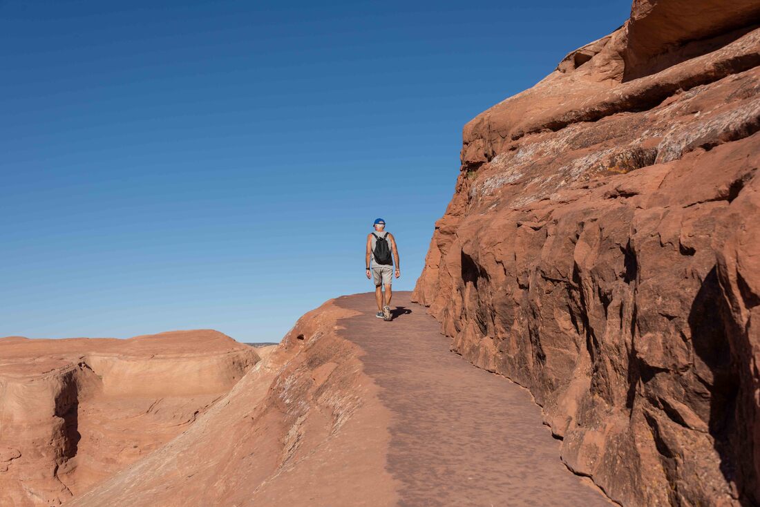
The best views of some of the arches had to be earned. Rated as difficult, this trail required a climb up a steep, slickrock slope followed by this 200 m long rock ledge.
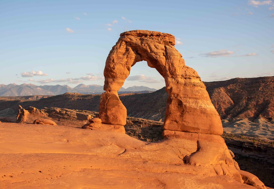
Gracing countless tourism brochures, Delicate Arch is a must-see. At close to 16m high, it was much taller than expected. For 2 hours we waited for the 10-minute window where the sun hit the rock at just the right angle to bring out its brilliant orange.
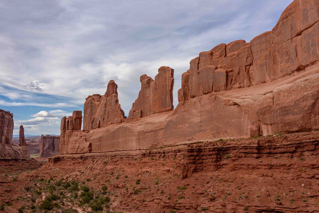
Park Ave - for its skyscraper appearance. The almost perfect horizontal cuts across the length of the rock wall were formed as water that was trickling down through the top layer of porous sandstone hit a layer of sandy “cement” with a less porous layer of rock below. This forced the water to flow sideways. Over time, the sand was washed away leaving a horizontal space.
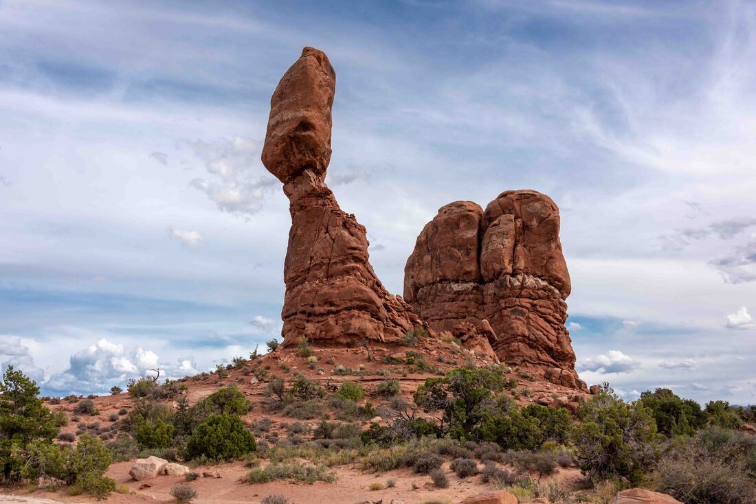
Balanced Rock
Thin upright rock slabs are called fins for their resemblance to fish fins. Over time the freeze and thaw of water, caught in small spaces in the fins, cracks away bits of rock. Eventually arches develop.
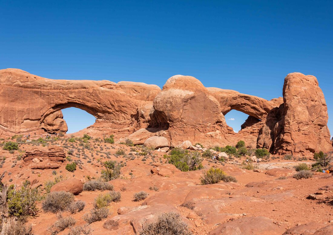
The Windows - side by side 'eyes' separated by a 'nose', make up an enormous face on this 100' wide fin remnant.
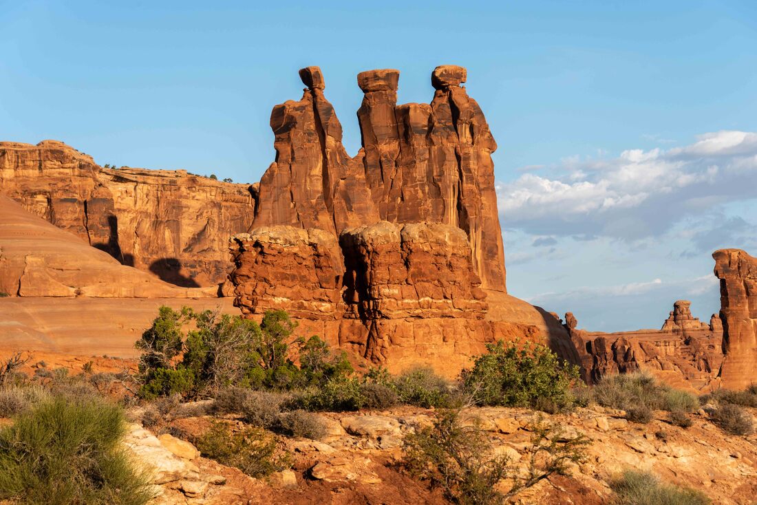
The Three Gossips - what a fitting moniker. The lumpy, muddy looking layer below the 'gossips' is what’s been left behind by the ancient mud flats that once covered this land.
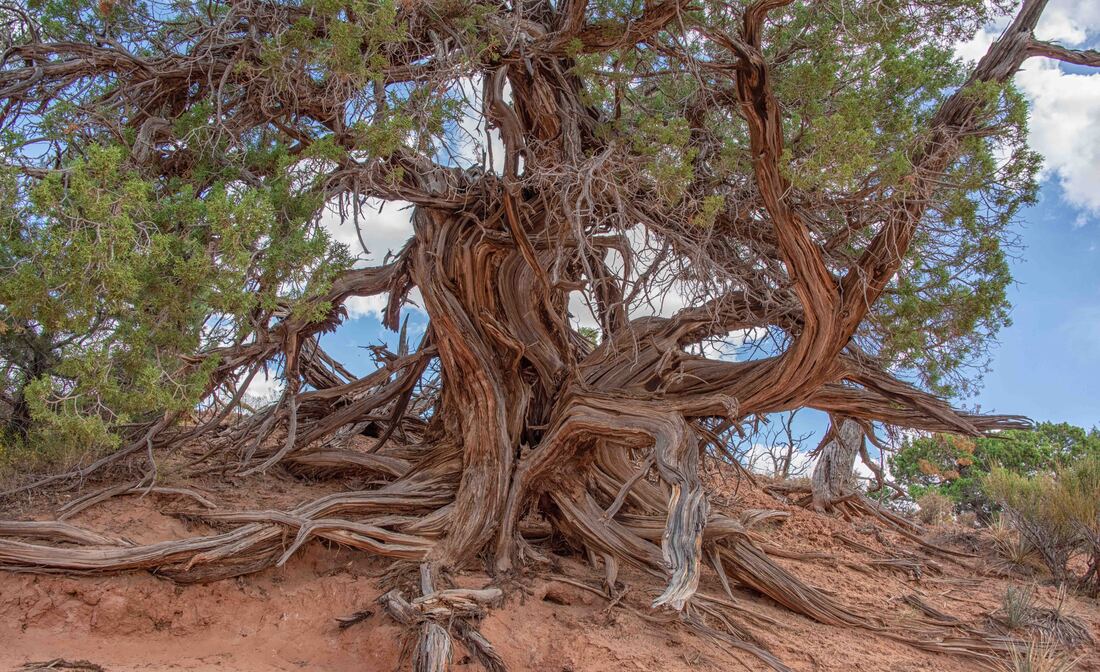
Utah Juniper trees can live for 350 to 700 years. Although they will at times appear half dead, they have just cut off the water supply to older branches in order for new growth to thrive in times of drought. Earlier civilizations used the bark to make diapers.
Warned of narrow ledges with steep drop offs and steep climbs on rock slabs, The Devils Garden trail was our most challenging hike in the park.
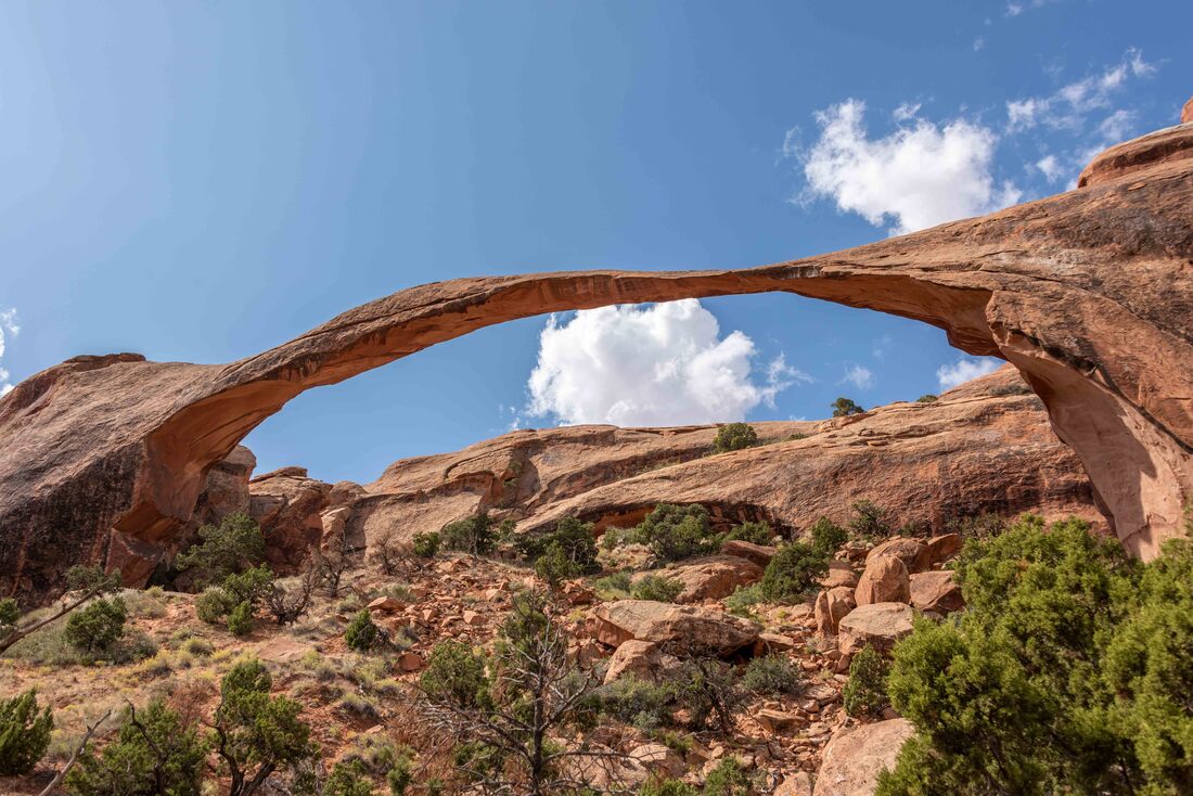
With a span of over 300’, Landscape Arch easily meets the minimum 3’ opening required to be considered an arch.
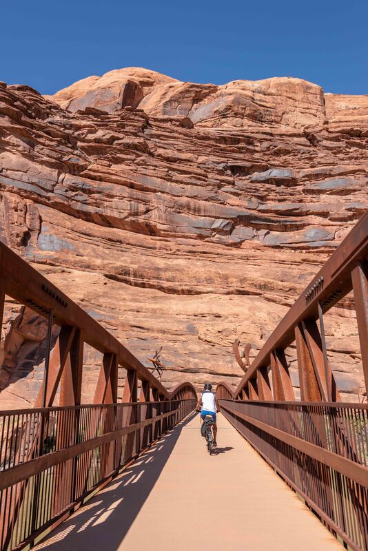
Taking a break from the national parks... The Moab Trail takes bikers from Moab to mountain bike trails south and north of the city.
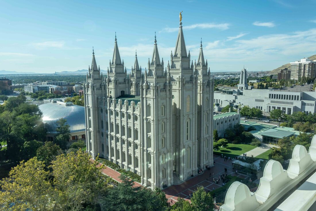
In the early 1840s, Latter Day Saints (LDS, aka Mormons) drew the concern of the federal government for practicing polygamy and allowing LDS beliefs to be the rule of law rather than the government’s judicial system. When the concern changed to persecution, the LDS moved west until they arrived in Salt Lake City. Temple Square, a 10-acre walled enclosure, was built to house a variety of church buildings and to provide some degree of protection. Today, the complex has expanded beyond the walls to support their burgeoning headquarters. (Salt Lake City, UT, Sept 12)
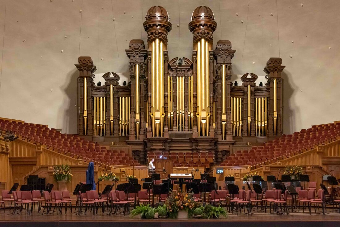
At the heart of Temple Square sits the Tabernacle, home of the Tabernacle Choir at Temple Square (once called the Mormon Tabernacle Choir). To demonstrate how acoustically perfect the tabernacle is, we could hear a pin drop into a bowl from where we sat 160’ from the stage. Daily recitals showcase the pipe organ, one of the largest in the world. The performance closed with a booming rendition of Phantom of the Opera - made your skin tingle.

Mormons believe they must pray on their ancestor’s behalf. To that end, volunteers scour the globe for books and visit the smallest of villages to microfilm registry records for inclusion in the Family History Library. LDS and non-LDS visitors are welcome to use this largest genealogical resource in the world, either in person or via the FamilySearch.org website.
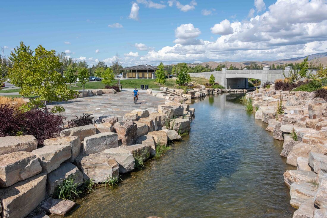
After a couple of full travel days, it felt good to get some exercise. The Scenic Boise River Greenbelt traverses a dozen parks as it hugs both sides of the river for 25 paved miles. (Boise, ID, Sept 11)
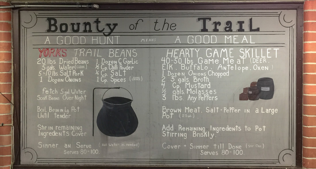
If you’ve ever wanted to eat like those hardy pioneers who rode their wagons along the Oregon Trail, here’s your recipe. (Baker City, OR, Sept 10)